Category:Old maps of Kyrgyzstan
Jump to navigation
Jump to search
Use the appropriate category for maps showing all or a large part of Kyrgyzstan. See subcategories for smaller areas:
| If the map shows | Category to use |
|---|---|
| Kyrgyzstan on a recently created map | Category:Maps of Kyrgyzstan or its subcategories |
| Kyrgyzstan on a map created more than 70 years ago | Category:Old maps of Kyrgyzstan or its subcategories |
| the history of Kyrgyzstan on a recently created map | Category:Maps of the history of Kyrgyzstan or its subcategories |
| the history of Kyrgyzstan on a map created more than 70 years ago | Category:Old maps of the history of Kyrgyzstan or its subcategories |
Media in category "Old maps of Kyrgyzstan"
The following 18 files are in this category, out of 18 total.
-
 Map of Burut-Kyrgyz.png 536 × 421; 458 KB
-

-

-
 Preliminary Map of Eastern Turkistan (Bottom Part).jpg 4,466 × 2,879; 3 MB
-
 Preliminary Map of Eastern Turkistan (Top Part).jpg 4,548 × 3,448; 2.96 MB
-
 Preliminary Map of Eastern Turkistan.png 4,356 × 5,319; 11.22 MB
-

-
 TE&II Vol 06 Fig 098.jpg 1,377 × 1,361; 148 KB
-
 TE&II Vol 06 Fig 098b.jpg 1,310 × 1,150; 130 KB
-
 NKC map before 1859 (cropped).jpg 712 × 1,080; 107 KB
-
 Asie, nord. (vers 1900) Asie russe et Tartarie chinoise - btv1b84596699.jpg 9,300 × 7,474; 9.39 MB
-
 EB9 Map of East and West Turkestan.png 3,851 × 3,026; 1.94 MB
-
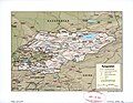
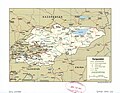 Kyrgyzstan. LOC 2006625308.jpg 2,662 × 2,073; 638 KB
-
 Kyrgyzstan. LOC 2006625308.tif 2,662 × 2,073; 15.79 MB
-
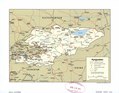
 Kyrgyzstan. LOC 2006625309.jpg 3,244 × 2,524; 1,018 KB
-
 Kyrgyzstan. LOC 2006625309.tif 3,244 × 2,524; 23.43 MB
-
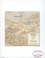
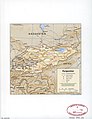 Kyrgyzstan. LOC 96684392.jpg 2,534 × 3,286; 725 KB
-
 Kyrgyzstan. LOC 96684392.tif 2,534 × 3,286; 23.82 MB

.jpg)
.jpg)
.jpg)
.jpg)

.jpg)


.jpg)
_Asie_russe_et_Tartarie_chinoise_-_btv1b84596699.jpg)


