Category:Old maps of Uttarakhand
Jump to navigation
Jump to search
States of India: Andhra Pradesh · Arunachal Pradesh · Assam · Bihar · Goa · Gujarat · Jharkhand · Karnataka · Kerala · Madhya Pradesh · Maharashtra · Manipur · Meghalaya · Odisha · Sikkim · Tamil Nadu · Telangana · Tripura · Uttar Pradesh · Uttarakhand · West Bengal
Union territories: Andaman and Nicobar Islands · Dadra and Nagar Haveli and Daman and Diu · Delhi · Jammu and Kashmir · Ladakh · Lakshadweep · Puducherry
Former states of India: Jammu and Kashmir ·
Former union territories: Daman and Diu ·
Union territories: Andaman and Nicobar Islands · Dadra and Nagar Haveli and Daman and Diu · Delhi · Jammu and Kashmir · Ladakh · Lakshadweep · Puducherry
Former states of India: Jammu and Kashmir ·
Former union territories: Daman and Diu ·
Media in category "Old maps of Uttarakhand"
The following 44 files are in this category, out of 44 total.
-
1780 Bonne Map of Northern India - Geographicus - IndiaNorth-bonne-1780.jpg 3,500 × 2,345; 2.4 MB
-
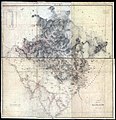
1819 Map of Province of Kumaon by Webb.jpg 19,472 × 20,100; 19.08 MB
-
1819-Kalapani-area-from-province-of-Kumaon-by-Webb.jpg 6,761 × 5,617; 10.64 MB
-
1851 Himalaya Mountains by Strachey.jpg 3,438 × 2,448; 1.02 MB
-
1851 map of Barahoti area Strachey.jpg 754 × 590; 268 KB
-
Ladakh-Garhwal-1863.jpg 2,340 × 1,700; 1.38 MB
-
1879 Kumaun and British Garhwal No. 37 by GTS.jpg 11,602 × 7,489; 9.08 MB
-
1900 map of Barahoti area Strachey.jpg 2,117 × 1,980; 2.33 MB
-
1900 Northern Border of Kumaon.jpg 5,544 × 2,844; 2.77 MB
-
1936 Survey of India map of Highlands of Tibet and Surrounding Regions.jpg 16,605 × 11,925; 17.46 MB
-
1946 Political Subdivisions of India by National Geographic.jpg 8,584 × 7,478; 3.18 MB
-
1955-US-Army-map-Kali-river-sources.jpg 1,475 × 1,519; 1.28 MB
-
1959 Political Map of India showning boundary with China.jpg 7,056 × 4,926; 3.17 MB
-
1960 Northern Frontier of India by SOI.jpg 4,384 × 3,252; 1.02 MB
-
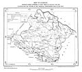
AgraFamine1837-38BoundaryMap.jpg 1,000 × 1,215; 377 KB
-
Badrinath Garhwal 1882 map.jpg 3,564 × 4,675; 3.43 MB
-
Dhauliganga and Rishiganga Valleys.jpg 1,925 × 2,809; 2.76 MB
-
Eastern-Punjab-1863.jpg 2,340 × 1,700; 1.28 MB
-
F28-31-1.jpg 12,357 × 10,758; 6.96 MB
-
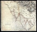
F28-31-2.jpg 12,286 × 9,962; 7.86 MB
-
F28-31-3.jpg 7,248 × 9,195; 3.68 MB
-
F28-31-4.jpg 7,390 × 10,410; 3.57 MB
-
F28-32 1829 Map of the Province of Kumaon by Webb.jpg 19,552 × 19,781; 19.05 MB
-
Gangotri Survey 1810 Webb.jpg 4,716 × 6,437; 10.62 MB
-
Joppen1907India1795a.jpg 828 × 1,200; 287 KB
-
Joppen1907India1805a-21.jpg 843 × 1,200; 289 KB
-
Joppen1907India1805a.jpg 843 × 1,200; 230 KB
-
Kumaon 1924.jpg 5,500 × 4,873; 3.79 MB
-
Map India and Pakistan 1-250,000 Tile NF 44-14 Philibhit.jpg 5,000 × 3,765; 3.51 MB
-
Map India and Pakistan 1-250,000 Tile NH 44-6 Nanda Devi.jpg 5,000 × 3,799; 4.02 MB
-
Map of the United Provinces from The Imperial Gazetteer of India (1907-1909).jpg 1,000 × 1,186; 427 KB
-
Plate 25. Sect. IV- East Punjab and Kashmir from maps of constantine 1893 hand atlas.jpg 1,721 × 1,400; 877 KB
-
Punjab, Kashmir, Far-west Nepal.jpg 1,669 × 2,172; 728 KB
-
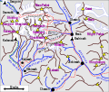
Shipton-Tilman 1934 Garhwal routes.svg 1,169 × 991; 225 KB
-
Sketch of Kumaon (Survey of India), 1819.jpg 4,176 × 3,418; 4.85 MB
-
Tehri Garhwal zoomed in.jpg 514 × 350; 70 KB
-
Txu-pclmaps-oclc-181831961-badrinath-53-n-1936.jpg 3,631 × 5,023; 2.86 MB
-
Txu-pclmaps-oclc-181831961-nandakot-62-b-1931.jpg 3,583 × 5,048; 2.2 MB
-
United Provinces 1903.png 640 × 480; 242 KB


