Category:Old maps of West Bengal
Jump to navigation
Jump to search
States of India: Andhra Pradesh · Arunachal Pradesh · Assam · Bihar · Goa · Gujarat · Jharkhand · Karnataka · Kerala · Madhya Pradesh · Maharashtra · Manipur · Meghalaya · Odisha · Sikkim · Tamil Nadu · Telangana · Tripura · Uttar Pradesh · Uttarakhand · West Bengal
Union territories: Andaman and Nicobar Islands · Dadra and Nagar Haveli and Daman and Diu · Delhi · Jammu and Kashmir · Ladakh · Lakshadweep · Puducherry
Former states of India: Jammu and Kashmir ·
Former union territories: Daman and Diu ·
Union territories: Andaman and Nicobar Islands · Dadra and Nagar Haveli and Daman and Diu · Delhi · Jammu and Kashmir · Ladakh · Lakshadweep · Puducherry
Former states of India: Jammu and Kashmir ·
Former union territories: Daman and Diu ·
Subcategories
This category has the following 5 subcategories, out of 5 total.
D
- Old maps of Darjeeling (7 F)
K
- Old maps of Kolkata (40 F)
O
- Old maps of Chandannagar (6 F)
- Old maps of Hugli-Chuchura (8 F)
Media in category "Old maps of West Bengal"
The following 7 files are in this category, out of 7 total.
-
 Mayurbhanj Midnapore border 1776.jpg 3,028 × 2,271; 10.25 MB
-
 Bankura district map 1908.png 3,048 × 3,620; 2.89 MB
-
 A (folding) map of Gour 1801 - 'The Ruins of Gour' (1817).jpg 600 × 216; 24 KB
-
 Hooghly River 1749.jpg 436 × 658; 114 KB
-
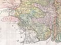
 Hooghly.jpg 1,394 × 854; 369 KB
-
 Madanpur in a sketch.jpg 4,568 × 2,742; 1.78 MB
-
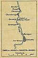
 MAp of The Hugli From Bandel To Fulta(After Rennell).jpg 882 × 381; 37 KB


.jpg)
_map_of_Gour_1801_-_%27The_Ruins_of_Gour%27_(1817).jpg)