Category:Old maps of Oberhausen
Jump to navigation
Jump to search
Use the appropriate category for maps showing all or a large part of Oberhausen. See subcategories for smaller areas:
| If the map shows | Category to use |
|---|---|
| Oberhausen on a recently created map | Category:Maps of Oberhausen or its subcategories |
| Oberhausen on a map created more than 70 years ago | Category:Old maps of Oberhausen or its subcategories |
| the history of Oberhausen on a recently created map | Category:Maps of the history of Oberhausen or its subcategories |
| the history of Oberhausen on a map created more than 70 years ago | Category:Old maps of the history of Oberhausen or its subcategories |
Media in category "Old maps of Oberhausen"
The following 9 files are in this category, out of 9 total.
-
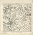 Messtischblatt 4507 Muelheim 1894.jpg 3,920 × 4,186; 3.54 MB
-
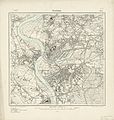 Messtischblatt 4506 Duisburg 1907.jpg 8,268 × 8,687; 13.52 MB
-
 Eisenheim Stand 1897.jpg 1,027 × 902; 373 KB
-
 Le Coq 1805 - Nordwestdeutschland - Oberhausen.png 1,632 × 2,012; 2.35 MB
-
 Messtischblatt 4406 Dinslaken 1906.jpg 1,654 × 1,766; 960 KB
-
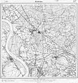
 Messtischblatt 4407 Bottrop 1907 Rechteck.jpg 7,318 × 7,054; 13.7 MB
-
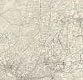
 Messtischblatt 4407 Bottrop 1907.jpg 8,275 × 8,721; 14.84 MB
-
 Plan Provinzialstraße1844.jpg 1,614 × 591; 554 KB
-
 Überichtskarte Eisenheim 1866.jpg 1,623 × 1,333; 1.16 MB


