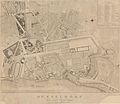
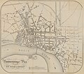
Category:Old maps of Düsseldorf
Appearance
Use the appropriate category for maps showing all or a large part of Düsseldorf. See subcategories for smaller areas:
| If the map shows | Category to use |
|---|---|
| Düsseldorf on a recently created map | Category:Maps of Düsseldorf or its subcategories |
| Düsseldorf on a map created more than 70 years ago | Category:Old maps of Düsseldorf or its subcategories |
| the history of Düsseldorf on a recently created map | Category:Maps of the history of Düsseldorf or its subcategories |
| the history of Düsseldorf on a map created more than 70 years ago | Category:Old maps of the history of Düsseldorf or its subcategories |
Subcategories
This category has the following 3 subcategories, out of 3 total.
D
T
Media in category "Old maps of Düsseldorf"
The following 59 files are in this category, out of 59 total.
-
Fürstlich Jülich‘sche Hochzeit-SMD.D V-3.1 StA.jpg 3,546 × 2,760; 1.58 MB
-
Düsseldorf im Jahre 1609.png 1,093 × 851; 1.78 MB
-
Grand Duche de Berg (cropped) Hellebroich.jpg 724 × 563; 78 KB
-
Düsseldorf, Karlstadt, Entwurf für die Erweiterung Düsseldorfs, 1699.jpg 1,024 × 752; 613 KB
-
Michael Cagnon, Extension Düsseldorf, 1697-1699.jpg 953 × 665; 563 KB
-
Belagerung Kaiserswerth 1702.jpg 850 × 613; 184 KB
-
Festungsplan v. Düsseldorf, kolor. Handzeichnung, 1759.jpg 1,600 × 1,092; 755 KB
-
149 of 'Historische Wanderung durch die alte Stadt Düsseldorf' (11200013776).jpg 1,517 × 2,413; 776 KB
-
Belagerung der Stadt Düsseldorf, Kupferstich, 1766.jpg 928 × 1,384; 585 KB
-
Jacobis Garten zu Pempelfort, Plan von Joh. Casp. Nosthoffen, 1776.jpg 853 × 853; 452 KB
-
Jüdischer Friedhof Kasernenstraße Düsseldorf, 18. Jahrhundert.jpg 1,613 × 1,215; 931 KB
-
Carte de Düsseldorf et des camps retranchés devant cette place. (1795–1799).jpg 6,411 × 4,951; 17.54 MB
-
Plan de Dusseldorf - btv1b531001985.jpg 12,113 × 7,643; 12.52 MB
-
Bolkerstraße, Düsseldorf, Plan der Grundstücke mit ihren Besitzern von 1801.jpg 3,021 × 3,764; 3.5 MB
-
Maximilian Friedrich Weyhe, Plan des Hofgarten 1804.jpg 740 × 1,095; 495 KB
-
TrK44-Neuss-Detail.jpg 2,273 × 2,322; 6.11 MB
-
Düsseldorf und seine Umgebungen 1809.jpg 2,620 × 2,270; 2.08 MB
-
Stadtplan von Düsseldorf von 1809.jpg 1,726 × 1,327; 2.25 MB
-
Düsseldorf, Königsallee mit den ehemaligen Bastionen, Stadtplan von 1826.jpg 1,809 × 1,254; 1.61 MB
-
Jülich-Cleve-Berg1836.jpg 2,899 × 2,172; 2.46 MB
-
Plan des Jacobi'schen Gartens und seiner Baulichkeiten, um 1840.jpg 460 × 590; 259 KB
-
Meyer‘s Zeitungsatlas 048 – Düsseldorf 1849.jpg 1,678 × 1,387; 1.29 MB
-
Stadtplan1854.jpg 480 × 303; 47 KB
-
Nummerirungsplan für die Stadt Düsseldorf 1858.jpg 5,951 × 5,317; 20.82 MB
-
Historischer Plan der Stadt Düsseldorf, Ernst von Schaumburg, Düsseldorf im April 1866.jpg 5,063 × 3,543; 5.74 MB
-
Gelände am Sicherheitshafen, Neubaustandort Kunstakademie, Handriss um 1873.png 820 × 1,245; 1.45 MB
-
Ausschnitt aus dem Stadtplan um 1874.jpg 1,431 × 850; 830 KB
-
Plan Gewerbe-Ausstellung für Rheinland, Westfalen, Grundzüge des Zoos 1880.jpg 1,572 × 864; 639 KB
-
Das germanische Gräberfeld bei Golzheim, 1884.jpg 1,931 × 1,987; 3.23 MB
-
Meyers b5 s0252a.jpg 2,349 × 1,468; 3.39 MB
-
150 of 'Historische Wanderung durch die alte Stadt Düsseldorf' (11199175843).jpg 1,633 × 2,558; 1,008 KB
-
151 of 'Historische Wanderung durch die alte Stadt Düsseldorf' (11198530493).jpg 1,599 × 2,525; 1.16 MB
-
Der Hofgarten zu Düsseldorf 1895 - Stadtarchiv.jpg 2,160 × 2,576; 2.86 MB
-
Figur 11 – Lageplan des Betriebsbahnhof Oberkassel.jpg 2,181 × 728; 387 KB
-
Figur 2 – Lageplan nach dem Bau der Rheinbrücke.jpg 1,655 × 1,877; 779 KB
-
Lageplan vor dem Bau der Rheinbrücke.jpg 1,594 × 1,906; 857 KB
-
Industrie-Gewerbe & Kunst-Ausstellung, Lageplan, Düsseldorf 1902.jpg 2,158 × 833; 896 KB
-
Stadtplan Düsseldorf in Adreßbuch für die Stadtgemeinde Düsseldorf, 1909.jpg 2,323 × 2,866; 3.87 MB
-
Stadtplan von Düsseldorf in Adreßbuch für die Stadtgemeinde Düsseldorf, 1905.jpg 1,400 × 1,721; 469 KB
-
Plan des Zoologischen Gartens Düsseldorf um 1908.jpg 1,187 × 852; 437 KB
-
Pharus. Plan Düsseldorf - btv1b8460070c.jpg 9,343 × 7,416; 12.31 MB
-
Rheinische Bahngesellschaft, Baugelände Düsseldorf-Obercassel, 1910.jpg 1,224 × 834; 854 KB
-
Rheinische Bahngesellschaft, Baugelände Düsseldorf-Obercassel, 1911.jpg 1,721 × 1,172; 1.21 MB
-
Bebauungsplan Groß-Düsseldorf.jpg 672 × 858; 194 KB
-
Hofgartenstraße Düsseldorf - Verlauf entlang der Landskrone, 1932.jpg 271 × 808; 177 KB
-
Lage Nordparksiedlung Düsseldorf 1937.jpg 3,416 × 2,311; 2.5 MB
-
Map of the Reichsaustellung Schaffendes Volk, Düsseldorf 1937.jpg 3,416 × 2,311; 4.9 MB
-
Düsseldorfer Rheinstadion, in Adressbuch der Stadt Düsseldorf, 1937.jpg 2,634 × 1,616; 1.6 MB
-
Karte von Düsseldorf (um 1740).tif 11,623 × 8,327; 16.52 MB


