Category:Old maps of Münster (Westfalen)
Jump to navigation
Jump to search
Subcategories
This category has only the following subcategory.
Media in category "Old maps of Münster (Westfalen)"
The following 38 files are in this category, out of 38 total.
-
 Atlas type Lafréri - btv1b52511601q (070 of 226).jpg 7,346 × 6,162; 6.82 MB
-
 Monasteriensis episcopatus - auctore Ioh. Gigante - btv1b53040478f (1 of 2).jpg 6,027 × 4,671; 5.06 MB
-
 Blaeu 1645 - Monasteriensis Episcopatus.jpg 2,949 × 2,251; 2.18 MB
-

-
 1757 Munster detail of map Seat of War in the Circle of Westphalia BPL 14521.png 1,011 × 747; 1.41 MB
-
 Westerkappeln-Land.jpg 1,901 × 2,917; 2.35 MB
-
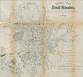
 Plan der Stadt Münster.jpg 4,639 × 3,623; 3.85 MB
-

-

-
 Belagerungen Muensters 1759 Plan 1760 (Westteil).jpg 800 × 1,696; 252 KB
-

-

-
 De merian Westphaliae 124.jpg 3,804 × 3,108; 3.35 MB
-
 Huegel Tuckesburg in Muenster.tif 3,376 × 2,960; 26.58 MB
-
 Maps of Franconia and of the Bishopric of Münster by Abraham Ortelius.jpeg 3,063 × 2,354; 2.33 MB
-
 Messtischblatt 4111 Ottmarsbocholt 1897.jpg 8,275 × 8,713; 12.47 MB
-
 Muenster merian.JPG 1,460 × 1,192; 241 KB
-
 MuensterAlerdinck1636HiRes.jpg 2,000 × 2,000; 1.69 MB
-
 MuensterBecksteinplan1648.jpg 377 × 420; 86 KB
-
 MuensterUnderSiege1534.jpg 686 × 366; 271 KB
-
 MuensterUnderSiege1657Planview.jpg 4,200 × 3,039; 7.65 MB
-
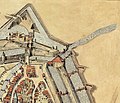
 MuensterZwinger1657.jpg 925 × 688; 419 KB
-
 MuensterZwingerVogelschau.jpg 559 × 478; 81 KB
-
 Münster - 1759.jpg 4,230 × 3,729; 7.11 MB
-
 Münster map 1860.jpg 1,544 × 1,025; 320 KB
-
 Münster partition 1802.jpg 595 × 626; 443 KB
-
 Münster um 1600.jpg 900 × 406; 146 KB
-
 MünsterGalenscheZitadelle.JPG 1,910 × 1,296; 281 KB
-
 Pharus Wandkarte der weiteren Umgebung von Münster (Westfalen) - btv1b8445838x.jpg 10,038 × 7,613; 16.63 MB
-
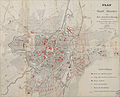
 Plan der Stadt Muenster 1854.jpg 3,336 × 2,312; 2.81 MB
-
 Plan Muenster 1864.jpeg 4,417 × 3,575; 6.42 MB
-
 Plan Muenster 1873.jpeg 5,640 × 5,200; 9.46 MB
-
 Plan Muenster 1880.jpeg 5,704 × 5,304; 10.91 MB
-
 Plan Zoologischer Garten Münster 1880.jpeg 1,655 × 2,052; 1.29 MB
-
 Spruner-Menke Handatlas 1880 Karte 39 Nebenkarte 5.jpg 1,118 × 966; 84 KB
-
 Topographische Karte der Kreise des Regierungs-Bezirks Muenster, Blatt 06 - Kreis Muenster, 1842.jpg 8,831 × 10,421; 24.18 MB
-

-
 Atlas ou Representation du Monde Universel t. 2. 1633 (110099432).jpg 16,394 × 12,073; 32.5 MB
.jpg)
.jpg)

.3.(64).jpg)


.jpg)
.jpg)
.jpg)


_-_btv1b8445838x.jpg)


.jpg)