Category:Old maps of Aachen
Jump to navigation
Jump to search
Use the appropriate category for maps showing all or a large part of Aachen. See subcategories for smaller areas:
| If the map shows | Category to use |
|---|---|
| Aachen on a recently created map | Category:Maps of Aachen or its subcategories |
| Aachen on a map created more than 70 years ago | Category:Old maps of Aachen or its subcategories |
| the history of Aachen on a recently created map | Category:Maps of the history of Aachen or its subcategories |
| the history of Aachen on a map created more than 70 years ago | Category:Old maps of the history of Aachen or its subcategories |
Subcategories
This category has only the following subcategory.
M
Media in category "Old maps of Aachen"
The following 43 files are in this category, out of 43 total.
-

-
 Aachen Stadtplan-AC-1893.jpg 2,745 × 2,323; 1.45 MB
-
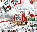
 Aachener Reich.jpg 400 × 323; 28 KB
-
 82 of 'Neumanns Orts-Lexikon des Deutschen Reichs' (11227775313).jpg 1,470 × 2,230; 1.09 MB
-
 Aachen rappard1860.png 5,905 × 3,992; 6.88 MB
-
 Aachen, Belgium (1600).jpg 800 × 600; 166 KB
-
 Aachen-Brockhaus-1892.jpg 3,249 × 2,150; 831 KB
-
 Aachen-Kornelimünster 1702.png 1,882 × 1,834; 6.2 MB
-
 Aachen-Stadtansicht-Holler-1638.png 2,339 × 1,942; 562 KB
-
 Aachen-Stadtansicht-Merian-1645.png 2,304 × 2,092; 4.97 MB
-
 Aachen-Stadtansicht-Vivie-1727.png 2,422 × 2,292; 574 KB
-
 Aachen.jpg 2,312 × 2,837; 1.47 MB
-
 AC Rappard 1860 Ausschnitt Robenshof.jpg 976 × 659; 226 KB
-
 AC Stadtgarten 1925.jpg 1,900 × 1,995; 3.13 MB
-
 AC Stadtplan1913 Ausschnitt Robensstraße.jpg 559 × 395; 99 KB
-
 Aich - btv1b55005195r.jpg 5,962 × 5,243; 3.21 MB
-
 Arnolds karte aachener reich.jpg 1,280 × 1,035; 1.26 MB
-
 Bahnhof Aachen Templerbend 1893.jpg 440 × 607; 220 KB
-
 Carl Rhoen Befestigungswerke Aachen-113.png 2,695 × 2,569; 1.05 MB
-
 Carl Rhoen Belagerung Aachens 1248.png 2,695 × 2,569; 2.97 MB
-
 De merian Westphaliae 102.jpg 3,300 × 2,975; 2.98 MB
-
 Dechen Sect Aachen.jpg 2,592 × 1,936; 3.78 MB
-
 Ebsdorfer weltkarte aachen 1300.jpg 426 × 370; 55 KB
-
 Grenzen und Grenzpfähle im Aachener Reich.jpg 790 × 665; 242 KB
-
 Gut Hebscheid Lage Tranchot-Karte.png 523 × 396; 474 KB
-
 Kaart van Aken en omgeving Aachen und umgegend (titel op object), RP-P-2018-963.jpg 4,376 × 5,222; 4.44 MB
-
 Kornelimünster 1789 Fabricius.jpg 1,637 × 1,487; 551 KB
-
 Meyers b1 s0002a b1.jpg 1,054 × 1,477; 2.17 MB
-
 Meyers b1 s0002a.jpg 1,494 × 2,352; 3.99 MB
-
 Meyer‘s Zeitungsatlas 059 – Rheinprovinz Niederrhein.jpg 7,302 × 6,231; 17.37 MB
-
 Moltkebahnhof 1925.jpg 800 × 434; 296 KB
-
 Neuester Fuehrer fuer Aachen und Umgebung2.jpg 4,785 × 3,971; 2.47 MB
-
 Regierungsbezirke Aachen u Trier 1905 LK-MARK.png 633 × 1,191; 1.28 MB
-
 Rhoen Die Aeltere Topographie von Aachen-Karte.jpg 1,969 × 2,021; 276 KB
-
 Rhoenbefest1.PNG 6,400 × 3,580; 843 KB
-
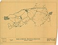 Road and Bridge Reconnaissance Aachen - Duren - DPLA - 9aa55925225cb04d7c95c03b4fb196c1.jpg 8,536 × 6,621; 3.06 MB
-
 Sgrothen 1573inde.jpg 793 × 753; 110 KB
-
 Stadtplan und Ansicht von Aachen Couven 1724.jpg 4,810 × 6,643; 8.5 MB
-
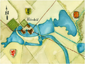
 Stiftslageplan 1820.jpg 912 × 750; 189 KB
-
 Umgebung von Aachen nach Rappard.jpg 1,851 × 2,011; 970 KB
-
 Urkatarnold.PNG 4,490 × 2,530; 1.09 MB
-
 Verkehrsnetz-1950-80-.jpg 1,181 × 1,182; 75 KB
-
 Continental Atlas fur Kraftfahrer - Deutschland 1-500.000 1929-1930 (134679034).jpg 3,931 × 5,941; 17.01 MB
_With_numerous_maps_and_notes%27_(11110828196).jpg)


.jpg)

.jpg)


,_RP-P-2018-963.jpg)


.jpg)