Category:Old maps of Bremen (state)
Jump to navigation
Jump to search
Federal states of Germany:
Use the appropriate category for maps showing all or a large part of Bremen. See subcategories for smaller areas:
| If the map shows | Category to use |
|---|---|
| Bremen on a recently created map | Category:Maps of Bremen (state) or its subcategories |
| Bremen on a map created more than 70 years ago | Category:Old maps of Bremen (state) or its subcategories |
| the history of Bremen on a recently created map | Category:Maps of the history of Bremen (state) or its subcategories |
| the history of Bremen on a map created more than 70 years ago | Category:Old maps of the history of Bremen (state) or its subcategories |
Subcategories
This category has the following 8 subcategories, out of 8 total.
.
- Old maps of Bremerhaven (15 F)
Pages in category "Old maps of Bremen (state)"
This category contains only the following page.
Media in category "Old maps of Bremen (state)"
The following 10 files are in this category, out of 10 total.
-
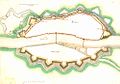 Bremen Old Map 3.jpg 996 × 694; 57 KB
-
 Bremen Neustadt Valckenburgh 1625.png 1,996 × 1,366; 377 KB
-
 Bremen Old Map 1.jpg 838 × 665; 116 KB
-
 Bremen Old Map 4.jpg 997 × 638; 82 KB
-
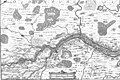 Karte Unterweser.jpg 3,250 × 2,158; 3.93 MB
-
 Bremen Old Map 2.jpg 993 × 680; 52 KB
-
 Bremen Old Map 5.jpg 978 × 833; 201 KB
-
 Bremen Old Map.jpg 995 × 636; 75 KB
-
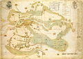 Bremen samt vier Gohen Heinbach.jpg 3,382 × 2,401; 8.06 MB
-


