Category:Old maps of Bremerhaven
Jump to navigation
Jump to search

Use the appropriate category for maps showing all or a large part of Bremerhaven. See subcategories for smaller areas:
| If the map shows | Category to use |
|---|---|
| Bremerhaven on a recently created map | Category:Maps of Bremerhaven or its subcategories |
| Bremerhaven on a map created more than 70 years ago | Category:Old maps of Bremerhaven or its subcategories |
| the history of Bremerhaven on a recently created map | Category:Maps of the history of Bremerhaven or its subcategories |
| the history of Bremerhaven on a map created more than 70 years ago | Category:Old maps of the history of Bremerhaven or its subcategories |
Media in category "Old maps of Bremerhaven"
The following 15 files are in this category, out of 15 total.
-
 Bremerhaven - 1831.jpg 961 × 595; 483 KB
-
 Map of Bremerhaven 1849.jpg 1,772 × 1,328; 2.13 MB
-
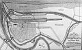
 Map elbe mouth 1910.jpg 1,500 × 927; 787 KB
-
 201 of 'Neumanns Orts-Lexikon des Deutschen Reichs' (11229341636).jpg 2,720 × 1,756; 1.53 MB
-
 Admiralty Chart No 3346 North Sea Jade and Weser Rivers, Published 1904.jpg 8,361 × 13,979; 20.35 MB
-
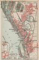 Bremerhaven, Geestemünde und Lehe (Karte, 1905).png 2,326 × 3,592; 17.78 MB
-
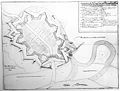 Carlsburg - Erik Dahlberg - 1681.jpg 842 × 639; 339 KB
-
 Carlsburg - Jean Mell - 1695.jpg 842 × 600; 912 KB
-
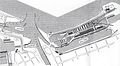 Fischereihafen (Alter Hafen).jpg 2,335 × 1,287; 1.44 MB
-
 Fischereihafen Geestemünde (1920).jpg 2,231 × 800; 807 KB
-
 Franzius Unterweser.jpg 2,160 × 1,407; 2.36 MB
-
 Geestemünder Häfen.jpg 4,593 × 3,453; 12.18 MB
-
 Lange diercke sachsen deutsche landschaften wattenkueste.jpg 1,235 × 2,057; 1.14 MB
-
 Map of Bremerhaven 1849 2011 11 27 Hochhaus.jpg 880 × 636; 521 KB
-
 Synagoge Geestemünde um 1905.jpg 928 × 712; 218 KB


.jpg)

.png)


.jpg)


.jpg)