Category:Old maps of Thuringia
Jump to navigation
Jump to search
Federal states of Germany:
Use the appropriate category for maps showing all or a large part of Thuringia. See subcategories for smaller areas:
| If the map shows | Category to use |
|---|---|
| Thuringia on a recently created map | Category:Maps of Thuringia or its subcategories |
| Thuringia on a map created more than 70 years ago | Category:Old maps of Thuringia or its subcategories |
| the history of Thuringia on a recently created map | Category:Maps of the history of Thuringia or its subcategories |
| the history of Thuringia on a map created more than 70 years ago | Category:Old maps of the history of Thuringia or its subcategories |
Subcategories
This category has the following 11 subcategories, out of 11 total.
Media in category "Old maps of Thuringia"
The following 72 files are in this category, out of 72 total.
-

-

-

-

-
 Atlas Ortelius KB PPN369376781-045av-045br.jpg 3,000 × 2,194; 4.12 MB
-
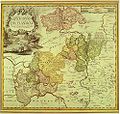
 Atlas Van der Hagen-KW1049B10 058-THVRINGIA LANDGRAVIATVS.jpeg 5,500 × 4,429; 4.17 MB
-
 Thuringia Lantgraviatus - CBT 5875242.jpg 5,589 × 4,542; 5.72 MB
-
 Thüringen, Sachsen, Brandenburg map (1708).jpg 2,000 × 1,404; 732 KB
-
 Ganerbschaft of Treffurt.JPG 1,056 × 1,408; 706 KB
-
 County of Stolberg.JPG 1,408 × 1,056; 783 KB
-
 The Eichsfeld.JPG 1,056 × 1,408; 803 KB
-
 The Vogtei.JPG 1,056 × 1,408; 715 KB
-
 Western Thuringia.JPG 2,112 × 2,816; 2.38 MB
-
 County of Hohenstein.JPG 1,408 × 1,056; 844 KB
-
 Grafschaft-Henneberg.jpg 1,344 × 1,152; 1.72 MB
-
 Grafschaft Hohnstein.jpg 600 × 538; 150 KB
-
 Herrschaft Lohra.jpg 817 × 649; 336 KB
-
 Special Charte vom Eichsfelde.jpg 2,353 × 2,134; 2.07 MB
-
 Reuss Karte.jpg 996 × 944; 452 KB
-
 (STANFORD) SAXON THURINGIA.jpg 4,771 × 3,387; 6.59 MB
-
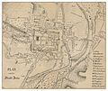 PLAN von der Stadt Jena.jpg 2,299 × 1,926; 2.6 MB
-
 Drachenschlucht.png 805 × 1,203; 2.49 MB
-
-
 Lichtenberg Leutzsch.jpg 918 × 492; 73 KB
-
 Map of Themar.png 532 × 728; 784 KB
-
 Geolog.thueringen.jpg 800 × 625; 203 KB
-
 Meyers b14 s0142a.jpg 800 × 629; 228 KB
-
 HUMAN(1886) Stadtplan von Hildburghausen.jpg 2,684 × 2,222; 3.88 MB
-
 Meyers b5 s0775a.jpg 2,048 × 1,555; 647 KB
-
 Westliches Mitteldeutschland.jpeg 3,396 × 2,507; 4.82 MB
-
 Rudolstadt-Bad Blankenburg.jpg 360 × 229; 31 KB
-
 Leipzig - 30-51.jpg 3,242 × 4,989; 3.47 MB
-
 (1903) Plan der Stadt Themar im 19. Jahrhundert.jpg 880 × 1,074; 452 KB
-
 Perthes Hörselberge (2).jpg 2,922 × 1,334; 2.14 MB
-
 Eisenacher Oberland.png 1,706 × 2,309; 557 KB
-
 Plan von Nordhausen.png 1,013 × 1,653; 3.08 MB
-
 Karte Kyffhäuser.jpg 748 × 1,009; 571 KB
-
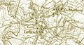
 Camburg Karte.jpg 699 × 523; 90 KB
-
 Ernestine Saxon duchies.jpg 367 × 319; 42 KB
-
 Map Vogtei Dorla.png 1,266 × 1,042; 395 KB
-
 NaulitzerSchanze.jpg 523 × 539; 299 KB
-
 Rosshof-3116-mtb.jpg 700 × 710; 190 KB
-
 23 of 'Geschichte Frankens' (11178239076).jpg 3,064 × 3,334; 1.67 MB
-
 429 of 'Thüringen. Ein geographisches Handbuch, etc' (11215743973).jpg 5,138 × 5,010; 7.3 MB
-

-

-
-
 Apfelstedt1886 bd1 S15 Gauen Nordthueringen.jpg 2,852 × 2,630; 2.1 MB
-
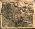
 Der Thüringer Wald.jpg 5,922 × 5,295; 12.5 MB
-

-
 Engilin1000.JPG 252 × 197; 24 KB
-

-

-

-

-
 Karte des Deutschen Reichs (Vogel) - Section 18 - Frankfurt Main.png 4,980 × 4,170; 14.5 MB
-

-

-

-

-

-

-

-
 Meyer‘s Zeitungsatlas 020 – Sachsen, die Staaten von Thüringen und benachbarte Länder.jpg 7,351 × 6,251; 16.91 MB
-
 Sachsen, Thüringen und Benachbarte Laender.jpg 5,548 × 4,533; 8.9 MB
-

-
 Sächsische Herzogthümer, Fürstehnth(ü)m(e)r Schwarzburg u. Reuss.jpg 3,501 × 3,010; 5.06 MB
-
 Thuringia - per Gerardum Mercatorem - btv1b8443509j.jpg 8,684 × 6,991; 8.93 MB
-
 Thuringia lantgraviatus - btv1b53223591g.jpg 6,502 × 5,370; 7.63 MB
-
 Thuringiae lantgraviatus tabula -- Petrus Schenk - KONB16-412453150 - Prent 1 van 1.jpg 1,500 × 1,277; 552 KB
-
 Thüringen HHR 1000AD.JPG 356 × 360; 155 KB
-
 Topographisch-militairische Charte von Teutschland - Section 069.png 3,466 × 2,711; 21.62 MB
.jpg)
.jpg)
.jpg)
.jpg)


.jpg)


_SAXON_THURINGIA.jpg)


_Stadtplan_von_Hildburghausen.jpg)


_Plan_der_Stadt_Themar_im_19._Jahrhundert.jpg)
.jpg)


.jpg)
.jpg)
.jpg)
.jpg)


_-_Section_18_-_Frankfurt_Main.png)

_NT.jpg)


_-_per_Joh._Bapt._Homa._-_btv1b59715775.jpg)


_inferior,_Ducatum_Vinariensem,_nec_non_Isenacensis_partes_Boreales_et_Orientales,_Principatum_Querfurtensem,_ut_et_Territorium_Erfurtense,_comitatum_Beichlingen_Balifiatum_Thuringiae_et_alia..._-_btv1b8491502d.jpg)
m(e)r_Schwarzburg_u._Reuss.jpg)


