Category:Old maps of Saarland
Jump to navigation
Jump to search
Federal states of Germany:
Use the appropriate category for maps showing all or a large part of Saarland. See subcategories for smaller areas:
| If the map shows | Category to use |
|---|---|
| Saarland on a recently created map | Category:Maps of Saarland or its subcategories |
| Saarland on a map created more than 70 years ago | Category:Old maps of Saarland or its subcategories |
| the history of Saarland on a recently created map | Category:Maps of the history of Saarland or its subcategories |
| the history of Saarland on a map created more than 70 years ago | Category:Old maps of the history of Saarland or its subcategories |
Subcategories
This category has the following 6 subcategories, out of 6 total.
Media in category "Old maps of Saarland"
The following 11 files are in this category, out of 11 total.
-
-

-
 Flözkarte von Kliver im Bereich Ruhbachtal.jpg 8,192 × 6,907; 69.66 MB
-
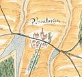
 Gutenberg grens tussen Frankrijk en Duitsland.jpg 800 × 1,364; 199 KB
-
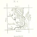
 Neunkirchen 1564 Ausschnitt.jpg 703 × 657; 225 KB
-
 Postrouten1786L1100283 (2).jpg 2,520 × 3,776; 4.45 MB
-
 Reilly 258.jpg 1,100 × 914; 402 KB
-
 SaarherzogtumL1150184 (4).jpg 2,414 × 2,439; 1.31 MB
-
 SaarlandL1150413 (2).jpg 2,243 × 2,063; 1.39 MB
-
 SaarprovinzL1150183 (4).jpg 2,304 × 2,621; 1.2 MB
-
 Vaudrevange Plan de Monville 1679.jpg 2,820 × 1,820; 1.24 MB
.jpg)
.jpg)


.jpg)

.jpg)
.jpg)
.jpg)
