Category:Maps showing 1854
Jump to navigation
Jump to search
| ← 1850 1851 1852 1853 1854 1856 1857 1859→ |
English: Maps showing the year 1854 (i.e. history maps)
See also category: 1854 maps. and 1850s maps for more maps showing this year usually created not long after the given year.
See also category: 1854 maps. and 1850s maps for more maps showing this year usually created not long after the given year.
Subcategories
This category has only the following subcategory.
Media in category "Maps showing 1854"
The following 2 files are in this category, out of 2 total.
-
 Imamat 1854.png 1,736 × 1,420; 128 KB
-
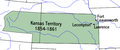 Kansasterritory.PNG 560 × 234; 35 KB

