Category:Maps showing 1860
Jump to navigation
Jump to search
| ← 1860 1861 1862 1863 1864 1865 1866 1867 1868 1869→ |
English: Maps showing the year 1860 (i.e. history maps)
See also category: 1860 maps. and 1860s maps for more maps showing this year usually created not long after the given year.
See also category: 1860 maps. and 1860s maps for more maps showing this year usually created not long after the given year.
Subcategories
This category has only the following subcategory.
Media in category "Maps showing 1860"
The following 10 files are in this category, out of 10 total.
-
 1860 colorado territory map.png 448 × 303; 46 KB
-
 Asian Americans 1860 County.png 7,750 × 4,650; 3.78 MB
-
 Black Americans 1860 County.png 15,610 × 8,900; 7.82 MB
-
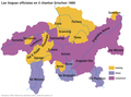 Maioritad linguistica GR 1860.png 1,500 × 1,115; 104 KB
-
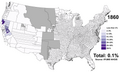
 Map Enslaved population in the USA in 1860.jpg 1,027 × 589; 129 KB
-
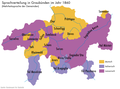 Mehrheitssprachen GR 1860.png 1,500 × 1,115; 151 KB
-
 The Kingdom of Sardinia in late August 1860.png 2,021 × 2,048; 293 KB
-

-
 White Americans 1860 County.png 15,610 × 8,900; 7.63 MB
-
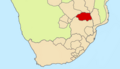 Zoutpansberg in 1860s.png 1,246 × 720; 206 KB


_(14758161966).jpg)

