
Category:Maps showing 1851
| ← 1850 1851 1852 1853 1854 1855 1856 1857 1858 1859→ |
English: Maps showing the year 1851 (i.e. history maps)
See also category: 1851 maps. and 1850s maps for more maps showing this year usually created not long after the given year.
See also category: 1851 maps. and 1850s maps for more maps showing this year usually created not long after the given year.
Subcategories
This category has only the following subcategory.
Media in category "Maps showing 1851"
The following 15 files are in this category, out of 15 total.
-
 Administration-regions-Nigeria-1851-today.jpg 1,500 × 2,160; 451 KB
-
 Administration-regions-Nigeria-1851-today2.jpg 1,500 × 2,160; 453 KB
-
 Battlefields between the Lakotas and the U.S. Army from 1854 to 1890 (approx.).png 2,485 × 2,790; 14.1 MB
-
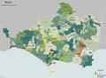 Dorset Map 1851.png 2,163 × 1,586; 811 KB
-
 England counties 1851 named.png 1,459 × 1,769; 166 KB
-
 Herrera y la fábrica de jabón de Josefa Tito Recalde hacia 1851.jpg 660 × 548; 226 KB
-
 Life-expectancy,Africa,1851.svg 850 × 691; 152 KB
-
 Life-expectancy,Asia,1851.svg 850 × 691; 152 KB
-
 Life-expectancy,Europe,1851.svg 850 × 691; 157 KB
-
 Life-expectancy,North America,1851.svg 850 × 691; 149 KB
-
 Life-expectancy,Oceania,1851.svg 850 × 691; 149 KB
-
 Life-expectancy,South America,1851.svg 850 × 691; 149 KB
-
 Life-expectancy,World,1851.svg 850 × 691; 162 KB
-
 Sioux-treaty-lands.png 500 × 371; 258 KB
-
 Westmorland en 1851.svg 1,108 × 1,345; 323 KB


.png)


