
Category:Maps showing 1849
| ← 1840 1841 1842 1843 1844 1845 1846 1847 1848 1849→ |
English: Maps showing the year 1849 (i.e. history maps)
See also category: 1849 maps. and 1840s maps for more maps showing this year usually created not long after the given year.
See also category: 1849 maps. and 1840s maps for more maps showing this year usually created not long after the given year.
Subcategories
This category has only the following subcategory.
Media in category "Maps showing 1849"
The following 15 files are in this category, out of 15 total.
-
 1849 Wisconsin gubernatorial election results map by county.svg 800 × 844; 599 KB
-
 1849-cu il kamerlakadan.png 5,644 × 5,106; 734 KB
-
 A history of the United States for secondary schools (1903) (14586324929).jpg 1,836 × 3,050; 906 KB
-
 Karl von Urban - campaign Transylvania Summer 49.png 1,356 × 1,328; 1.65 MB
-
 Life-expectancy,Africa,1849.svg 850 × 691; 152 KB
-
 Life-expectancy,Asia,1849.svg 850 × 691; 152 KB
-
 Life-expectancy,Europe,1849.svg 850 × 691; 157 KB
-
 Life-expectancy,North America,1849.svg 850 × 691; 149 KB
-
 Life-expectancy,Oceania,1849.svg 850 × 691; 149 KB
-
 Life-expectancy,South America,1849.svg 850 × 691; 149 KB
-
 Life-expectancy,World,1849.svg 850 × 691; 162 KB
-
 Map of England showing prevalence of cholera, 1849 Wellcome L0039174.jpg 3,760 × 4,653; 9.8 MB
-
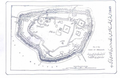 Multan fort.png 600 × 391; 284 KB
-
 United States 1849-1850.png 1,000 × 677; 95 KB
-
 WI Assembly Partisan Map 1849.svg 245 × 262; 48 KB


_(14586324929).jpg)


