Category:Maps showing 11th-century history
Jump to navigation
Jump to search
| Preceded by: 10th century maps |
11th century maps 1001 AD-1100 AD |
Succeeded by: 12th century maps |
Subcategories
This category has the following 17 subcategories, out of 17 total.
Media in category "Maps showing 11th-century history"
The following 101 files are in this category, out of 101 total.
-
 DominionCnutus.JPG 627 × 599; 140 KB
-
 1068 másolata.jpg 956 × 711; 185 KB
-
 Seltsjoekentekst.png 1,236 × 689; 146 KB
-
 11 13th century Asia Minor Turkish Invasions.Ellinika.png 1,232 × 599; 664 KB
-
 11 13th century Asia Minor Turkish Invasions.png 1,226 × 549; 641 KB
-
 93-vaspurakan908-1021.gif 700 × 486; 61 KB
-
 Anatolia 1097 ca.svg 1,440 × 749; 720 KB
-
 Anatolia 1097 es.svg 1,440 × 749; 625 KB
-
 Anatolia 1097 it.svg 1,440 × 749; 818 KB
-
 Anatolia 1097 pt.svg 1,440 × 749; 103 KB
-
 Anatolia 1097-ar.svg 1,440 × 749; 486 KB
-
 Anatolia 1097-zh.svg 1,800 × 936; 188 KB
-
 Anatolia 1097.svg 1,440 × 749; 518 KB
-
 Antiochia 1098.svg 630 × 448; 323 KB
-
 Arab world before Seljuk invasion (old Russian).jpg 545 × 270; 69 KB
-
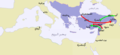
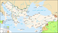
 Asia 1025ad.jpg 1,939 × 1,176; 775 KB
-
 Atlas Hermann Haack.jpg 5,694 × 7,211; 6.2 MB
-
 Bagratid Armenia, 962-1064.gif 700 × 472; 61 KB
-
 Battle of Kleidion.png 2,796 × 1,717; 678 KB
-
 Bremen Domburg um 1000.png 962 × 834; 240 KB
-
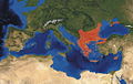
 Byzantine AD1081.jpg 1,200 × 759; 110 KB
-
 Byzantine during the reign of Basil II sr.svg 2,670 × 958; 103 KB
-
 Byzantine Empire (PSF).jpg 757 × 393; 110 KB
-
 Byzantine Empire PSF.png 748 × 385; 222 KB
-
 Byzantium 1081 c AD.jpg 1,077 × 681; 257 KB
-
 Byzantium vs Seljuk c 1071 cropped.png 449 × 346; 65 KB
-
 Byzantium vs Seljuk c 1071-ar.png 800 × 369; 138 KB
-
 Byzantium vs Seljuk c 1071.png 800 × 369; 139 KB
-
 Byzantium1081.png 550 × 375; 33 KB
-
 Byzantiumforecrusades ESP.PNG 550 × 375; 36 KB
-
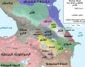
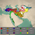 Büyük Selçuklu İmparatorluğu 1092 Yılı Etnik Haritası.png 1,080 × 1,080; 1.31 MB
-
 Califadofatimida-es.svg 1,405 × 621; 404 KB
-
 Carte des Hammadides et leurs voisins v.1050 (English cropped).png 4,503 × 2,534; 1,019 KB
-

-
 Cartina dei domini di Philaretus Brachamius it.svg 704 × 674; 58 KB
-
 Caucasus 1060 map ar.svg 1,155 × 898; 4.22 MB
-
 Caucasus 1060 map en.svg 1,155 × 898; 4.1 MB
-
 Caucasus 1060 map es.svg 1,155 × 898; 3.58 MB
-
 Caucasus 11 century.svg 1,155 × 898; 4.55 MB
-
 Cnut 1014 1035.jpg 765 × 731; 284 KB
-
 Cnut lands de.svg 642 × 517; 374 KB
-
 DUKLJA 1050..jpg 900 × 1,033; 86 KB
-
 EmpireNorth.JPG 674 × 668; 204 KB
-
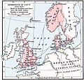
 England in the time of Cnut the Great.png 758 × 725; 1,019 KB
-
 Europe mainland d1097.JPG 938 × 600; 165 KB
-
 Ghaznavids1028.png 1,164 × 658; 27 KB
-
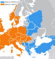
 Great Schism 1054 with former borders Turkish Version.png 2,000 × 2,141; 459 KB
-
 Great Schism 1054 with former borders-.png 2,000 × 2,141; 509 KB
-
 Great Schism 1054 with former borders-ar.png 2,000 × 2,141; 543 KB
-
 Great Schism 1054-es.svg 1,106 × 1,184; 1.21 MB
-
 Great Schism 1054.svg 1,106 × 1,184; 1.2 MB
-
 Great Schism with former borders (1054).png 2,000 × 2,141; 529 KB
-
 Hammadid Dynasty at its Greatest Extent.png 830 × 482; 60 KB
-
 History of Russia, IX-XV c.jpg 2,538 × 3,277; 1.4 MB
-
 Jorgat harasm.gif 700 × 579; 73 KB
-
 Kievan-rus-1015-1113.png 2,193 × 2,686; 604 KB
-
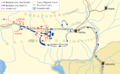
 Malazkirt Manzikert battle campaign map 1071.png 676 × 417; 16 KB
-
 Manzikertbattlecampaignmap21071.svg 901 × 556; 660 KB
-
 Map Byzantine Empire 1025-ar.svg 2,094 × 1,178; 807 KB
-
 Map Byzantine Empire 1025-de.svg 1,963 × 1,104; 105 KB
-
 Map Byzantine Empire 1025-el.svg 1,963 × 1,104; 98 KB
-
 Map Byzantine Empire 1025-en.svg 1,963 × 1,104; 960 KB
-
 Map Byzantine Empire 1025-es.svg 1,963 × 1,104; 96 KB
-
 Map Byzantine Empire 1025-fr.jpg 5,333 × 3,000; 535 KB
-
 Map Byzantine Empire 1025-fr.svg 1,963 × 1,104; 75 KB
-
 Map Byzantine Empire 1025-gl.svg 1,963 × 1,104; 78 KB
-
 Map Byzantine Empire 1025-hu.svg 1,963 × 1,104; 77 KB
-
 Map Byzantine Empire 1025-it.svg 1,963 × 1,104; 88 KB
-
 Map Byzantine Empire 1025-mk.svg 1,963 × 1,104; 105 KB
-
 Map Byzantine Empire 1025-pt.svg 1,963 × 1,104; 90 KB
-
 Map Byzantine Empire 1025-zh.svg 2,454 × 1,380; 390 KB
-
 Map Byzantine Empire 1045-es.svg 1,300 × 900; 327 KB
-
 Map Byzantine Empire 1045-zh.svg 1,300 × 900; 335 KB
-
 Map Byzantine Empire 1045.svg 1,300 × 900; 428 KB
-
 Map Byzantine Empire 1076-es.svg 1,963 × 1,104; 90 KB
-
 Map Byzantine Empire 1076-fr.jpg 5,333 × 3,000; 550 KB
-
 Map Byzantine Empire 1076-fr.svg 1,963 × 1,104; 92 KB
-
 Map Byzantine Empire 1076-pt.svg 512 × 288; 71 KB
-
 Map Byzantine Empire 1076-vi.svg 512 × 288; 41 KB
-
 Map Byzantine Empire 1076-zh.svg 2,454 × 1,380; 297 KB
-
 Map States Philaretos Brakhamios-es.svg 704 × 674; 45 KB
-
 Map States Philaretos Brakhamios-fr.svg 704 × 674; 82 KB
-
 Map States Philaretos Brakhamios-ru.svg 704 × 674; 22 KB
-
 NE 1025ad.jpg 1,599 × 1,356; 346 KB
-
 Norway 1020 AD.png 1,134 × 2,002; 337 KB
-
 Patriarchat von Ohrid 1020.jpg 1,472 × 1,505; 1.64 MB
-
 Rus Caspian.png 711 × 612; 669 KB
-
 Serbia religion 1054 01.png 638 × 1,077; 57 KB
-
 Serbia religion 1054 02.png 638 × 1,077; 58 KB
-
 Shaddadid-es.svg 2,938 × 1,873; 2.26 MB
-
 Shaddadid.gif 1,396 × 910; 369 KB
-
 State of Philaretus-ar.jpg 767 × 599; 442 KB
-
 State of Philaretus.jpg 767 × 599; 165 KB
-
 The Kingdom of Syounik-Baghk, 1020-1166.gif 700 × 627; 67 KB
-
 Türk Tarihi 1055.jpg 1,100 × 914; 333 KB
-
 Türk Tarihi 1092.jpg 1,100 × 914; 365 KB
-
 Türk Tarihi-1071.jpg 1,100 × 914; 344 KB
-
 Zirids after Hammadid secession.PNG 596 × 430; 16 KB
-
 Малая Азия 1097 г..svg 1,440 × 749; 95 KB
-
 دولة الحمادية في أقصى إتساع لها.png 830 × 482; 53 KB
-
 نبرد ملازگرد.png 676 × 417; 21 KB


.jpg)


.jpg)


.png)


.png)


