Category:Maps of Norman England
Jump to navigation
Jump to search
Media in category "Maps of Norman England"
The following 13 files are in this category, out of 13 total.
-
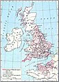 Williams dominions 1087.jpg 1,062 × 1,486; 1.92 MB
-
 Angleterre 1087.png 400 × 458; 89 KB
-
 Anlo-Norman Kingdom es.png 312 × 468; 33 KB
-
 Anlo-Norman Kingdom.png 312 × 468; 24 KB
-
 Den normanniske erobring 1066.svg 600 × 600; 123 KB
-

-
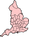 EnglandDomesdayCounties.png 480 × 600; 94 KB
-
 Map of England 1086.png 2,398 × 3,000; 1.43 MB
-
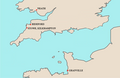 MapGrenvilleSeats.PNG 800 × 522; 174 KB
-
 Public School History of England and Canada 016.jpg 6,224 × 4,496; 3.03 MB
-
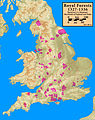
 Royal.Forests.1327.1336.annotated.jpg 2,324 × 2,931; 875 KB
-
 Royal.Forests.1327.1336.notannotated.jpg 2,324 × 2,931; 856 KB
-
 Royal.Forests.1327.1336.selected.jpg 2,324 × 2,931; 917 KB


.png)


