Category:Maps showing 1030
Jump to navigation
Jump to search
| 1030 1031 1035 1037 → |
English: Maps showing the year 1030 (i.e. history maps)
See also category: 1030 maps. and 1030s maps for more maps showing this year usually created not long after the given year.
See also category: 1030 maps. and 1030s maps for more maps showing this year usually created not long after the given year.
Media in category "Maps showing 1030"
The following 10 files are in this category, out of 10 total.
-
 1030 CE, Europe-IT.svg 512 × 438; 1.78 MB
-
 1030 CE, Europe.svg 512 × 438; 1.75 MB
-
 Leon 1030.png 620 × 654; 786 KB
-
 Leon1030.jpg 1,149 × 870; 305 KB
-
 Map Iberian Peninsula 1030-ast.svg 827 × 574; 260 KB
-
 Map Iberian Peninsula 1030-de.svg 827 × 574; 335 KB
-
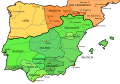
 Map Iberian Peninsula 1030-es.svg 827 × 574; 280 KB
-
 Map Iberian Peninsula 1030-hu.svg 827 × 574; 265 KB
-
 Peninsula iberica 1030 rus.svg 818 × 569; 2.42 MB
-
 Vasconie 1030 Shepherd.png 1,208 × 1,556; 255 KB


