
Category:Maps of France in 1030
Media in category "Maps of France in 1030"
The following 11 files are in this category, out of 11 total.
-
 Map France 1030-en2.svg 989 × 1,126; 715 KB
-
 Comté de Toulouse 1030 ru.png 338 × 316; 82 KB
-
 Map France 1030-br.svg 989 × 1,126; 741 KB
-
 Map France 1030-ca.svg 1,053 × 1,199; 4.9 MB
-
 Map France 1030-de.svg 988 × 1,124; 1.49 MB
-
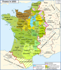
 Map France 1030-en.svg 989 × 1,126; 715 KB
-
 Map France 1030-es.svg 1,053 × 1,199; 4.12 MB
-
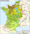 Map France 1030-fr.svg 989 × 1,126; 718 KB
-
 Map France 1030-ru.svg 988 × 1,124; 789 KB
-
 Map France 1030-uk.svg 988 × 1,124; 789 KB
-
 Occitània - Division territòriala vèrs 1030.png 1,050 × 755; 397 KB


Categories:
- Maps of France in the 11th century
- Maps of Burgundy in the 11th century
- Maps showing 1030
- County of Champagne
- Maps of the county of Flanders
- Duchy of Brittany
- Duchy of Normandy
- Maps of the history of Lorraine
- Maine (province)
- Maps of Poitou
- Bourbonnais
- Nivernais
- Marche (province)
- County of Anjou
- Angoumois
- Saintonge
- County of Auvergne
- Forez
- Maps of Limousin
- Maps of the history of Provence
- Kingdom of Navarre
- Maps of the County of Barcelona
- County of Toulouse
- Roussillon
- Maps of Gascogne