Category:Maps of the history of North Macedonia in ancient times
Jump to navigation
Jump to search
Subcategories
This category has the following 2 subcategories, out of 2 total.
M
- Maps of Illyricum (67 F)
Media in category "Maps of the history of North Macedonia in ancient times"
The following 42 files are in this category, out of 42 total.
-
 Ancient balkans 4thcentury-es.svg 2,039 × 1,823; 854 KB
-
 Ancient balkans 4thcentury-sr.png 1,113 × 845; 88 KB
-
 Ancient balkans 4thcentury-zh.svg 2,039 × 1,823; 318 KB
-
 Ancient balkans 4thcentury.png 1,113 × 845; 88 KB
-
 Ancient Epirus & Modern Borders (Colored)-pt.svg 688 × 1,002; 168 KB
-
 Ancient Epirus & Modern Borders (Colored).svg 688 × 1,002; 175 KB
-
 Ancient Epirus & Modern Borders zh (Colored).svg 860 × 1,252; 252 KB
-
 Ancient Epirus & Modern Borders.svg 688 × 1,002; 200 KB
-
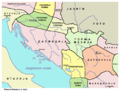
 Dardania kingdom-sr.png 877 × 894; 48 KB
-
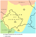 Dardania kingdom.png 877 × 894; 51 KB
-
 Epirus & modern borders.jpg 410 × 600; 182 KB
-
 Glasinac culture-sr.png 1,009 × 862; 59 KB
-
 Glasinac culture.png 1,009 × 862; 66 KB
-
 Illyrian Tribes satellite Map (Greek).svg 947 × 791; 2.36 MB
-
 IllyriansGR.jpg 800 × 542; 556 KB
-
 Kurgan kultur.png 440 × 364; 272 KB
-
 Macedonia ad400-zh.svg 787 × 881; 883 KB
-
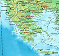 Macedonia ad400.png 630 × 605; 416 KB
-
 Map of ancient Epirus and environs (Deutsch).svg 1,422 × 1,614; 1.76 MB
-
 Map of ancient Epirus and environs (English) alternate contrast.svg 1,278 × 1,470; 6.06 MB
-
 Map of ancient Epirus and environs (English).svg 1,303 × 1,500; 495 KB
-
 Map of ancient Epirus and environs (Español).svg 1,303 × 1,500; 5.44 MB
-
 Map of ancient Epirus and environs (Français).svg 1,303 × 1,500; 381 KB
-
 Map of ancient Epirus and environs (Italiano).svg 1,303 × 1,500; 383 KB
-
 Map of ancient Epirus and environs (Português).svg 1,303 × 1,500; 379 KB
-
 Map of ancient Epirus and environs (Pусский).svg 1,303 × 1,500; 378 KB
-
 Map of ancient Epirus and environs (Shqipe).svg 1,303 × 1,500; 380 KB
-
 Map of ancient Epirus and environs (Български).svg 1,303 × 1,500; 378 KB
-
 Map of ancient Epirus and environs (Македонски).svg 1,303 × 1,500; 378 KB
-
 Map of ancient Epirus and environs (Српски-srpski).svg 1,303 × 1,500; 379 KB
-
 Map of ancient Epirus and environs.png 474 × 556; 343 KB
-
 Map of Triballi tribe (English).jpg 558 × 396; 123 KB
-
 Map of Triballi tribe-es.svg 559 × 395; 200 KB
-
 Neolithic vinca culture en.png 888 × 930; 54 KB
-
 Neolithic vinca culture sr.png 888 × 930; 56 KB
-
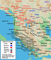
 Roman MAK.jpg 625 × 294; 64 KB
-
 South Illyria & Environs (English).svg 672 × 654; 694 KB
-
 South Illyria & Environs (Portuguese).svg 672 × 654; 694 KB
-
 South Illyria and Environs (English).png 782 × 1,030; 196 KB
-
 Starcevo culture-sr.png 1,151 × 1,027; 65 KB
-
 Starcevo culture.png 1,088 × 960; 26 KB
-
 Tribalia diagrama.jpg 2,038 × 1,677; 2 MB


-pt.svg)
.svg)
.svg)


.svg)


.svg)
_alternate_contrast.svg)
.svg)
.svg)
.svg)
.svg)
.svg)
.svg)
.svg)
.svg)
.svg)
.svg)

.jpg)


.svg)
.svg)
.png)


