Category:Maps of the history of Croatia in ancient times
Jump to navigation
Jump to search
Subcategories
This category has the following 5 subcategories, out of 5 total.
Media in category "Maps of the history of Croatia in ancient times"
The following 24 files are in this category, out of 24 total.
-
Ancient balkans 4thcentury-es.svg 2,039 × 1,823; 854 KB
-
Ancient balkans 4thcentury-sr.png 1,113 × 845; 88 KB
-
Ancient balkans 4thcentury-zh.svg 2,039 × 1,823; 318 KB
-
Ancient balkans 4thcentury.png 1,113 × 845; 88 KB
-
Ancient Bosnia.png 2,038 × 1,939; 520 KB
-
Map of the Kingdom of Agron of the Ardiaei (English).svg 1,600 × 1,600; 6.46 MB
-
Map of the Kingdom of Agron of the Ardiaei (Portuguese).svg 1,600 × 1,600; 6.46 MB
-
Map of the Kingdom of Gentius of the Ardiaei (English).svg 1,600 × 1,600; 6.39 MB
-
Map of the Kingdom of Gentius of the Ardiaei (Portuguese).svg 1,600 × 1,600; 6.39 MB
-
Map of the Kingdom of Teuta of the Ardiaei (English).svg 1,600 × 1,600; 6.46 MB
-
Map of the Kingdom of Teuta of the Ardiaei (Portuguese).svg 1,600 × 1,600; 6.46 MB
-
Map of the territory of Demetrius of Pharos (English).svg 1,600 × 1,600; 6.43 MB
-
Map of the territory of Demetrius of Pharos (Portuguese).svg 1,600 × 1,600; 6.43 MB
-
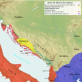
Marcellinus Dalmatia-it.svg 822 × 750; 118 KB
-
Marcellinus Dalmatia.jpg 1,054 × 1,041; 98 KB
-
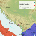
PAEONIAN ARDIAEAN (ILLYRIAN) DARDANIAN KINGDOMS EXTENT DURING 230 BC.png 1,049 × 938; 1.88 MB
-
Pannonia secunda-es.svg 4,596 × 2,857; 720 KB
-
Pannonia secunda-sr.png 1,034 × 630; 49 KB
-
Pannonia secunda.png 1,034 × 630; 49 KB
-
Rivolta pannonica 6 jpg.JPG 1,127 × 777; 241 KB
-
Rivolta pannonica 7.jpg 1,127 × 777; 242 KB
-
Rivolta pannonica 8.jpg 1,127 × 777; 239 KB
-
Rivolta pannonica 9.jpg 1,127 × 777; 244 KB
-
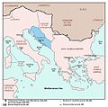
Roman Provinces and Church Dioceses IV Century Croatia.png 2,230 × 1,944; 403 KB


