Category:Maps of the history of Albania in ancient times
Jump to navigation
Jump to search
Subcategories
This category has the following 4 subcategories, out of 4 total.
Media in category "Maps of the history of Albania in ancient times"
The following 30 files are in this category, out of 30 total.
-
 Ancient balkans 4thcentury-es.svg 2,039 × 1,823; 854 KB
-
 Ancient balkans 4thcentury-sr.png 1,113 × 845; 88 KB
-
 Ancient balkans 4thcentury-zh.svg 2,039 × 1,823; 318 KB
-
 Ancient balkans 4thcentury.png 1,113 × 845; 88 KB
-
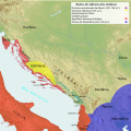
 Ancient Epirus & Modern Borders (Colored)-pt.svg 688 × 1,002; 168 KB
-
 Ancient Epirus & Modern Borders (Colored).svg 688 × 1,002; 175 KB
-
 Ancient Epirus & Modern Borders zh (Colored).svg 860 × 1,252; 252 KB
-
 Ancient Epirus & Modern Borders.svg 688 × 1,002; 200 KB
-
 Epirus & modern borders.jpg 410 × 600; 182 KB
-
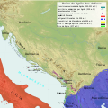
 Glasinac culture-sr.png 1,009 × 862; 59 KB
-
 Glasinac culture.png 1,009 × 862; 66 KB
-
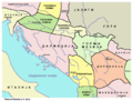
 Illyria and Dardania Kingdoms-sr.png 1,596 × 1,576; 118 KB
-
 Illyria and Dardania Kingdoms.png 1,596 × 1,576; 118 KB
-
 Illyrian Kingdom of Agron in 231 BC (Hungarian).png 1,731 × 1,015; 2.44 MB
-
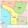
 KingdomofTeuta.png 2,000 × 2,000; 3.95 MB
-
 Map of the Kingdom of Agron of the Ardiaei (English).png 2,000 × 2,000; 3.95 MB
-
 Map of the Kingdom of Agron of the Ardiaei (English).svg 1,600 × 1,600; 6.46 MB
-
 Map of the Kingdom of Agron of the Ardiaei (Portuguese).svg 1,600 × 1,600; 6.46 MB
-
 Map of the Kingdom of Gentius in 169 BC (Hungarian).png 1,731 × 1,015; 2.39 MB
-
 Map of the Kingdom of Gentius of the Ardiaei (English).svg 1,600 × 1,600; 6.39 MB
-
 Map of the Kingdom of Gentius of the Ardiaei (Portuguese).svg 1,600 × 1,600; 6.39 MB
-
 Map of the Kingdom of Pinnes in 228 BC (Hungarian).png 1,731 × 1,015; 2.5 MB
-
 Map of the Kingdom of Teuta of the Ardiaei (English).svg 1,600 × 1,600; 6.46 MB
-
 Map of the Kingdom of Teuta of the Ardiaei (Portuguese).svg 1,600 × 1,600; 6.46 MB
-
 Map of the territory of Demetrius of Pharos (English).png 2,000 × 2,000; 3.95 MB
-
 Map of the territory of Demetrius of Pharos (English).svg 1,600 × 1,600; 6.43 MB
-
 Map of the territory of Demetrius of Pharos (Portuguese).svg 1,600 × 1,600; 6.43 MB
-
 Map of the Third Illyrian War 168 BC (hu).png 585 × 861; 732 KB
-
 Medieval Balec and ancient roman roads.png 1,717 × 1,951; 372 KB
-
 PAEONIAN ARDIAEAN (ILLYRIAN) DARDANIAN KINGDOMS EXTENT DURING 230 BC.png 1,049 × 938; 1.88 MB


-pt.svg)
.svg)
.svg)


.png)

.png)
.svg)
.svg)
.png)
.svg)
.svg)
.png)
.svg)
.svg)
.png)
.svg)
.svg)
.png)

_DARDANIAN_KINGDOMS_EXTENT_DURING_230_BC.png)