Category:Maps of the history of Bulgaria in ancient times
Jump to navigation
Jump to search
Subcategories
This category has the following 2 subcategories, out of 2 total.
M
- Maps of Illyricum (67 F)
T
- Maps of ancient Thrace (84 F)
Media in category "Maps of the history of Bulgaria in ancient times"
The following 10 files are in this category, out of 10 total.
-
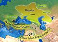 7. yüzyıl Hazarlar.jpg 1,905 × 1,376; 2.31 MB
-
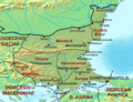 Dioecesis Thraciae 400 AD.png 461 × 352; 205 KB
-
 Map of Triballi tribe (English).jpg 558 × 396; 123 KB
-
 Map of Triballi tribe-es.svg 559 × 395; 200 KB
-
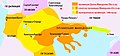
 Nikulitza Ongal 2010.jpg 3,225 × 2,339; 7.27 MB
-
 Pistiros - map of the excavated area (2009).jpg 661 × 885; 65 KB
-
 Roman MAK.jpg 625 × 294; 64 KB
-
 Thraciae-veteris-typvs.jpg 4,452 × 3,424; 3.59 MB
-
 Tribalia diagrama.jpg 2,038 × 1,677; 2 MB
-
 Картограф Ортелий-1595г Балкани мизи даки трибали българи гети.jpg 1,614 × 1,119; 559 KB


.jpg)


.jpg)


