Category:Maps of the Danube watercourse system
Jump to navigation
Jump to search
Deutsch: Karten des Gewässersystems der Donau
English: Maps of the Danube watercourse system
Please sort by !All, and the rivers by a name or maps categories.
See also:
- Category:Satellite pictures of the Danube
- Neigbouring Regions: Category:Hydrographical maps of the Alps, Category:Maps of the Black Sea, Category:Maps of Central Europe, Category:Maps of Eastern Europe, Category:Maps of the Balkans
- States:
- Rivers: Category:Maps of rivers of Austria, Category:Rivers of Bosnia and Herzegovina, Category:Rivers of Bulgaria, Category:Rivers of Croatia, Category:Rivers of the Czech Republic, Category:Rivers of Germany, Category:Maps of rivers of Hungary, Category:Rivers of Moldova, Category:Rivers of Romania, Category:Rivers of Slovakia, Category:Maps of rivers of Slovenia, Category:Rivers of Serbia, Category:Maps of rivers of Switzerland, Category:Rivers of Ukraine
- Lakes: Category:Maps of lakes of Austria, Category:Lakes of Bosnia and Herzegovina, Category:Lakes of Bulgaria, Category:Lakes of Croatia, Category:Lakes of the Czech Republic, Category:Lakes of Germany, Category:Lakes of Hungary, Category:Lakes of Moldova, Category:Lakes of Romania, Category:Lakes of Slovakia, Category:Lakes of Slovenia, Category:Lakes of Serbia, Category:Maps of lakes of Switzerland, Category:Lakes of Ukraine
Subcategories
This category has the following 16 subcategories, out of 16 total.
Media in category "Maps of the Danube watercourse system"
The following 57 files are in this category, out of 57 total.
-
 International Commission for the Protection of the Danube River.PNG 720 × 600; 67 KB
-
 Karte Donau.jpg 800 × 700; 160 KB
-
 Bassin-du-Danube-blank-map.png 1,416 × 741; 123 KB
-
 Bassin-du-Danube.png 1,416 × 741; 156 KB
-
 Danubemap.JPG 695 × 475; 91 KB
-
 Danubemap.png 747 × 480; 601 KB
-
 Danubio mapa.JPG 1,024 × 451; 52 KB
-
 Donau-Karte.png 1,024 × 451; 65 KB
-
 Karte Donau.png 806 × 726; 426 KB
-
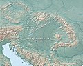 Carpathian Basin-Pannonian Basin.jpg 965 × 774; 282 KB
-
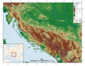 Dinarisches Gebirge Topo.png 2,900 × 2,250; 7.61 MB
-
 Alps orographic.png 600 × 371; 262 KB
-

-
 2021-05-05 Donau.jpg 8,510 × 4,740; 6.24 MB
-
 Balkan hu.svg 1,400 × 1,278; 507 KB
-
 Balkan mk.svg 1,400 × 1,278; 470 KB
-
 Balkan topo fr.svg 1,400 × 1,278; 466 KB
-
 Balkan topo la.svg 1,400 × 1,278; 472 KB
-
 Balkan topo pl.jpg 1,400 × 1,278; 794 KB
-
 Carlo giovanni gibertoni, corso del danubio, 1694 (Inv.3715, Museo Galileo).jpg 3,396 × 1,980; 1.49 MB
-

-

-
 Constanta-Rotterdam blank-he.svg 512 × 217; 38 KB
-
 Constanta-Rotterdam blank.png 894 × 377; 29 KB
-
 Constanta-Rotterdam blank.svg 512 × 217; 39 KB
-
 Constanta-Rotterdam DE.PNG 894 × 377; 32 KB
-
 Constanta-Rotterdam eo.png 894 × 377; 42 KB
-
 Danubemap-ar.png 747 × 480; 589 KB
-
 Danubemap.jpg 998 × 720; 389 KB
-
 Der Donauverlauf von der Quelle bis zur Mündung.jpg 2,670 × 1,182; 2.47 MB
-
 Donau Einzugsgebiet.png 2,130 × 1,137; 4.04 MB
-
 Donauknie.jpg 574 × 230; 17 KB
-
 DTD-Kanalsystem.png 588 × 474; 166 KB
-
 Duna-terkep.png 1,024 × 451; 60 KB
-
 ETH-BIB-Fluss-System der Donau-Dia 247-Z-00254.tif 3,600 × 2,896; 30.01 MB
-
 Gabčíkovo-Nagymaros map no.1.png 798 × 497; 71 KB
-
 Gabčíkovo-Nagymaros map no.2.png 798 × 501; 89 KB
-
 Gabčíkovo-Nagymaros map no.3.png 800 × 492; 78 KB
-
 Geokarte Lauchert+Graben Schwäbische Alb.jpg 1,200 × 1,800; 1.55 MB
-
 HR+HU+SK relief.png 957 × 778; 1.25 MB
-
 Karte einzugsbereich iller.png 800 × 1,397; 149 KB
-
 Lage fluss altmühl.PNG 1,066 × 788; 536 KB
-
 Balkan topo blank.jpg 1,400 × 1,278; 705 KB
-
 OgostaMap.jpg 2,479 × 3,507; 760 KB
-
 Olt fiume copia.jpg 593 × 399; 128 KB
-
 Olt river.jpg 593 × 399; 26 KB
-
 OsamMap.jpg 2,479 × 3,507; 433 KB
-
 Pannonian Basin geographic map blank croped.svg 2,639 × 2,153; 10.07 MB
-
 Pannonian Basin geographic map blank.svg 3,186 × 2,600; 10.08 MB
-
 Pannonian Basin geographic map-es.svg 3,186 × 2,600; 10.29 MB
-
 Pannonian Basin geographic map.svg 3,186 × 2,600; 9.58 MB
-
 RusenskiLomMap.jpg 2,476 × 2,804; 710 KB
-
 Szentgotthárdi csata (csapatok felállása).PNG 846 × 483; 475 KB
-
 Thiz river.jpg 593 × 399; 102 KB
-
 Topografischer Hintergrund HU + SK.png 728 × 681; 768 KB
-
 VitMap.jpg 2,479 × 3,507; 811 KB
-


.jpg)


.jpg)

.jpg)


.PNG)


.jpg)