Category:Maps of the Danube
Jump to navigation
Jump to search
Subcategories
This category has the following 4 subcategories, out of 4 total.
M
- Maps of the upper Danube (49 F)
O
Media in category "Maps of the Danube"
The following 28 files are in this category, out of 28 total.
-
-
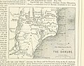
 (1853) MAP OF LOWER DANUBIA.jpg 3,131 × 2,568; 3.47 MB
-
 2021-05-05 Donau.jpg 8,510 × 4,740; 6.24 MB
-
 Ada Kaleh szigete 1918 körül.JPG 713 × 887; 179 KB
-
 Aquila (1918) (19721490826).jpg 2,864 × 1,912; 953 KB
-
 Aquila (1918) (19747701745).jpg 2,944 × 2,116; 976 KB
-
 Aquila (1918) (19752356601).jpg 2,808 × 1,984; 936 KB
-
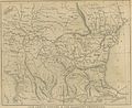
 Banat Josephinische Landaufnahme pg193.jpg 9,213 × 5,738; 34.87 MB
-
 Bulgarien BV043558403 (cropped).jpg 1,146 × 844; 94 KB
-

-
 Carpathian-Basin.jpg 278 × 190; 26 KB
-

-
 Chemins de fer d'Europe, principalement de Londres et Paris à Basiasch sur le Danube.jpg 11,681 × 4,699; 8.62 MB
-
 Danube basin.png 1,361 × 768; 1.46 MB
-
 Danube in Machland 1812 - Severin Hohensinner 2008.tif 4,890 × 2,988; 1.23 MB
-
 Danube River Basin Boundaries - DPLA - 7faf360017077c7d8baba44e6cc73335.jpg 6,760 × 4,274; 3.77 MB
-
 Danube River near Vienna around 1570 CE.jpg 4,570 × 6,357; 7.49 MB
-
 Danubius fluuius Europae maximus a fontibus ad ostia - CBT 5873408.jpg 6,705 × 3,288; 5.35 MB
-
 Hydrographia Germaniae - CBT 5873266.jpg 5,807 × 4,773; 7.5 MB
-
 Imprejurimile Comuneĭ Olteniţa.jpg 1,396 × 984; 120 KB
-
 Iron Gates map.png 300 × 200; 100 KB
-
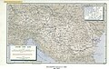
 IronGates Locator map.png 2,000 × 1,029; 1,012 KB
-
 Karte Hochwasser in Deutschland Landkreise.png 1,325 × 1,396; 784 KB
-

-
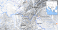
 NPDA 2019.jpg 3,742 × 2,214; 1,024 KB
-
 Radetzky 004.jpg 2,667 × 2,000; 1.05 MB
-
 UBBasel Map 1578 Kartenslg AA 57 Tractus Danubii prima.tiff 11,953 × 9,800, 2 pages; 666.34 MB
-
 На лепом српском Дунаву, 333.jpg 4,116 × 2,171; 1.61 MB
%27_(11253112224).jpg)
_MAP_OF_LOWER_DANUBIA.jpg)


_(19721490826).jpg)
_(19747701745).jpg)
_(19752356601).jpg)

.jpg)


