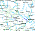
Category:Maps of the upper Danube
Appearance
The Category:Maps of the Danube is separated into three categories:
- Category:Maps of the upper Danube, from the confluent of Brigach and Brege to the Gate of Vienna, in the (northern) Alpine Foreland, flowing through Germany and Austria
- Category:Maps of the middle Danube, from the Gate of Vienna to the Iron Gate, in the Pannonian Plains/Carpathian Basin, flowing through Austria, Slovakia, Hungary, Croatia, and Serbia
- Category:Maps of the lower Danube, from the Iron Gate to the Black Sea, including the Danube Delta, flowing through Romania, Bulgaria, Moldawia and Ukraine
Media in category "Maps of the upper Danube"
The following 49 files are in this category, out of 49 total.
-
Karte Obere Donau.png 761 × 726; 138 KB
-
Obere donau.png 586 × 336; 14 KB
-
Altmuehl.png 829 × 915; 1.42 MB
-
Altmuehl2.png 812 × 864; 523 KB
-
Altmühl.png 831 × 886; 1.96 MB
-
Ansbach - 28-49.jpg 3,328 × 4,972; 3.3 MB
-
Charte von Schwaben Tafel 29 Donauquellen.jpg 2,123 × 2,615; 4.45 MB
-
Charte von Schwaben Tafel 32 Pfullendorf.jpg 2,140 × 2,624; 4.63 MB
-
Danube in Machland 1812 - Severin Hohensinner 2008.tif 4,890 × 2,988; 1.23 MB
-
Danube River near Vienna around 1570 CE.jpg 4,570 × 6,357; 7.49 MB
-
Donau-Oder-Kanal.jpg 3,425 × 2,379; 3.01 MB
-
Donauleiten-Löwenwand.jpg 776 × 336; 264 KB
-
Donaustrudel 1721.jpg 650 × 450; 135 KB
-
Ducatus Wurtenbergensis (8342804155).jpg 658 × 800; 206 KB
-
Hausstein 1721.jpg 650 × 450; 132 KB
-
Karte einzugsbereich iller.png 800 × 1,397; 149 KB
-
Ingolstadt - 29-49.jpg 3,404 × 5,040; 3.24 MB
-
J. B. Homann - Danubii cum adiacentibus regnis.jpg 640 × 517; 141 KB
-
Kamp krems.png 1,599 × 803; 1.92 MB
-
Karte Altmyhl.gif 419 × 379; 19 KB
-
Konstanz - 27-48.jpg 3,388 × 4,995; 3.47 MB
-
Lage altmyhl.png 1,066 × 788; 169 KB
-
Linz - 32-48.jpg 3,395 × 4,945; 3.78 MB
-
Main-Donau-Kanal-Karte.jpg 1,280 × 1,094; 202 KB
-
Map of Swabia, Bavaria, Odenwald NE 1600.jpg 800 × 600; 166 KB
-
Matthäus Seutter - Theatrum Belli sive Novissima Tabula.jpg 640 × 520; 143 KB
-
Nicolaes Visscher I - Danvbiuvs, fluvius Europae maximus.jpg 640 × 281; 69 KB
-
Passau - 31-49.jpg 3,309 × 4,953; 3.64 MB
-
Passau Altstadt.svg 769 × 525; 34 KB
-
Passau Hacklberg.svg 1,000 × 552; 78 KB
-
Passau Haidenhof.svg 1,000 × 552; 78 KB
-
Passau mit Kräutelstein Urpositionsblatt.jpg 1,742 × 813; 1.25 MB
-
Passau Stadtteile.svg 1,000 × 552; 77 KB
-
Passau-St Pas 1827 p2-1-2.jpg 2,500 × 2,471; 2.1 MB
-
Passau-St Pas 1827-MJ-2-2.jpg 4,358 × 2,297; 4.11 MB
-
Passau-St Pas 1827-MJ-2.jpg 4,358 × 2,297; 5 MB
-
Passau-St Pas 1827-MJ.jpg 4,358 × 2,297; 8.83 MB
-
PLAN EIN STICK VON DER DANAW.jpg 2,880 × 1,043; 440 KB
-
Regensburg - 30-49.jpg 3,329 × 4,981; 3.5 MB
-
Schaffhausen - 26-48.jpg 3,390 × 5,006; 3.67 MB
-
St. Pölten - 33-48.jpg 3,401 × 4,934; 4.88 MB
-
Topographia Austriacarum (Merian) 017.jpg 2,000 × 1,661; 664 KB
-
Ulm - 28-48.jpg 3,383 × 5,008; 3.34 MB
-
Urdonau+Donau-Historie Schwaebische-Alb.jpg 1,800 × 1,414; 918 KB
-
Vienna Basin physical.png 926 × 1,066; 1.81 MB


