Category:Maps of cantons of Sarthe
Jump to navigation
Jump to search
Departments of Metropolitan France: Ain [01] · Aisne [02] · Allier [03] · Alpes-de-Haute-Provence [04] · Hautes-Alpes [05] · Alpes-Maritimes [06] · Ardèche [07] · Ardennes [08] · Ariège [09] · Aube [10] · Aude [11] · Aveyron [12] · Bouches-du-Rhône [13] · Calvados [14] · Cantal [15] · Charente [16] · Charente-Maritime [17] · Cher [18] · Corrèze [19] · Corse-du-Sud [2A]† · Haute-Corse [2B]† · Côte-d’Or [21] · Côtes-d'Armor [22] · Creuse [23] · Dordogne [24] · Doubs [25] · Drôme [26] · Eure [27] · Eure-et-Loir [28] · Finistère [29] · Gard [30] · Haute-Garonne [31] · Gers [32] · Gironde [33] · Hérault [34] · Ille-et-Vilaine [35] · Indre [36] · Indre-et-Loire [37] · Isère [38] · Jura [39] · Landes [40] · Loir-et-Cher [41] · Loire [42] · Haute-Loire [43] · Loire-Atlantique [44] · Loiret [45] · Lot [46] · Lot-et-Garonne [47] · Lozère [48] · Maine-et-Loire [49] · Manche [50] · Marne [51] · Haute-Marne [52] · Mayenne [53] · Meurthe-et-Moselle [54] · Meuse [55] · Morbihan [56] · Moselle [57] · Nièvre [58] · Nord [59] · Oise [60] · Orne [61] · Pas-de-Calais [62] · Puy-de-Dôme [63] · Pyrénées-Atlantiques [64] · Hautes-Pyrénées [65] · Pyrénées-Orientales [66] · Bas-Rhin [67] · Haut-Rhin [68] · departmental district of the Rhône [69] · Haute-Saône [70] · Saône-et-Loire [71] · Sarthe [72] · Savoie [73] · Haute-Savoie [74] · Seine-Maritime [76] · Seine-et-Marne [77] · Yvelines [78] · Deux-Sèvres [79] · Somme [80] · Tarn [81] · Tarn-et-Garonne [82] · Var [83] · Vaucluse [84] · Vendée [85] · Vienne [86] · Haute-Vienne [87] · Vosges [88] · Yonne [89] · Territoire de Belfort [90] · Essonne [91] · Hauts-de-Seine [92] · Seine-Saint-Denis [93] · Val-de-Marne [94] · Val-d'Oise [95]
Overseas departments and regions: Guadeloupe [971] · Martinique [972] · French Guiana [973] · Mayotte [976]
Overseas departments and regions: Guadeloupe [971] · Martinique [972] · French Guiana [973] · Mayotte [976]
Subcategories
This category has the following 4 subcategories, out of 4 total.
*
2
Media in category "Maps of cantons of Sarthe"
The following 30 files are in this category, out of 30 total.
-
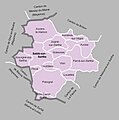
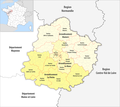 Département Sarthe Arrondissement Kantone 2021.png 2,500 × 2,220; 972 KB
-
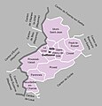
 Département Sarthe Kantone 2021.png 2,500 × 2,220; 943 KB
-
 MapCanton2012-7202-BeaumonSurSarthe.jpg 938 × 784; 219 KB
-
 MapCanton2012-7203-Bonnétable.jpg 843 × 769; 184 KB
-
 MapCanton2012-7204-Bouloire.jpg 954 × 942; 193 KB
-
 MapCanton2012-7205-Brûlon.jpg 1,109 × 800; 234 KB
-
 MapCanton2012-7206-LaChartreSurLeLoir.jpg 997 × 942; 205 KB
-
 MapCanton2012-7207-ChâteauDuLoir.jpg 924 × 1,052; 218 KB
-
 MapCanton2012-7208-Conlie.jpg 1,146 × 864; 267 KB
-
 MapCanton2012-7210-LaFertéBernard.jpg 1,166 × 820; 221 KB
-
 MapCanton2012-7211-LaFresnayeSurChédouet.jpg 911 × 783; 201 KB
-
 MapCanton2012-7212-FresnaySurSarthe.jpg 1,036 × 952; 257 KB
-
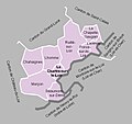
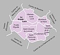 MapCanton2012-7213-LeGrandLucé.jpg 902 × 819; 195 KB
-
 MapCanton2012-7214-LaFlèche.jpg 1,247 × 781; 203 KB
-
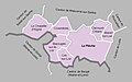
 MapCanton2012-7215-Loué.jpg 1,349 × 759; 117 KB
-
 MapCanton2012-7216-LeLude.jpg 1,466 × 889; 270 KB
-
 MapCanton2012-7217-MalicorneSurSarthe.jpg 988 × 860; 201 KB
-
 MapCanton2012-7218-Mamers.jpg 1,251 × 983; 292 KB
-
 MapCanton2012-7222-MarollesLesBraults.jpg 868 × 731; 217 KB
-
 MapCanton2012-7223-Mayet.jpg 894 × 821; 132 KB
-
 MapCanton2012-7224-MontfortLeGesnois.jpg 963 × 953; 237 KB
-
 MapCanton2012-7225-Montmirail.jpg 1,126 × 733; 182 KB
-
 MapCanton2012-7226-Pontvallain.jpg 1,004 × 950; 194 KB
-
 MapCanton2012-7227-SabléSurSarthe.jpg 1,194 × 1,201; 286 KB
-
 MapCanton2012-7228-SaintCalais.jpg 1,077 × 1,081; 270 KB
-
 MapCanton2012-7229-SaintPaterne.jpg 1,046 × 860; 267 KB
-
 MapCanton2012-7230-SilléLeGuillaume.jpg 1,050 × 1,099; 249 KB
-
 MapCanton2012-7231-LaSuzeSurSarthe.jpg 982 × 808; 222 KB
-
 MapCanton2012-7232-Tuffé.jpg 965 × 818; 206 KB
-
 MapCanton2012-7233-Vibraye.jpg 1,154 × 667; 139 KB


