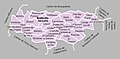
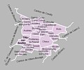
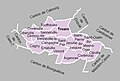
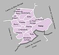
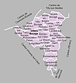
Category:Maps of cantons of Calvados
Jump to navigation
Jump to search
Departments of Metropolitan France: Ain [01] · Aisne [02] · Allier [03] · Alpes-de-Haute-Provence [04] · Hautes-Alpes [05] · Alpes-Maritimes [06] · Ardèche [07] · Ardennes [08] · Ariège [09] · Aube [10] · Aude [11] · Aveyron [12] · Bouches-du-Rhône [13] · Calvados [14] · Cantal [15] · Charente [16] · Charente-Maritime [17] · Cher [18] · Corrèze [19] · Corse-du-Sud [2A]† · Haute-Corse [2B]† · Côte-d’Or [21] · Côtes-d'Armor [22] · Creuse [23] · Dordogne [24] · Doubs [25] · Drôme [26] · Eure [27] · Eure-et-Loir [28] · Finistère [29] · Gard [30] · Haute-Garonne [31] · Gers [32] · Gironde [33] · Hérault [34] · Ille-et-Vilaine [35] · Indre [36] · Indre-et-Loire [37] · Isère [38] · Jura [39] · Landes [40] · Loir-et-Cher [41] · Loire [42] · Haute-Loire [43] · Loire-Atlantique [44] · Loiret [45] · Lot [46] · Lot-et-Garonne [47] · Lozère [48] · Maine-et-Loire [49] · Manche [50] · Marne [51] · Haute-Marne [52] · Mayenne [53] · Meurthe-et-Moselle [54] · Meuse [55] · Morbihan [56] · Moselle [57] · Nièvre [58] · Nord [59] · Oise [60] · Orne [61] · Pas-de-Calais [62] · Puy-de-Dôme [63] · Pyrénées-Atlantiques [64] · Hautes-Pyrénées [65] · Pyrénées-Orientales [66] · Bas-Rhin [67] · Haut-Rhin [68] · departmental district of the Rhône [69] · Haute-Saône [70] · Saône-et-Loire [71] · Sarthe [72] · Savoie [73] · Haute-Savoie [74] · Seine-Maritime [76] · Seine-et-Marne [77] · Yvelines [78] · Deux-Sèvres [79] · Somme [80] · Tarn [81] · Tarn-et-Garonne [82] · Var [83] · Vaucluse [84] · Vendée [85] · Vienne [86] · Haute-Vienne [87] · Vosges [88] · Yonne [89] · Territoire de Belfort [90] · Essonne [91] · Hauts-de-Seine [92] · Seine-Saint-Denis [93] · Val-de-Marne [94] · Val-d'Oise [95]
Overseas departments and regions: Guadeloupe [971] · Martinique [972] · French Guiana [973] · Mayotte [976]
Overseas departments and regions: Guadeloupe [971] · Martinique [972] · French Guiana [973] · Mayotte [976]
Subcategories
This category has the following 5 subcategories, out of 5 total.
*
Media in category "Maps of cantons of Calvados"
The following 76 files are in this category, out of 76 total.
-
 Calvados - Canton Aunay-sur-Odon 2015.svg 935 × 571; 962 KB
-
 Calvados - Canton Bayeux 2015.svg 935 × 571; 962 KB
-
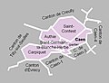
 Calvados - Canton Bretteville-l'Orgueilleuse 2015.svg 935 × 571; 962 KB
-
 Calvados - Canton Cabourg 2015.svg 935 × 571; 962 KB
-
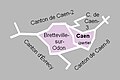
 Calvados - Canton Caen-1 2015.svg 935 × 571; 962 KB
-
 Calvados - Canton Caen-2 2015.svg 935 × 571; 962 KB
-
 Calvados - Canton Caen-3 2015.svg 935 × 571; 962 KB
-
 Calvados - Canton Caen-4 2015.svg 935 × 571; 962 KB
-
 Calvados - Canton Caen-5 2015.svg 935 × 571; 962 KB
-
 Calvados - Canton Condé-sur-Noireau 2015.svg 935 × 571; 962 KB
-
 Calvados - Canton Courseulles-sur-Mer 2015.svg 935 × 571; 962 KB
-
 Calvados - Canton Falaise 2015.svg 935 × 571; 962 KB
-
 Calvados - Canton Honfleur-Deauville 2015.svg 935 × 571; 962 KB
-
 Calvados - Canton Hérouville-Saint-Clair 2015.svg 935 × 571; 962 KB
-
 Calvados - Canton Ifs 2015.svg 935 × 571; 962 KB
-
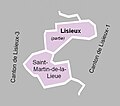
 Calvados - Canton Lisieux 2015.svg 935 × 571; 962 KB
-
 Calvados - Canton Livarot 2015.svg 935 × 571; 962 KB
-
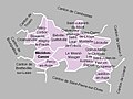
 Calvados - Canton Mézidon-Canon 2015.svg 935 × 571; 962 KB
-
 Calvados - Canton Ouistreham 2015.svg 935 × 571; 962 KB
-
 Calvados - Canton Pont-l'Évêque 2015.svg 935 × 571; 962 KB
-
 Calvados - Canton Thury-Harcourt 2015.svg 935 × 571; 962 KB
-
 Calvados - Canton Troarn 2015.svg 935 × 571; 962 KB
-
 Calvados - Canton Trévières 2015.svg 935 × 571; 962 KB
-
 Calvados - Canton Vire 2015.svg 935 × 571; 962 KB
-
 Calvados - Canton Évrecy 2015.svg 935 × 571; 962 KB
-
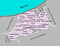
 Département Calvados Arrondissement Kantone 2021.png 2,499 × 1,679; 937 KB
-
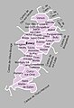
 Département Calvados Kantone 2021.png 2,499 × 1,679; 901 KB
-
 MapCanton2012-1401-AunaySurOdon.jpg 1,235 × 839; 266 KB
-
 MapCanton2012-1402-Balleroy.jpg 1,182 × 781; 278 KB
-
 MapCanton2012-1403-Bayeux.jpg 746 × 608; 157 KB
-
 MapCanton2012-1404-LeBényBocage.jpg 1,144 × 856; 287 KB
-
 MapCanton2012-1405-BlangyLeChâteau.jpg 1,073 × 907; 252 KB
-
 MapCanton2012-1406-Bourguébus.jpg 1,191 × 615; 265 KB
-
 MapCanton2012-1407-BrettevilleSurLaize.jpg 1,399 × 687; 360 KB
-
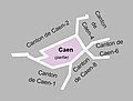
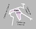
 MapCanton2012-1408-Caen1.jpg 601 × 400; 61 KB
-
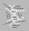
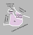
 MapCanton2012-1409-Caen2.jpg 726 × 554; 116 KB
-
 MapCanton2012-1410-Cambremer.jpg 1,077 × 747; 229 KB
-
 MapCanton2012-1411-CaumontLÉventé.jpg 1,159 × 712; 224 KB
-
 MapCanton2012-1412-CondéSurNoireau.jpg 864 × 804; 206 KB
-
 MapCanton2012-1413-Creully.jpg 1,066 × 801; 278 KB
-
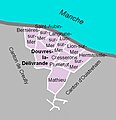 MapCanton2012-1414-DouvresLaDélivrande.jpg 629 × 652; 129 KB
-
 MapCanton2012-1415-Dozulé.jpg 995 × 762; 277 KB
-
 MapCanton2012-1416-Évrecy.jpg 775 × 1,130; 293 KB
-
 MapCanton2012-1417-FalaiseNord.jpg 1,089 × 859; 329 KB
-
 MapCanton2012-1418-FalaiseSud.jpg 725 × 734; 141 KB
-
 MapCanton2012-1419-Honfleur.jpg 815 × 649; 192 KB
-
 MapCanton2012-1420-IsignySurMer.jpg 907 × 1,034; 327 KB
-
 MapCanton2012-1421-Lisieux1.jpg 966 × 799; 230 KB
-
 MapCanton2012-1422-Lisieux2.jpg 563 × 496; 64 KB
-
 MapCanton2012-1423-Livarot.jpg 920 × 783; 284 KB
-
 MapCanton2012-1424-MézidonCanon.jpg 1,020 × 769; 262 KB
-
 MapCanton2012-1425-MorteauxCoulibœuf.jpg 932 × 977; 249 KB
-
 MapCanton2012-1426-Orbec.jpg 802 × 898; 265 KB
-
 MapCanton2012-1427-PontLÉvêque.jpg 1,068 × 789; 264 KB
-
 MapCanton2012-1428-Ryes.jpg 1,147 × 576; 239 KB
-
 MapCanton2012-1429-SaintPierreSurDives.jpg 944 × 913; 218 KB
-
 MapCanton2012-1430-SaintSeverCalvados.jpg 1,052 × 1,116; 327 KB
-
 MapCanton2012-1431-ThuryHarcourt.jpg 1,093 × 954; 294 KB
-
 MapCanton2012-1432-TillySurSeulles.jpg 963 × 810; 248 KB
-
 MapCanton2012-1433-Trévières.jpg 1,009 × 764; 246 KB
-
 MapCanton2012-1434-Troarn.jpg 936 × 628; 195 KB
-
 MapCanton2012-1435-TrouvilleSurMer.jpg 659 × 579; 120 KB
-
 MapCanton2012-1436-Vassy.jpg 906 × 841; 178 KB
-
 MapCanton2012-1437-VillersBocage.jpg 876 × 954; 269 KB
-
 MapCanton2012-1438-Vire.jpg 864 × 785; 182 KB
-
 MapCanton2012-1439-Caen3.jpg 611 × 462; 62 KB
-
 MapCanton2012-1440-Caen4.jpg 487 × 507; 69 KB
-
 MapCanton2012-1441-Caen5.jpg 614 × 522; 74 KB
-
 MapCanton2012-1442-Caen6.jpg 589 × 455; 76 KB
-
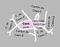
 MapCanton2012-1443-Caen7.jpg 603 × 533; 78 KB
-
 MapCanton2012-1444-Caen8.jpg 672 × 681; 115 KB
-
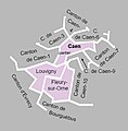
 MapCanton2012-1445-Caen9.jpg 528 × 428; 46 KB
-
 MapCanton2012-1446-Caen10.jpg 518 × 547; 68 KB
-
 MapCanton2012-1447-Cabourg.jpg 942 × 691; 177 KB
-
 MapCanton2012-1448-Ouistreham.jpg 628 × 605; 138 KB
-
 MapCanton2012-1449-Lisieux3.jpg 887 × 747; 219 KB


