Category:Maps of cantons of Manche
Jump to navigation
Jump to search
Departments of Metropolitan France: Ain [01] · Aisne [02] · Allier [03] · Alpes-de-Haute-Provence [04] · Hautes-Alpes [05] · Alpes-Maritimes [06] · Ardèche [07] · Ardennes [08] · Ariège [09] · Aube [10] · Aude [11] · Aveyron [12] · Bouches-du-Rhône [13] · Calvados [14] · Cantal [15] · Charente [16] · Charente-Maritime [17] · Cher [18] · Corrèze [19] · Corse-du-Sud [2A]† · Haute-Corse [2B]† · Côte-d’Or [21] · Côtes-d'Armor [22] · Creuse [23] · Dordogne [24] · Doubs [25] · Drôme [26] · Eure [27] · Eure-et-Loir [28] · Finistère [29] · Gard [30] · Haute-Garonne [31] · Gers [32] · Gironde [33] · Hérault [34] · Ille-et-Vilaine [35] · Indre [36] · Indre-et-Loire [37] · Isère [38] · Jura [39] · Landes [40] · Loir-et-Cher [41] · Loire [42] · Haute-Loire [43] · Loire-Atlantique [44] · Loiret [45] · Lot [46] · Lot-et-Garonne [47] · Lozère [48] · Maine-et-Loire [49] · Manche [50] · Marne [51] · Haute-Marne [52] · Mayenne [53] · Meurthe-et-Moselle [54] · Meuse [55] · Morbihan [56] · Moselle [57] · Nièvre [58] · Nord [59] · Oise [60] · Orne [61] · Pas-de-Calais [62] · Puy-de-Dôme [63] · Pyrénées-Atlantiques [64] · Hautes-Pyrénées [65] · Pyrénées-Orientales [66] · Bas-Rhin [67] · Haut-Rhin [68] · departmental district of the Rhône [69] · Haute-Saône [70] · Saône-et-Loire [71] · Sarthe [72] · Savoie [73] · Haute-Savoie [74] · Seine-Maritime [76] · Seine-et-Marne [77] · Yvelines [78] · Deux-Sèvres [79] · Somme [80] · Tarn [81] · Tarn-et-Garonne [82] · Var [83] · Vaucluse [84] · Vendée [85] · Vienne [86] · Haute-Vienne [87] · Vosges [88] · Yonne [89] · Territoire de Belfort [90] · Essonne [91] · Hauts-de-Seine [92] · Seine-Saint-Denis [93] · Val-de-Marne [94] · Val-d'Oise [95]
Overseas departments and regions: Guadeloupe [971] · Martinique [972] · French Guiana [973] · Mayotte [976]
Overseas departments and regions: Guadeloupe [971] · Martinique [972] · French Guiana [973] · Mayotte [976]
Subcategories
This category has the following 3 subcategories, out of 3 total.
2
Media in category "Maps of cantons of Manche"
The following 113 files are in this category, out of 113 total.
-
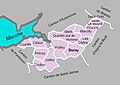
 50-01 Map of canton d'Agon-Coutainville (2015).svg 650 × 1,130; 67 KB
-
 50-02 Map of canton d'Avranches (2015).svg 650 × 1,130; 62 KB
-
 50-03 Map of canton de Bréhal (2015).svg 650 × 1,130; 67 KB
-
 50-04 Map of canton de Bricquebec-en-Cotentin.svg 650 × 1,130; 69 KB
-
 50-05 Map of canton de Carentan-les-Marais.svg 650 × 1,130; 75 KB
-
 50-06 Map of canton de Cherbourg-en-Cotentin-1.svg 650 × 1,130; 52 KB
-
 50-07 Map of canton de Cherbourg-en-Cotentin-2.svg 650 × 1,130; 56 KB
-
 50-08 Map of canton de Cherbourg-en-Cotentin-3.svg 650 × 1,130; 58 KB
-
 50-09 Map of canton de Condé-sur-Vire (2015).svg 650 × 1,130; 73 KB
-
 50-10 Map of canton de Coutances (2015).svg 650 × 1,130; 62 KB
-
 50-11 Map of canton de Créances (2015).svg 650 × 1,130; 71 KB
-
 50-12 Map of canton de Cherbourg-en-Cotentin-4.svg 650 × 1,130; 51 KB
-
 50-13 Map of canton de Granville (2015).svg 650 × 1,130; 53 KB
-
 50-14 Map of canton de la Hague (2015).svg 650 × 1,130; 63 KB
-
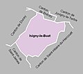
 50-15 Map of canton d'Isigny-le-Buat (2015).svg 650 × 1,130; 71 KB
-
 50-16 Map of canton du mortainais (2015).svg 650 × 1,130; 69 KB
-
 50-17 Map of canton des Pieux (2015).svg 650 × 1,130; 68 KB
-
 50-18 Map of canton de Pont-Hébert (2015).svg 650 × 1,130; 70 KB
-
 50-19 Map of canton de Pontorson (2015).svg 650 × 1,130; 66 KB
-
 50-20 Map of canton de Quettreville-sur-Sienne (2015).svg 650 × 1,130; 70 KB
-
 50-21 Map of canton de Saint-Hilaire-du-Harcouët (2015).svg 650 × 1,130; 69 KB
-
 50-22 Map of canton de Saint-Lô-1 (2015).svg 650 × 1,130; 58 KB
-
 50-23 Map of canton de Saint-Lô-2 (2015).svg 650 × 1,130; 61 KB
-
 50-24 Map of canton de Cherbourg-en-Cotentin-5.svg 650 × 1,130; 53 KB
-
 50-25 Map of canton de Valognes (2015).svg 650 × 1,130; 69 KB
-
 50-26 Map of canton du val-de-Saire (2015).svg 650 × 1,130; 68 KB
-
 50-27 Map of canton de Villedieu-les-Poêles-Rouffigny.svg 650 × 1,130; 67 KB
-
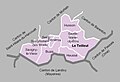
 Cantons de la Manche 2015.svg 586 × 1,023; 1.39 MB
-
 Cantons de la Manche 2021.svg 343 × 599; 132 KB
-
 Cantons de la Manche découpage 2015.svg 660 × 1,144; 440 KB
-

-
 Département Manche Arrondissement Kantone 2023.png 2,500 × 3,105; 1.22 MB
-
 Département Manche Kantone 2023.png 2,500 × 3,105; 1.25 MB
-
 Etiquette par cantons 2015.svg 660 × 1,144; 80 KB
-
 Manche - Canton Agon-Coutainville 2015.svg 586 × 1,023; 1.39 MB
-
 Manche - Canton Avranches 2015.svg 586 × 1,023; 1.39 MB
-
 Manche - Canton Bricquebec 2015.svg 586 × 1,023; 1.39 MB
-
 Manche - Canton Bréhal 2015.svg 586 × 1,023; 1.39 MB
-
 Manche - Canton Carentan 2015.svg 586 × 1,023; 1.39 MB
-
 Manche - Canton Cherbourg-Octeville-1 2015.svg 586 × 1,023; 1.39 MB
-
 Manche - Canton Cherbourg-Octeville-2 2015.svg 586 × 1,023; 1.39 MB
-
 Manche - Canton Cherbourg-Octeville-3 2015.svg 586 × 1,023; 1.39 MB
-
 Manche - Canton Condé-sur-Vire 2015.svg 586 × 1,023; 1.39 MB
-
 Manche - Canton Coutances 2015.svg 586 × 1,023; 1.39 MB
-
 Manche - Canton Créances 2015.svg 586 × 1,023; 1.39 MB
-
 Manche - Canton Granville 2015.svg 586 × 1,023; 1.39 MB
-
 Manche - Canton Isigny-le-Buat 2015.svg 586 × 1,023; 1.39 MB
-
 Manche - Canton la Hague 2015.svg 586 × 1,023; 1.39 MB
-
 Manche - Canton le Mortainais 2015.svg 586 × 1,023; 1.39 MB
-
 Manche - Canton Les Pieux 2015.svg 586 × 1,023; 1.39 MB
-
 Manche - Canton Pont-Hébert 2015.svg 586 × 1,023; 1.39 MB
-
 Manche - Canton Pontorson 2015.svg 586 × 1,023; 1.39 MB
-
 Manche - Canton Quettreville-sur-Sienne 2015.svg 586 × 1,023; 1.39 MB
-
 Manche - Canton Saint-Hilaire-du-Harcouët 2015.svg 586 × 1,023; 1.39 MB
-
 Manche - Canton Saint-Lô-1 2015.svg 586 × 1,023; 1.39 MB
-
 Manche - Canton Saint-Lô-2 2015.svg 586 × 1,023; 1.39 MB
-
 Manche - Canton Tourlaville 2015.svg 586 × 1,023; 1.39 MB
-
 Manche - Canton Val-de-Saire 2015.svg 586 × 1,023; 1.39 MB
-
 Manche - Canton Valognes 2015.svg 586 × 1,023; 1.39 MB
-
 Manche - Canton Villedieu-les-Poêles 2015.svg 586 × 1,023; 1.39 MB
-
 Manche - Canton Équeurdreville-Hainneville 2015.svg 586 × 1,023; 1.39 MB
-
 MapCanton2012-5001-Avranches.jpg 955 × 763; 212 KB
-
 MapCanton2012-5002-Barenton.jpg 754 × 912; 142 KB
-
 MapCanton2012-5003-BarnevilleCarteret.jpg 748 × 785; 220 KB
-
 MapCanton2012-5004-BeaumontHague.jpg 1,048 × 856; 234 KB
-
 MapCanton2012-5005-Brécey.jpg 907 × 731; 225 KB
-
 MapCanton2012-5006-Bréhal.jpg 835 × 784; 216 KB
-
 MapCanton2012-5007-Bricquebec.jpg 990 × 817; 211 KB
-
 MapCanton2012-5008-Canisy.jpg 811 × 723; 195 KB
-
 MapCanton2012-5009-Carentan.jpg 1,013 × 920; 236 KB
-
 MapCanton2012-5010-CerisyLaSalle.jpg 871 × 792; 194 KB
-
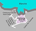
 MapCanton2012-5011-CherbourgOctevilleNordOuest.jpg 584 × 600; 97 KB
-
 MapCanton2012-5012-Coutances.jpg 681 × 670; 132 KB
-
 MapCanton2012-5013-Ducey.jpg 966 × 681; 187 KB
-
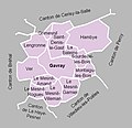 MapCanton2012-5014-Gavray.jpg 789 × 760; 185 KB
-
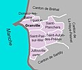 MapCanton2012-5015-Granville.jpg 659 × 563; 117 KB
-
 MapCanton2012-5016-LaHayeDuPuits.jpg 1,350 × 659; 318 KB
-
 MapCanton2012-5017-LaHayePesnel.jpg 932 × 725; 214 KB
-
 MapCanton2012-5018-IsignyLeBuat.jpg 716 × 640; 86 KB
-
 MapCanton2012-5019-JuvignyLeTertre.jpg 863 × 684; 158 KB
-
 MapCanton2012-5020-Lessay.jpg 929 × 879; 215 KB
-
 MapCanton2012-5021-Marigny.jpg 778 × 878; 171 KB
-
 MapCanton2012-5022-Montebourg.jpg 855 × 705; 239 KB
-
 MapCanton2012-5023-MontmartinSurMer.jpg 896 × 661; 191 KB
-
 MapCanton2012-5024-Mortain.jpg 839 × 789; 169 KB
-
 MapCanton2012-5025-CherbourgOctevilleSudOuest.jpg 687 × 729; 171 KB
-
 MapCanton2012-5026-Percy.jpg 858 × 884; 178 KB
-
 MapCanton2012-5027-Périers.jpg 905 × 1,001; 195 KB
-
 MapCanton2012-5028-LesPieux.jpg 1,011 × 857; 225 KB
-
 MapCanton2012-5029-Pontorson.jpg 726 × 896; 186 KB
-
 MapCanton2012-5030-Quettehou.jpg 847 × 722; 200 KB
-
 MapCanton2012-5031-SaintClairSurLElle.jpg 1,021 × 794; 247 KB
-
 MapCanton2012-5032-SaintHilaireDuHarcouët.jpg 958 × 887; 219 KB
-
 MapCanton2012-5033-SaintJames.jpg 991 × 842; 256 KB
-
 MapCanton2012-5034-SaintJeanDeDaye.jpg 832 × 889; 205 KB
-
 MapCanton2012-5035-SaintLôEst.jpg 573 × 600; 93 KB
-
 MapCanton2012-5036-SaintMaloDeLaLande.jpg 812 × 708; 188 KB
-
 MapCanton2012-5037-SainteMèreÉglise.jpg 1,022 × 754; 295 KB
-
 MapCanton2012-5038-SaintPierreÉglise.jpg 866 × 701; 207 KB
-
 MapCanton2012-5039-SaintPois.jpg 886 × 728; 190 KB
-
 MapCanton2012-5040-SaintSauveurLendelin.jpg 945 × 656; 187 KB
-
 MapCanton2012-5041-SaintSauveurLeVicomte.jpg 996 × 739; 255 KB
-
 MapCanton2012-5042-Sartilly.jpg 772 × 636; 162 KB
-
 MapCanton2012-5043-Sourdeval.jpg 936 × 717; 173 KB
-
 MapCanton2012-5044-LeTeilleul.jpg 1,008 × 689; 163 KB
-
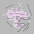 MapCanton2012-5045-TessySurVire.jpg 848 × 870; 195 KB
-
 MapCanton2012-5046-TorigniSurVire.jpg 982 × 939; 248 KB
-
 MapCanton2012-5047-Valognes.jpg 1,029 × 829; 198 KB
-
 MapCanton2012-5048-VilledieuLesPoêles.jpg 940 × 735; 167 KB
-
 MapCanton2012-5049-CherbourgOctevilleSudEst.jpg 654 × 571; 95 KB
-
 MapCanton2012-5050-ÉqueurdrevilleHainneville.jpg 726 × 729; 150 KB
-
 MapCanton2012-5051-Tourlaville.jpg 864 × 643; 138 KB
-
 MapCanton2012-5052-SaintLôOuest.jpg 588 × 576; 100 KB
.svg)
.svg)
.svg)


.svg)
.svg)
.svg)

.svg)
.svg)
.svg)
.svg)
.svg)
.svg)
.svg)
.svg)
.svg)
.svg)
.svg)

.svg)
.svg)


