Category:Maps of cantons of Saône-et-Loire
Jump to navigation
Jump to search
Departments of Metropolitan France: Ain [01] · Aisne [02] · Allier [03] · Alpes-de-Haute-Provence [04] · Hautes-Alpes [05] · Alpes-Maritimes [06] · Ardèche [07] · Ardennes [08] · Ariège [09] · Aube [10] · Aude [11] · Aveyron [12] · Bouches-du-Rhône [13] · Calvados [14] · Cantal [15] · Charente [16] · Charente-Maritime [17] · Cher [18] · Corrèze [19] · Corse-du-Sud [2A]† · Haute-Corse [2B]† · Côte-d’Or [21] · Côtes-d'Armor [22] · Creuse [23] · Dordogne [24] · Doubs [25] · Drôme [26] · Eure [27] · Eure-et-Loir [28] · Finistère [29] · Gard [30] · Haute-Garonne [31] · Gers [32] · Gironde [33] · Hérault [34] · Ille-et-Vilaine [35] · Indre [36] · Indre-et-Loire [37] · Isère [38] · Jura [39] · Landes [40] · Loir-et-Cher [41] · Loire [42] · Haute-Loire [43] · Loire-Atlantique [44] · Loiret [45] · Lot [46] · Lot-et-Garonne [47] · Lozère [48] · Maine-et-Loire [49] · Manche [50] · Marne [51] · Haute-Marne [52] · Mayenne [53] · Meurthe-et-Moselle [54] · Meuse [55] · Morbihan [56] · Moselle [57] · Nièvre [58] · Nord [59] · Oise [60] · Orne [61] · Pas-de-Calais [62] · Puy-de-Dôme [63] · Pyrénées-Atlantiques [64] · Hautes-Pyrénées [65] · Pyrénées-Orientales [66] · Bas-Rhin [67] · Haut-Rhin [68] · departmental district of the Rhône [69] · Haute-Saône [70] · Saône-et-Loire [71] · Sarthe [72] · Savoie [73] · Haute-Savoie [74] · Seine-Maritime [76] · Seine-et-Marne [77] · Yvelines [78] · Deux-Sèvres [79] · Somme [80] · Tarn [81] · Tarn-et-Garonne [82] · Var [83] · Vaucluse [84] · Vendée [85] · Vienne [86] · Haute-Vienne [87] · Vosges [88] · Yonne [89] · Territoire de Belfort [90] · Essonne [91] · Hauts-de-Seine [92] · Seine-Saint-Denis [93] · Val-de-Marne [94] · Val-d'Oise [95]
Overseas departments and regions: Guadeloupe [971] · Martinique [972] · French Guiana [973] · Mayotte [976]
Overseas departments and regions: Guadeloupe [971] · Martinique [972] · French Guiana [973] · Mayotte [976]
Subcategories
This category has the following 3 subcategories, out of 3 total.
*
Media in category "Maps of cantons of Saône-et-Loire"
The following 36 files are in this category, out of 36 total.
-
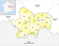
 Cantons de Saône-et-Loire (Bourgogne, France).svg 954 × 758; 98 KB
-
 Cantons de Saône-et-Loire 2015.svg 857 × 677; 1.43 MB
-
 Cantons de Saône-et-Loire 2021.svg 759 × 600; 121 KB
-
 Cantons Sâone-et-Loire.svg 1,000 × 787; 51 KB
-
 Département Saône-et-Loire Arrondissement Kantone 2023.png 2,500 × 1,954; 1.04 MB
-
 Département Saône-et-Loire Kantone 2023.png 2,500 × 1,954; 1 MB
-
 Saône-et-Loire - Autun arrondissement.svg 1,010 × 800; 64 KB
-
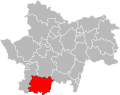
 Saône-et-Loire - Canton Autun-1 2015.svg 857 × 677; 1.43 MB
-
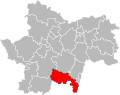
 Saône-et-Loire - Canton Autun-2 2015.svg 857 × 677; 1.43 MB
-
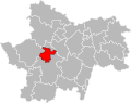
 Saône-et-Loire - Canton Blanzy 2015.svg 857 × 677; 1.43 MB
-
 Saône-et-Loire - Canton Chagny 2015.svg 857 × 677; 1.43 MB
-
 Saône-et-Loire - Canton Chalon-sur-Saône-1 2015.svg 857 × 677; 1.43 MB
-
 Saône-et-Loire - Canton Chalon-sur-Saône-2 2015.svg 857 × 677; 1.43 MB
-
 Saône-et-Loire - Canton Chalon-sur-Saône-3 2015.svg 857 × 677; 1.43 MB
-
 Saône-et-Loire - Canton Charolles 2015.svg 857 × 677; 1.43 MB
-
 Saône-et-Loire - Canton Chauffailles 2015.svg 857 × 677; 1.43 MB
-
 Saône-et-Loire - Canton Cluny 2015.svg 857 × 677; 1.43 MB
-
 Saône-et-Loire - Canton Cuiseaux 2015.svg 857 × 677; 1.43 MB
-
 Saône-et-Loire - Canton Digoin 2015.svg 857 × 677; 1.43 MB
-
 Saône-et-Loire - Canton Gergy 2015.svg 857 × 677; 1.43 MB
-
 Saône-et-Loire - Canton Givry 2015.svg 857 × 677; 1.43 MB
-
 Saône-et-Loire - Canton Gueugnon 2015.svg 857 × 677; 1.43 MB
-
 Saône-et-Loire - Canton Hurigny 2015.svg 857 × 677; 1.43 MB
-
 Saône-et-Loire - Canton La Chapelle-de-Guinchay 2015.svg 857 × 677; 1.43 MB
-
 Saône-et-Loire - Canton Le Creusot-1 2015.svg 857 × 677; 1.43 MB
-
 Saône-et-Loire - Canton Le Creusot-2 2015.svg 857 × 677; 1.43 MB
-
 Saône-et-Loire - Canton Louhans 2015.svg 857 × 677; 1.43 MB
-
 Saône-et-Loire - Canton Montceau-les-Mines 2015.svg 857 × 677; 1.43 MB
-
 Saône-et-Loire - Canton Mâcon-1 2015.svg 857 × 677; 1.43 MB
-
 Saône-et-Loire - Canton Mâcon-2 2015.svg 857 × 677; 1.43 MB
-
 Saône-et-Loire - Canton Ouroux-sur-Saône 2015.svg 857 × 677; 1.43 MB
-
 Saône-et-Loire - Canton Paray-le-Monial 2015.svg 857 × 677; 1.43 MB
-
 Saône-et-Loire - Canton Pierre-de-Bresse 2015.svg 857 × 677; 1.43 MB
-
 Saône-et-Loire - Canton Saint-Rémy 2015.svg 857 × 677; 1.43 MB
-
 Saône-et-Loire - Canton Saint-Vallier 2015.svg 857 × 677; 1.43 MB
-
 Saône-et-Loire - Canton Tournus 2015.svg 857 × 677; 1.43 MB
.svg)


