Category:Maps of Queens, New York City
Jump to navigation
Jump to search
Boroughs of New York City: Bronx · Brooklyn · Manhattan · Queens · Staten Island
Counties of New York City: Bronx · Kings (Brooklyn) · New York (Manhattan) · Queens · Richmond (Staten Island)
Counties of New York City: Bronx · Kings (Brooklyn) · New York (Manhattan) · Queens · Richmond (Staten Island)
Wikimedia category | |||||
| Upload media | |||||
| Instance of | |||||
|---|---|---|---|---|---|
| Category combines topics | |||||
| Queens | |||||
borough in New York City, New York, United States | |||||
| Instance of | |||||
| Named after | |||||
| Location | New York City, New York | ||||
| Located in or next to body of water | |||||
| Head of government |
| ||||
| Inception |
| ||||
| Population |
| ||||
| Area |
| ||||
| Different from | |||||
| official website | |||||
 | |||||
Subcategories
This category has the following 10 subcategories, out of 10 total.
Media in category "Maps of Queens, New York City"
The following 56 files are in this category, out of 56 total.
-
30 years of progress, 1934-1964 - Clearview Expressway.jpg 853 × 1,544; 262 KB
-
30 years of progress, 1934-1964 - I-78 Unbuilt Brooklyn and Queens.jpg 1,441 × 1,005; 279 KB
-
30 years of progress, 1934-1964 - I-78 Unbuilt.jpg 1,980 × 1,005; 399 KB
-
AirTrain JFK map.png 599 × 845; 34 KB
-
AirTrain-JFK-Map.png 1,273 × 1,707; 264 KB
-
Cunningham Ballfields td (2018-10-30) 47 - Comfort Station.jpg 5,472 × 3,648; 8.57 MB
-
Cunningham Park South td (2018-12-15) 41.jpg 5,472 × 3,648; 4.13 MB
-
Cunningham Park South td (2019-06-05) 135.jpg 5,472 × 3,648; 4.02 MB
-
Jamaica-bay-unit.png 711 × 643; 327 KB
-
JamaicaBay.jpeg 3,113 × 1,654; 783 KB
-
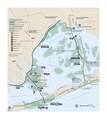
Gateway National Recreation Area Jamaica Bay Unit map.jpg 412 × 423; 49 KB
-
Hurricane Sandy Hazardous Waste Pickup Sites - Queens County (8211190719).jpg 4,608 × 3,456; 8.12 MB
-
Linea Archer Avenue.png 2,873 × 1,748; 7.02 MB
-
LIRR CTZ.svg 893 × 1,100; 76 KB
-
Map-Self-Transcendence-3100-Mile-Race.jpg 1,179 × 852; 746 KB
-
New York City - Queens.PNG 1,326 × 1,291; 86 KB
-
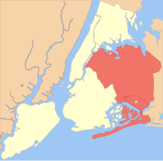
New York City location Queens.PNG 498 × 492; 36 KB
-
New York District 06 109th US Congress.png 747 × 415; 30 KB
-
New York District 09 109th US Congress.png 739 × 399; 35 KB
-
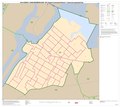
New York State Assembly District 23 (with inset2).jpg 607 × 571; 120 KB
-
New York's 3rd congressional district (new version) (since 2025).svg 1,600 × 1,069; 2.61 MB
-
New York's 6th congressional district (new version) (since 2025).svg 1,600 × 1,069; 1.58 MB
-
New York's 6th congressional district (since 2025).svg 533 × 533; 945 KB
-
NewYorkCongD14(2020).svg 800 × 450; 31 KB
-
NewYorkCongD5(2020).svg 800 × 450; 36 KB
-
NewYorkCongD6(2020).svg 800 × 450; 12 KB
-
NewYorkCongD8(2020).svg 800 × 450; 31 KB
-
NOAA Chart 12366 (2008).jpg 9,398 × 8,843; 12.63 MB
-
NPS jacob-riis-park-fishing-map.jpg 1,980 × 1,305; 316 KB
-
NPS jamaica-bay-map.pdf 3,612 × 4,043; 947 KB
-
NYCWorldFair1939.jpg 756 × 500; 204 KB
-
Queens Borough President 2021.svg 744 × 744; 1.64 MB
-
Queens neighborhoods and districts map.svg 662 × 874; 2.49 MB
-
Queens neighborhoods map.png 2,279 × 3,008; 5.94 MB
-
Rockaway Park Shuttle metropolitana di New York.png 1,126 × 772; 509 KB
-
New York State Senate District 10 (2012).png 2,740 × 2,480; 540 KB
-
New York State Senate District 11 (2012).png 2,740 × 2,480; 546 KB
-
New York State Senate District 12 (2012).png 2,740 × 2,480; 541 KB
-
New York State Senate District 13 (2012).png 2,740 × 2,480; 536 KB
-
New York State Senate District 14 (2012).png 2,740 × 2,480; 539 KB
-
New York State Senate District 15 (2012).png 2,740 × 2,480; 547 KB
-
New York State Senate District 16 (2012).png 2,740 × 2,480; 542 KB
-
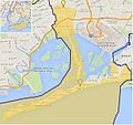
Spring Creek Park Map 1.png 2,495 × 1,591; 2.39 MB
-
Spring Creek Park Map 2.png 2,495 × 1,591; 2.39 MB
-
Spring Creek Park Map 3.png 2,495 × 1,591; 2.49 MB
-
Team Rubicon - Rockaways - Palantir screenshot.jpg 1,280 × 853; 102 KB
-
Trails of Forest Park.JPG 5,184 × 3,456; 5.45 MB
-
Woodhaven Bl Jamaica Av 57.jpg 3,648 × 5,472; 5.18 MB


