Category:Maps of Brooklyn, New York City
Jump to navigation
Jump to search
Boroughs of New York City: Bronx · Brooklyn · Manhattan · Queens · Staten Island
Counties of New York City: Bronx · Kings (Brooklyn) · New York (Manhattan) · Queens · Richmond (Staten Island)
Counties of New York City: Bronx · Kings (Brooklyn) · New York (Manhattan) · Queens · Richmond (Staten Island)
Wikimedia category | |||||
| Upload media | |||||
| Instance of | |||||
|---|---|---|---|---|---|
| Category combines topics | |||||
| Brooklyn | |||||
borough of New York City, New York, United States     | |||||
| Spoken text audio | |||||
| Instance of |
| ||||
| Named after | |||||
| Location | New York City, New York | ||||
| Located in or next to body of water | |||||
| Head of government |
| ||||
| Inception |
| ||||
| Population |
| ||||
| Area |
| ||||
| official website | |||||
 | |||||
Subcategories
This category has the following 8 subcategories, out of 8 total.
1
B
- Maps of Bay Ridge, Brooklyn (19 F)
C
- Maps of Coney Island, Brooklyn (10 F)
O
P
- Maps of Prospect Park (26 F)
T
Media in category "Maps of Brooklyn, New York City"
The following 84 files are in this category, out of 84 total.
-
 1827 Williamsburg Map.jpg 7,721 × 5,171; 24.3 MB
-
-
-
-
-
-
-
-
 2013 BAM Fisher Fishman Space balcony railing map.jpg 2,258 × 1,225; 618 KB
-
 2018 New York ePrix td Saturday 118 - eVillage.jpg 5,472 × 3,648; 5.1 MB
-
 30 years of progress, 1934-1964 - Bushwick Expressway.jpg 1,441 × 1,005; 299 KB
-
 30 years of progress, 1934-1964 - I-78 Unbuilt Brooklyn and Queens.jpg 1,441 × 1,005; 279 KB
-
 30 years of progress, 1934-1964 - I-78 Unbuilt.jpg 1,980 × 1,005; 399 KB
-
 34th St Hudson Yards td 22 - R211 Open House.jpg 3,864 × 5,152; 7.61 MB
-

-
 Battle of Long Island, 1776 - ru.svg 919 × 1,041; 508 KB
-
 Brooklyn - NARA - 26335545.jpg 8,384 × 6,167; 10.75 MB
-
 Brooklyn Borough President 2021.svg 744 × 744; 1.3 MB
-
 Brooklyn census tracts by percent Asian, 2020.svg 619 × 409; 479 KB
-
 Brooklyn census tracts by percent Black, 2020.svg 619 × 409; 480 KB
-
 Brooklyn census tracts by percent Hispanic, 2020.svg 619 × 409; 489 KB
-
 Brooklyn census tracts by percent non-Hispanic White, 2020.svg 619 × 409; 480 KB
-
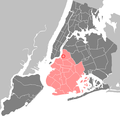
 Brooklyn Highlight New York City Map Julius Schorzman.png 2,652 × 2,582; 1.62 MB
-
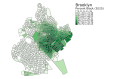
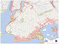
 Brooklyn neighborhoods map.png 2,000 × 2,162; 3.27 MB
-
 Brooklyn Neighborhoods.PNG 501 × 538; 51 KB
-
 Brooklyn Silhouette.PNG 501 × 538; 8 KB
-
 Brooklyn V. 2, Double Page Plate No. 53 (Map bounded by Greene Ave., Carlton Ave., De Kalb Ave., St. James Place) NYPL1809052.tiff 7,216 × 5,412, 2 pages; 111.79 MB
-
 Brooklyn V. 3, Plate No. 21.tif 5,412 × 7,216, 7 pages; 58.47 MB
-
 Brooklyn Water Works Detail.jpeg 976 × 1,200; 1.09 MB
-
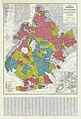 Brooklyn, New York HOLC Redlining Map.jpg 7,840 × 11,524; 21.73 MB
-
 Bushwick.png 580 × 565; 313 KB
-
 Coney island creek brooklyn NY map.png 1,631 × 825; 542 KB
-
 DitmasParkBoundaries.jpg 1,170 × 1,561; 297 KB
-
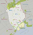 Eastnewyork graphicmap.jpg 2,626 × 2,779; 1.1 MB
-
 From the B61 td (2018-07-07) 01.jpg 5,472 × 3,648; 4.73 MB
-
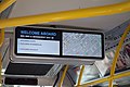 From the B82 SBS td (2019-01-25) 02 - Information Screen.jpg 5,472 × 3,648; 3.67 MB
-
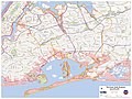
 Jamaica-bay-unit.png 711 × 643; 327 KB
-
 JamaicaBay.jpeg 3,113 × 1,654; 783 KB
-
 Gateway National Recreation Area Jamaica Bay Unit map.jpg 412 × 423; 49 KB
-
 Gowanus Canal Map.jpg 1,340 × 1,256; 538 KB
-
 Grand Army Plaza Greenmarket general map.JPG 741 × 729; 135 KB
-
 Grand Army Plaza Map @ SW Station Entrance.JPG 4,000 × 3,000; 2.46 MB
-
 Hurricane Sandy Hazardous Waste Pickup Sites - Kings County (8211192111).jpg 4,608 × 3,456; 8.35 MB
-
 Hurricane Sandy Hazardous Waste Pickup Sites - Queens County (8211190719).jpg 4,608 × 3,456; 8.12 MB
-
 Index to Streets. Adams Street - Woodruff Avenue (Clarakson Avenue.) NYPL1517492.tiff 3,488 × 4,650; 46.42 MB
-

-

-
 LIRR CTZ.svg 893 × 1,100; 76 KB
-
 Map of New York highlighting Kings County.png 300 × 232; 8 KB
-
 Map with Dumbo highlighted.jpg 1,527 × 742; 286 KB
-
 New York City - Bedford-Stuyvesant (Brooklyn).PNG 1,326 × 1,291; 91 KB
-
 New York City - Brooklyn - Williamsburg.PNG 1,326 × 1,291; 86 KB
-
 New York City - Brooklyn.PNG 1,326 × 1,291; 86 KB
-
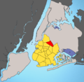
 New York City location Brooklyn.svg 2,000 × 1,978; 137 KB
-
 New York District 09 109th US Congress.png 739 × 399; 35 KB
-
 New York District 10 109th US Congress.png 768 × 415; 31 KB
-
 New York District 11 109th US Congress.png 753 × 414; 28 KB
-
 New York Streetcars (1930).svg 600 × 600; 285 KB
-
 NewYorkCongD11(2016).svg 800 × 450; 33 KB
-
 NewYorkCongD11(2020).svg 800 × 450; 33 KB
-
 NewYorkCongD8(2020).svg 800 × 450; 31 KB
-
 NPS jamaica-bay-map.pdf 3,612 × 4,043; 947 KB
-
 NY Brooklyn 123132 1967 24000.jpg 3,323 × 4,059; 4.34 MB
-
 NY Brooklyn 20190925 TM.jpg 7,409 × 8,874; 7.77 MB
-
 NYC Borough Brooklyn.PNG 2,652 × 2,582; 401 KB
-
 Prospect Park Scene - Prospect Park - Brooklyn - New York - USA - 01 (10389216076).jpg 3,648 × 2,736; 4.86 MB
-
 New York State Senate District 17 (2012).png 2,740 × 2,480; 535 KB
-
 New York State Senate District 18 (2012).png 2,740 × 2,480; 538 KB
-
 New York State Senate District 19 (2012).png 2,740 × 2,480; 540 KB
-
 New York State Senate District 20 (2012).png 2,740 × 2,480; 537 KB
-
 New York State Senate District 21 (2012).png 2,740 × 2,480; 538 KB
-
 New York State Senate District 22 (2012).png 2,740 × 2,480; 541 KB
-
 New York State Senate District 23 (2012).png 2,740 × 2,480; 542 KB
-
 New York State Senate District 25 (2012).png 2,740 × 2,480; 537 KB
-
 New York State Senate District 26 (2012).png 2,740 × 2,480; 539 KB
-
 SmokyFinancialDistrictToDUMBO.png 1,003 × 493; 646 KB
-
 Spring Creek Park Map 1.png 2,495 × 1,591; 2.39 MB
-
 Spring Creek Park Map 2.png 2,495 × 1,591; 2.39 MB
-
 Spring Creek Park Map 3.png 2,495 × 1,591; 2.49 MB
-
 The Citizen guide to Brooklyn and Long Island (1893) (14773377962).jpg 1,698 × 2,554; 980 KB
-
 Usgs photo five boroughs brooklyn.jpg 300 × 315; 36 KB
-
 Washington Cemetery Map.png 1,164 × 1,608; 3.02 MB
-
 Water-works1880.jpg 976 × 608; 579 KB
-
 Williamsburg, Brooklyn Immersionism Map V2.jpg 3,000 × 2,907; 5.59 MB


_01.jpg)
_02_-_Information_Screen.jpg)


.jpg)
.jpg)


.PNG)


.svg)
.svg)
.svg)
.svg)


.jpg)
.png)
.png)
.png)
.png)
.png)
.png)
.png)
.png)
.png)


_(14773377962).jpg)


