Category:Maps of Long Island City, Queens
Jump to navigation
Jump to search
Media in category "Maps of Long Island City, Queens"
The following 69 files are in this category, out of 69 total.
-

-

-

-
 2012 NY-12 election results.svg 800 × 1,012; 15 KB
-
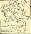
 Belcher Hyde Blissville map.jpg 755 × 559; 582 KB
-

-

-

-

-

-

-
 EB9 New York - City and vicinity.jpg 3,837 × 5,476; 4.69 MB
-
 LIRR 1891 Laurel Hill station.jpg 679 × 594; 114 KB
-
 LIRR 1891 Long Island City.jpg 2,524 × 1,536; 860 KB
-
 Long Island City map 1896.jpg 360 × 615; 296 KB
-
 Old Tracks and Routes in Newtown (Plate LIV, p. 272).jpg 1,052 × 1,628; 236 KB
-
 Old Tracks and Routes in Newtown - Crop.jpg 959 × 1,038; 413 KB
-

-

-

-

-
-

-

-

-

-

-

-

-

-
-

-

-

-

-

-

-

-

-

-

-

-

-

-

-

-

-

-
-

-

-

-

-

-

-

-

-

-

-

-

-

-
 Queensboro Plaza Weekend Service Changes Maps (53407827232).png 4,281 × 2,752; 2.09 MB
-
 Queensboro Plaza Weekend Service Changes Maps (53408749866).png 3,605 × 2,144; 2.47 MB
-
 Queensboro Plaza Weekend Service Changes Maps (53408929343).png 4,281 × 2,743; 3.09 MB
-
 Queensboro Plaza Weekend Service Changes Maps (53409084949).png 4,281 × 1,837; 2.74 MB
-

-
 Sunnyside Yard, Amtrak and MTA, NYC.png 3,007 × 1,322; 3.09 MB
-
 The New York improvement and tunnel extension of the Pennsylvania railroad.jpg 1,672 × 1,424; 384 KB


_-_Queens_County_-_Queens_-_ED_41-1_to_2176_-_NARA_-_24519584_(page_4).jpg)


_(14755089431).jpg)
_(14755160801).jpg)
_(14757960362).jpg)
_(14758024062).jpg)
_(14758045692).jpg)
_(14778146273).jpg)


.jpg)

.png)
.png)
.png)
.png)
.jpg)

