Category:Maps of Puebla
Jump to navigation
Jump to search
Wikimedia category | |||||
| Upload media | |||||
| Instance of | |||||
|---|---|---|---|---|---|
| Category combines topics | |||||
| Puebla | |||||
state of Mexico | |||||
| Instance of | |||||
| Location | Mexico | ||||
| Capital | |||||
| Legislative body |
| ||||
| Head of government |
| ||||
| Inception |
| ||||
| Highest point |
| ||||
| Population |
| ||||
| Area |
| ||||
| Elevation above sea level |
| ||||
| official website | |||||
 | |||||
Subcategories
This category has the following 8 subcategories, out of 8 total.
Media in category "Maps of Puebla"
The following 48 files are in this category, out of 48 total.
-
485 of 'A Popular History of the Mexican People' (11290000975).jpg 1,350 × 1,162; 459 KB
-
Anales del Instituto Geológico de México (1917) (18164689272).jpg 3,314 × 2,532; 1.9 MB
-
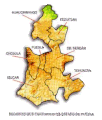
Angelópolis.jpg 170 × 262; 10 KB
-
Central Mexico.png 691 × 492; 278 KB
-
Chacha.JPG 596 × 242; 31 KB
-
COVID-19 en Puebla por municipio.svg 1,797 × 2,389; 990 KB
-
Distritos puebla.jpg 550 × 737; 117 KB
-
Eleccíon de gobernador de Puebla, 2019.svg 5,072 × 6,922; 53 KB
-
FC Esperanza - Maltrata.png 3,435 × 2,532; 13.29 MB
-
HHBHM V1 D316 Central and eastern Mexico map.jpg 1,853 × 1,197; 306 KB
-
HHBHM V1 D522 Area surrounding Mexico City.jpg 1,883 × 994; 151 KB
-
HHBHM V5 D700 Puebla.jpg 1,821 × 1,500; 764 KB
-
Puebla-hidro.png 566 × 765; 165 KB
-
La ruta hacia el Iztaccihuatl (2980175355).jpg 1,280 × 805; 175 KB
-
Map of Puebla.svg 404 × 541; 162 KB
-
Mapa de Regiones de Puebla.png 2,048 × 2,084; 643 KB
-
Mapa pue regiones.gif 256 × 302; 32 KB
-
Puebla-relieve.png 566 × 765; 192 KB
-
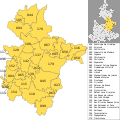
Municipios de Puebla (numerado).svg 1,184 × 1,062; 1.22 MB
-
MX-PUE-Cholula.png 1,056 × 816; 225 KB
-
MX-PUE-Huauchinango.png 1,056 × 816; 215 KB
-
MX-PUE-Izúcar.png 1,292 × 816; 309 KB
-
MX-PUE-Puebla.png 1,056 × 816; 139 KB
-
MX-PUE-Serdán.png 1,056 × 816; 222 KB
-
MX-PUE-Teziutlán.png 1,056 × 816; 227 KB
-
Oriental Puebla.png 743 × 994; 168 KB
-
Planos de las garitas de la Aduana de Puebla (1724).jpg 3,173 × 1,557; 725 KB
-
Puebla - Lenguas indígenas.png 850 × 1,100; 268 KB
-
Puebla Ayuntamientos 2007.svg 765 × 990; 118 KB
-
Puebla en Mexico.PNG 1,319 × 834; 47 KB
-
Puebla Ixcamilpa de Guerrero.png 2,041 × 2,504; 976 KB
-
Puebla San Andrés Cholula község.png 2,041 × 2,504; 976 KB
-
Puebla Übersichtskarte.png 1,048 × 733; 217 KB
-
Puebla, 1787.png 1,241 × 1,755; 213 KB
-
Puebla1793.png 1,241 × 1,755; 215 KB
-
Regiones de Puebla.svg 765 × 990; 92 KB
-
Regiones Puebla 2015 - Región 1.svg 4,582 × 5,738; 2.1 MB
-
Regiones Puebla 2015 - Región 2.svg 6,877 × 5,291; 2.05 MB
-
Regiones Puebla 2015 - Región 3.svg 5,334 × 5,339; 2.09 MB
-
Regiones Puebla 2015 - Región 4.svg 5,864 × 5,850; 2.07 MB
-
Regiones Puebla 2015 - Región 5.svg 5,774 × 5,230; 2.07 MB
-
Regiones Puebla 2015 - Región 6.svg 10,490 × 7,044; 2.27 MB
-
Regiones Puebla 2015 - Región 7.svg 6,502 × 4,533; 2.25 MB
-
Regiones Puebla 2015.svg 3,619 × 4,870; 1.02 MB
-
Ubicapuebla.jpg 332 × 336; 27 KB
-
Valle de puebla.png 192 × 245; 20 KB
-
Zacapoaxtla croquis.jpg 7,242 × 9,304; 2.67 MB


