Category:Maps of Baja California
Jump to navigation
Jump to search
Subcategories
This category has the following 12 subcategories, out of 12 total.
Media in category "Maps of Baja California"
The following 79 files are in this category, out of 79 total.
-
 (Mapa-2) Las Californias.jpg 684 × 855; 80 KB
-
 (Silueta) Baja California.png 4,200 × 4,000; 62 KB
-
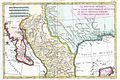 1780 Bonne Map of Texas, Louisiana ^ New Mexico - Geographicus - Texas2-bonne-1780.jpg 3,000 × 2,002; 1.13 MB
-
 1780 Raynal and Bonne Map of Mexico and Texas - Geographicus - NouveauMexique-bonne-1780.jpg 2,500 × 1,685; 1.27 MB
-
 Anales del Instituto Geológico de México (1917) (18167871275).jpg 3,642 × 2,849; 1.23 MB
-
 Anales del Instituto Geológico de México (1917) (18169011071).jpg 4,268 × 3,216; 2.48 MB
-
 Baja California (Mexico) Flag Map.png 4,032 × 6,000; 630 KB
-
 Baja California - Población municipal 2020.svg 765 × 990; 44 KB
-
 Baja California Desert map.svg 1,712 × 1,992; 344 KB
-
 Bajacaliforniamapa(2020-2022).png 4,608 × 4,608; 89 KB
-
 Bajacaliforniamapa.png 4,608 × 4,608; 90 KB
-
 Bajacaliforniamapaconcodigosmunicipales(2020-2022).png 4,608 × 4,608; 94 KB
-
 BC Area Codes Map.png 659 × 658; 404 KB
-
 BC SHH 2024.svg 1,280 × 1,413; 142 KB
-
 BCI EN.png 6,144 × 9,216; 243 KB
-
 BCPI ES.png 6,144 × 9,216; 244 KB
-
 Bulletin (1971-) (20397322456).jpg 846 × 1,374; 157 KB
-
 Bulletin (1971-) (20423105755).jpg 1,670 × 3,044; 674 KB
-
 Bulletin. 1901-13 (20235907148).jpg 2,182 × 3,576; 1.32 MB
-

-

-
 Catalogue of mammals collected by E. Heller in Southern California (1904) (20394988180).jpg 2,600 × 2,839; 1.17 MB
-
 Mexico - Cedros.PNG 534 × 484; 32 KB
-
 Cedros BC.PNG 438 × 517; 10 KB
-
 California Coastal Sage and Chaparral map.svg 1,712 × 1,992; 341 KB
-
 West Coast of North America satellite orthographic.jpg 384 × 1,000; 91 KB
-
 West Coast of North America satellite orthographic.png 383 × 1,000; 467 KB
-
 Coronado Islands Map.jpg 1,266 × 877; 129 KB
-
 COVID-19 en Baja California por municipio.svg 539 × 584; 224 KB
-

-
 Distritos electorales locales - Baja California.svg 512 × 626; 83 KB
-
 Distritos Electorales Locales BC 2022.png 10,368 × 12,672; 1.33 MB
-
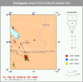
 2010 Southern California Earthquake Storm.PNG 500 × 461; 74 KB
-
 Delegaciones del municipio de Ensenada (hasta 2020).png 4,608 × 4,608; 156 KB
-
 Delegaciones del municipio de Ensenada BC.png 4,608 × 4,608; 143 KB
-
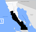
 Irredentismo California (en).jpg 718 × 624; 99 KB
-
 Irredentismo California.jpg 718 × 624; 100 KB
-
 Isla de los Cedros.png 5,400 × 5,400; 12.89 MB
-
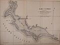
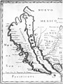
 Karta Kalifornije i Baje Californije,Ferdinand Konščak.jpg 470 × 481; 120 KB
-
 Malapoust.png 254 × 454; 32 KB
-
 Map of California Shown as an Island WDL2661.png 1,435 × 1,024; 3 MB
-
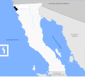
 Map of the Flying Samaritans Clinics in Baja California, Mexico.jpg 337 × 342; 30 KB
-
 Mapa de Las Californias.svg 1,509 × 1,288; 905 KB
-
 Mapa de las delegaciones de Tijuana.png 1,024 × 768; 65 KB
-
 Mexicali comunicaciones.svg 1,198 × 829; 646 KB
-
 Mexicali localidades.svg 1,198 × 829; 654 KB
-
 MexicaliEarthquakeSwarm.gif 543 × 532; 13 KB
-
-
 Mojave Sonoran deserts.jpg 632 × 1,000; 192 KB
-
 Mojave-sonoran deserts.png 632 × 1,000; 309 KB
-
 Mojave-Sonoran.gif 632 × 1,000; 27 KB
-
 Municipio de Ensenada.svg 512 × 458; 77 KB
-
 Municipio de Mexicali.svg 512 × 458; 77 KB
-
 Municipio de Playas de Rosarito.svg 512 × 458; 76 KB
-
 Municipio de San Felipe.svg 512 × 458; 77 KB
-
 Municipio de San Quintín.svg 512 × 458; 76 KB
-
 Municipio de Tecate.svg 512 × 458; 76 KB
-
 Municipios de Baja California 2022.png 4,608 × 4,608; 125 KB
-
 Municipios de Baja California 2022.svg 512 × 458; 93 KB
-
 Mural del Distrito de Riego 12.jpg 986 × 714; 164 KB
-

-

-

-

-
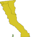
 Península de Baja California Mapa.svg 2,042 × 1,370; 253 KB
-
 Punta Brava Golf Course locator.png 645 × 754; 779 KB
-
 Punta Brava peninsula.png 1,208 × 767; 125 KB
-
 Rebelion Baja California 1911.png 1,024 × 955; 104 KB
-
 Representación cartográfica de la isla Montague, Baja California.jpg 1,212 × 841; 61 KB
-
 San Diego-Tijuana Metro 3D Map.jpg 1,150 × 724; 1.27 MB
-
 Delegaciones del municipio de San Quintín.png 4,608 × 4,608; 130 KB
-
 Southwest Blackout of 2011.png 2,097 × 2,460; 1,019 KB
-
 Southwest Blackout of 2011.svg 1,789 × 2,154; 372 KB
-
 Terremoto del Valle de Mexicali del 2009.jpg 612 × 718; 118 KB
-
 Tiburon Island Mexico Grindell Expedition 1905.gif 552 × 509; 14 KB
-
 Mexico - Tiburón Island.PNG 534 × 484; 32 KB
-
 USGS Shakemap - 1979 Imperial Valley earthquake.jpg 612 × 722; 185 KB
-
 Western Yuman.png 579 × 554; 96 KB
-
 Wpdms shdrlfi020l colorado desert.jpg 300 × 267; 49 KB
_Las_Californias.jpg)
_Baja_California.png)


_(18167871275).jpg)
_(18169011071).jpg)
_Flag_Map.png)


.png)

.png)


_(20397322456).jpg)
_(20423105755).jpg)
.jpg)
_(14776478144).jpg)
_(14798785933).jpg)
_(20394988180).jpg)


.png)

.jpg)


,_1903_(CHS-1652).jpg)


_(14762212044).jpg)
_(14582011130).jpg)
_(14765565041).jpg)
_(14768718545).jpg)


