Category:Maps of Campeche
Jump to navigation
Jump to search
Wikimedia category | |||||
| Upload media | |||||
| Instance of | |||||
|---|---|---|---|---|---|
| Category combines topics | |||||
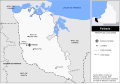
| Campeche | |||||
state of Mexico  Резиденция губернатора     | |||||
| Instance of | |||||
| Location | Mexico | ||||
| Capital | |||||
| Legislative body |
| ||||
| Anthem |
| ||||
| Head of government | |||||
| Inception |
| ||||
| Population |
| ||||
| Area |
| ||||
| official website | |||||
 | |||||
Subcategories
This category has the following 8 subcategories, out of 8 total.
Media in category "Maps of Campeche"
The following 20 files are in this category, out of 20 total.
-
 (Map showing coast of State of Campeche from Campeche City to Seiba) LOC 2001624290.jpg 4,218 × 3,943; 1.5 MB
-
 (Map showing coast of State of Campeche from Campeche City to Seiba) LOC 2001624290.tif 4,218 × 3,943; 47.58 MB
-

-
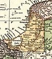
 Atlas mexicano. LOC 2007627316-9.jpg 7,121 × 6,422; 5.43 MB
-
 Atlas mexicano. LOC 2007627316-9.tif 7,121 × 6,422; 130.84 MB
-
 Becan Map.jpg 444 × 292; 43 KB
-
 Calakmul - Localidades.png 1,022 × 879; 59 KB
-
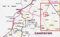
 Campeche1910s.jpg 411 × 465; 86 KB
-
 Chenesunam.png 1,317 × 824; 946 KB
-
 Diputados por distrito local.png 1,024 × 970; 128 KB
-
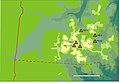
 Dzibilnocac Campeche 1986 Sketch Map.jpg 643 × 988; 227 KB
-
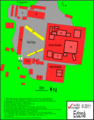 Edzna.png 1,428 × 1,826; 376 KB
-
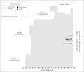
 Escarcega Climas.svg 1,466 × 1,034; 182 KB
-
 Iturbide Campeche 1986 Sketch Map.jpg 744 × 1,166; 374 KB
-
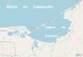 LagunaDeTérminos.png 950 × 656; 107 KB
-
 Map of Tenabo.svg 1,000 × 680; 121 KB
-
 Palizada localidades.svg 1,198 × 829; 542 KB
-
 Población Campeche 2015.png 841 × 782; 30 KB
-
 Río Bec.jpg 4,282 × 2,974; 527 KB
-
 Territorios de Sierragorda e de Isla del Carmen 1858.png 9,388 × 6,818; 98.63 MB
_LOC_2001624290.jpg)


