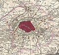
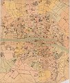
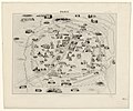
Category:Maps of Paris in the 1850s
Jump to navigation
Jump to search
Subcategories
This category has only the following subcategory.
Media in category "Maps of Paris in the 1850s"
The following 85 files are in this category, out of 85 total.
-
HEINZELMANN(1850) 05.395 Kartenblatt Paris.jpg 2,936 × 2,831; 5.05 MB
-
1850 Andriveau-Goujon Map of Paris and Environs - Geographicus - Paris-goujon-1850.jpg 5,033 × 3,569; 10.25 MB
-
Population density of Paris, 1851 - Demographia.svg 512 × 293; 187 KB
-
1852 Levasseur Map of France - Geographicus - France-levasseur-1852.jpg 3,500 × 4,021; 4.68 MB
-
Plan de Paris, avec indication des rues nouvelles et des travaux en cours d'exécution.jpg 4,261 × 2,975; 8.46 MB
-
1855 Colton Map or City Plan of Paris, France - Geographicus - Paris-c-55.jpg 3,000 × 2,451; 2.84 MB
-
Population density of Paris, 1856 - Demographia.svg 512 × 293; 188 KB
-
Bénard, Nouveau plan illustré de la ville de Paris, 1857.jpg 4,364 × 3,436; 3.37 MB
-
1857 Colton Map of Paris, France - Geographicus - Paris-cbl-1855.jpg 3,500 × 2,855; 2.92 MB
-
Achille Delesse, Carte geologique souterraine de la ville de Paris, 1858 - David Rumsey.jpg 32,856 × 23,604; 198.9 MB
-
Andriveau-Goujon, Plan géométral de Paris et de ses agrandissments, 1858 - David Rumsey.jpg 36,866 × 24,777; 310.3 MB
-
Carte hydrographique du département de la Seine - 1852.jpg 8,083 × 7,509; 9.86 MB
-
Carte statistique de la distribution des eaux de la ville de Paris - BHVP.jpg 4,120 × 3,046; 1.86 MB
-
Carte statistique des égouts de la ville de Paris - BHVP.jpg 8,160 × 6,036; 6.57 MB
-
Carte topographique des environs de Paris, 1856 - Stanford Libraries.jpg 15,418 × 10,771; 31.69 MB
-
Carte topographique des environs de Paris, 1856 - Stanford Libraries.tif 15,418 × 10,771; 158.38 MB
-
Colton, The Environs of Paris, 1856 - David Rumsey.jpg 5,252 × 4,313; 11.65 MB
-
Comparaison arrondissements Paris avant et après 1859.svg 1,052 × 744; 144 KB
-
Cédille, Plan de Paris pour l'Exposition de 1855 - Gallica.jpg 10,876 × 7,740; 20.81 MB
-
Emmery de Sept-Fontaines & Achin, Carte statistique des égouts de la ville de Paris, 1852 - David Rumsey.jpg 33,626 × 23,958; 187.27 MB
-
Henriot, Nouveau plan complet de Paris avec ses fortifications, 1855 - Gallica.jpg 11,007 × 7,685; 21.75 MB
-
Henriot, Nouveau plan complet de Paris avec ses fortifications, 1857 - Gallica.jpg 10,944 × 7,593; 20.56 MB
-
Itinéraire des omnibus dans Paris by J. Migeon, 1856 - Stanford Libraries.jpg 4,485 × 3,727; 2.9 MB
-
Itinéraire des omnibus dans Paris by J. Migeon, 1856 - Stanford Libraries.tif 4,485 × 3,727; 15.97 MB
-
Joseph Edmund Herder, Bayonne, 1850 - David Rumsey.jpg 16,668 × 14,444; 69.82 MB
-
Joseph Meyer, Topographische Karte von Paris und Gegend, 1852 - David Rumsey.jpg 6,002 × 4,750; 20.8 MB
-
Map of Paris, 1855 Wellcome L0013020.jpg 1,490 × 1,232; 924 KB
-
Maillard, Paris illustré et ses fortifications.jpg 4,382 × 3,422; 8.36 MB
-
Map of Paris, ca. 1855 - Stanford Libraries.jpg 6,915 × 8,135; 8.55 MB
-
Map of Paris, ca. 1855 - Stanford Libraries.tif 6,915 × 8,135; 53.67 MB
-
Nouveau plan complet de Paris avec ses fortifications, 1851 - UWM Libraries.jpg 10,347 × 7,149; 14.94 MB
-
Nouveau Plan Complet De Paris Avec Ses Fortifications.jpg 10,658 × 7,903; 16.85 MB
-
Nouveau plan de Paris fortifié - Norman B. Leventhal Map Center.jpg 6,912 × 4,738; 7.99 MB
-
Nouveau plan de Paris fortifié - Norman B. Leventhal Map Center.tif 6,912 × 4,738; 93.72 MB
-
Nouveau plan de Paris fortifié, 1851 - Stanford Libraries.jpg 14,680 × 9,688; 64.82 MB
-
Nouveau plan de Paris illustré avec toutes ses fortifications... 1855 - Gallica.jpg 10,871 × 7,615; 22.51 MB
-
Nouveau Plan illustré de la ville de Paris, 1850 (15493000).jpg 21,492 × 14,642; 111.63 MB
-
Nouveau plan illustré de la ville de Paris, 1852 - Norman B. Leventhal Map Center.jpg 8,596 × 6,693; 13.09 MB
-
Nouveau plan illustré de la ville de Paris, 1852 - Norman B. Leventhal Map Center.tif 8,596 × 6,693; 164.63 MB
-
Nouveau plan illustré de la ville de Paris, 1858 - Norman B. Leventhal Map Center.jpg 8,621 × 6,716; 12.65 MB
-
Nouveau plan illustré de la ville de Paris, 1858 - Norman B. Leventhal Map Center.tif 8,621 × 6,716; 165.68 MB
-
Nouveau plan routier de Paris by Toussaint, 1852 - UWM Libraries.jpg 11,000 × 7,771; 16.98 MB
-
Paris - 1855 by Testard, 1855 - Gallica.jpg 11,073 × 7,634; 24.49 MB
-
Paris by Buland, 1855 - Gallica.jpg 9,244 × 7,713; 16.33 MB
-
Paris illustré et ses fortifications by Auguste Logerot, 1853 - UWM Libraries.jpg 13,500 × 10,316; 24.75 MB
-
Paris illustré et ses fortifications, 1853 - UWM Libraries.jpg 12,787 × 8,938; 21.32 MB
-
Paris monumental et ses environs - Norman B. Leventhal Map Center.jpg 5,256 × 4,192; 3.99 MB
-
Paris monumental et ses environs - Norman B. Leventhal Map Center.tif 5,256 × 4,192; 63.06 MB
-
Paris nouveau, 1855 by Alexandre Vuillemin - Stanford Libraries.jpg 13,977 × 10,828; 40.07 MB
-
Paris nouveau, 1855 by Alexandre Vuillemin - Stanford Libraries.tif 13,977 × 10,828; 144.36 MB
-
Paris PC 1859 jms.jpg 5,820 × 4,968; 6.28 MB
-
Paris, ses fortifications et sa banlieue, 1850 - Mount Holyoke College.jpg 13,740 × 10,028; 44.23 MB
-
Paris. Dessiné par Navlet; et lith. par Walter, 1850 - Gallica.jpg 9,889 × 7,807; 19.45 MB
-
Plan cata paris 1857 jms.jpg 6,966 × 4,388; 7.1 MB
-
Plan de Paris - nouveau système, méthode Zugenbuhler, 1858 - Stanford Libraries.jpg 13,682 × 9,154; 25.43 MB
-
Plan de Paris - nouveau système, méthode Zugenbuhler, 1858 - Stanford Libraries.tif 13,682 × 9,154; 119.47 MB
-
Plan de Paris en MDCCC LIII, 1853 - Gallica.jpg 8,677 × 6,222; 9.82 MB
-
Plan de Paris et son enceinte by Ch. Dyonnet, 1852 - Stanford Libraries - Original.jpg 26,746 × 18,405; 149.84 MB
-
Plan de Paris et son enceinte by Ch. Dyonnet, 1852 - Stanford Libraries.jpg 26,746 × 18,405; 190.77 MB
-
Plan de Paris par sections - système Acklin breveté S.G.D.G, 1852 - Gallica.jpg 7,704 × 5,888; 10.47 MB
-
Plan des fortifications des environs de Paris. Paris als Waffenplatz, ca 1859 - BHVP.jpg 3,850 × 3,050; 9.4 MB
-
Plan du Bois de Boulogne - Norman B. Leventhal Map Center.jpg 6,442 × 9,068; 10.59 MB
-
Plan du Bois de Boulogne - Norman B. Leventhal Map Center.tif 6,442 × 9,068; 167.15 MB
-
Plan géométral de Paris et de ses agrandissements, 1858 - National Library of Australia.jpg 36,416 × 24,943; 403.07 MB
-
Plan of the fortifications of Paris by Ranfft, 1857 - Stanford Libraries.jpg 15,848 × 11,221; 30.28 MB
-
Plan of the fortifications of Paris by Ranfft, 1857 - Stanford Libraries.tif 15,848 × 11,221; 169.62 MB
-
The environs of Paris by J. & C. Walker, ca. 1852 - Stanford Libraries.jpg 7,500 × 6,050; 15.83 MB
-
The environs of Paris by J.H. Colton & Co., 1855 - Stanford Libraries.jpg 7,506 × 6,555; 19.95 MB


