Category:Maps of Paris in the 1790s
Jump to navigation
Jump to search
Subcategories
This category has the following 5 subcategories, out of 5 total.
M
P
Media in category "Maps of Paris in the 1790s"
The following 40 files are in this category, out of 40 total.
-

-
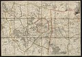
 1790 map of the environs of Paris.jpg 6,081 × 4,208; 5.69 MB
-
 1790 – Division du Département de Paris. (Décrets des 13 et 19 janvier 1790).jpg 9,216 × 6,248; 13.55 MB
-
 1791 - Environs de Paris et Département de Seine et l'Oise - Open Data Hauts-de-Seine.jpg 9,640 × 6,688; 12.22 MB
-
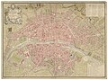
 Plan de la ville et faubourg de Paris - no-nb krt 00706.jpg 9,804 × 6,347; 24.81 MB
-

-

-
 1797 Jean Map of Paris and the Faubourgs, France - Geographicus - Paris-jean-1797.jpg 6,000 × 3,938; 9.78 MB
-

-

-
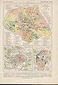
 Département de Paris, décrété le 10 février 1790, par l'Assemblée nationale - BHVP.jpg 4,235 × 3,153; 2.3 MB
-
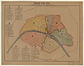
 Département de Paris. Noms des 6 tribunaux - BHVP.jpg 2,612 × 1,778; 858 KB
-

-
 Fg St Germain 1790.JPG 4,744 × 4,066; 3.6 MB
-
 François Cointeraux, Paris tel qu'il est aujourd'hui, 1799 - Gallica.jpg 6,510 × 4,487; 3.51 MB
-
 François d'Houdan, Département de Paris divisé en III districts, 1795 - Gallica.jpg 4,132 × 3,763; 2.21 MB
-
 Jean Lattré, Plan de la ville de Paris et de ses faubourgs, 1792 - Paris Musées.jpg 11,808 × 7,872; 63.6 MB
-

-
-

-

-

-

-

-
 Nouveau plan de Paris, 1796 by Louis Brion de La Tour - Gallica.jpg 9,881 × 7,196; 17.67 MB
-

-
 Paris divisé en 33 paroisses, décret des 4-11 février 1791 - BHVP.jpg 6,528 × 4,704; 3.76 MB
-

-
 Pierre Dumez, Département de Paris, décrété le 13 et 19 janvier 1790 - Gallica.jpg 8,513 × 6,511; 11.49 MB
-
 Plan de la ville de Paris, période révolutionnaire (1790-1794) - Paris Musées (edited).jpg 12,400 × 9,670; 72.15 MB
-
 Plan de la ville de Paris, période révolutionnaire (1790-1794) - Paris Musées.jpg 13,098 × 10,410; 82.87 MB
-
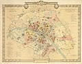
 Plan de la ville et faubourg de Paris divisé en 12 municipalités, 1798 - Gallica.jpg 10,722 × 7,993; 16.24 MB
-
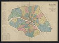
 Plan de Paris en 1789-1790, division administrative - Paris Musées.jpg 7,592 × 6,040; 27.71 MB
-
 Plan de Paris en 1797, division administrative - Paris Musées.jpg 7,648 × 6,064; 26.29 MB
-
 Plan relatif au programe décrété le 30 Juin 1793 par la Convention Nationale - Stanford Libraries.jpg 17,353 × 11,193; 20.24 MB
-
 Plan relatif au programe décrété le 30 Juin 1793 par la Convention Nationale - Stanford Libraries.tif 17,353 × 11,193; 185.26 MB
-
 Quartier des Tuileries sous la Convention.jpg 1,449 × 918; 838 KB
-
 Rue du Chemin de Pantin 1790.jpg 925 × 505; 148 KB
-
-


.jpg)


_-_BHVP.jpg)
_-_BHVP.jpg)


_-_Paris_Mus%C3%A9es_(edited).jpg)
_-_Paris_Mus%C3%A9es.jpg)


