Category:Maps of LaPorte County, Indiana (style A)
Jump to navigation
Jump to search
Media in category "Maps of LaPorte County, Indiana (style A)"
The following 21 files are in this category, out of 21 total.
-
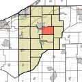
 Map highlighting Cass Township, LaPorte County, Indiana.svg 512 × 512; 82 KB
-
 Map highlighting Center Township, LaPorte County, Indiana.svg 512 × 512; 82 KB
-
 Map highlighting Clinton Township, LaPorte County, Indiana.svg 512 × 512; 82 KB
-
 Map highlighting Coolspring Township, LaPorte County, Indiana.svg 512 × 512; 82 KB
-
 Map highlighting Dewey Township, LaPorte County, Indiana.svg 512 × 512; 82 KB
-
 Map highlighting Galena Township, LaPorte County, Indiana.svg 512 × 512; 82 KB
-
 Map highlighting Hanna Township, LaPorte County, Indiana.svg 512 × 512; 82 KB
-
 Map highlighting Hudson Township, LaPorte County, Indiana.svg 512 × 512; 82 KB
-
 Map highlighting Johnson Township, LaPorte County, Indiana.svg 512 × 512; 82 KB
-
 Map highlighting Kankakee Township, LaPorte County, Indiana.svg 512 × 512; 82 KB
-
 Map highlighting Lincoln Township, LaPorte County, Indiana.svg 512 × 512; 82 KB
-
 Map highlighting Michigan Township, LaPorte County, Indiana.svg 512 × 512; 82 KB
-
 Map highlighting New Durham Township, LaPorte County, Indiana.svg 512 × 512; 82 KB
-
 Map highlighting Noble Township, LaPorte County, Indiana.svg 512 × 512; 82 KB
-
 Map highlighting Pleasant Township, LaPorte County, Indiana.svg 512 × 512; 82 KB
-
 Map highlighting Prairie Township, LaPorte County, Indiana.svg 512 × 512; 82 KB
-
 Map highlighting Scipio Township, LaPorte County, Indiana.svg 512 × 512; 82 KB
-
 Map highlighting Springfield Township, LaPorte County, Indiana.svg 512 × 512; 82 KB
-
 Map highlighting Union Township, LaPorte County, Indiana.svg 512 × 512; 82 KB
-
 Map highlighting Washington Township, LaPorte County, Indiana.svg 512 × 512; 82 KB
-
 Map highlighting Wills Township, LaPorte County, Indiana.svg 512 × 512; 82 KB


