Category:Maps of Crawford County, Indiana (style A)
Jump to navigation
Jump to search
Media in category "Maps of Crawford County, Indiana (style A)"
The following 9 files are in this category, out of 9 total.
-
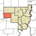
 Map highlighting Boone Township, Crawford County, Indiana.svg 512 × 512; 37 KB
-
 Map highlighting Jennings Township, Crawford County, Indiana.svg 512 × 512; 37 KB
-
 Map highlighting Johnson Township, Crawford County, Indiana.svg 512 × 512; 37 KB
-
 Map highlighting Liberty Township, Crawford County, Indiana.svg 512 × 512; 37 KB
-
 Map highlighting Ohio Township, Crawford County, Indiana.svg 512 × 512; 38 KB
-
 Map highlighting Patoka Township, Crawford County, Indiana.svg 512 × 512; 37 KB
-
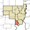
 Map highlighting Sterling Township, Crawford County, Indiana.svg 512 × 512; 37 KB
-
 Map highlighting Union Township, Crawford County, Indiana.svg 512 × 512; 37 KB
-
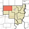
 Map highlighting Whiskey Run Township, Crawford County, Indiana.svg 512 × 512; 38 KB


