Category:France in the 17th century
Jump to navigation
Jump to search
Countries of Europe: Albania · Armenia‡ · Austria · Azerbaijan‡ · Belarus · Belgium · Bosnia and Herzegovina · Bulgaria · Croatia · Czech Republic · Denmark · Estonia · Finland · France‡ · Georgia‡ · Germany · Greece · Hungary · Iceland · Republic of Ireland · Italy · Latvia · Lithuania · Luxembourg · Malta · Montenegro · Netherlands‡ · Norway · Poland · Portugal‡ · Romania · Russia‡ · San Marino · Serbia · Slovakia · Slovenia · Spain‡ · Sweden · Switzerland · Turkey‡ · Ukraine · United Kingdom · Vatican City
Specific status: Faroe Islands · Gibraltar · Isle of Man – Limited recognition: Kosovo
‡: partly located in Europe
Specific status: Faroe Islands · Gibraltar · Isle of Man – Limited recognition: Kosovo
‡: partly located in Europe

Wikimedia category | |||||
| Upload media | |||||
| Instance of | |||||
|---|---|---|---|---|---|
| Category combines topics | |||||
| Follows | |||||
| Followed by | |||||
| |||||
Subcategories
This category has the following 53 subcategories, out of 53 total.
Media in category "France in the 17th century"
The following 23 files are in this category, out of 23 total.
-
 16xx Lion Caloire Guillotiere Vaize Rilliau.png 677 × 543; 676 KB
-
 Arolsen Klebeband 13 211 1.jpg 1,926 × 947; 1.15 MB
-
 Arolsen Klebeband 13 211 2.jpg 1,929 × 957; 1.22 MB
-
 Arolsen Klebeband 13 213 2.jpg 1,928 × 972; 1.04 MB
-
 Arolsen Klebeband 13 217 1.jpg 1,954 × 988; 1.99 MB
-
 Banner of Louis XIV, King of France (r. 1643–1715) MET 14.28.2a 001 Aug2014.jpg 3,972 × 3,384; 4.01 MB
-
 Banner of Louis XIV, King of France (r. 1643–1715) MET 14.28.2a 002 Aug2014.jpg 4,000 × 2,685; 5.21 MB
-
 Banner of Louis XIV, King of France (r. 1643–1715) MET 14.28.2a 003 Aug2014.jpg 4,000 × 2,871; 3.6 MB
-
 Banner of Louis XIV, King of France (r. 1643–1715) MET 20444.jpg 4,000 × 3,251; 2.53 MB
-
 Conquêtes de Louis XIV de 1648 à 1681.jpeg 591 × 635; 118 KB
-
 Corteta.jpg 219 × 318; 37 KB
-
 EB1911 Costume Figs. 50. & 51.—French & Spanish Nobleman.jpg 525 × 393; 39 KB
-
 France vs United Provinces 1672 - 1697.jpg 1,500 × 1,957; 523 KB
-
 French - Cabinet with Mythological Scenes - Walters 6519 - Front Open.jpg 1,800 × 1,424; 2.85 MB
-
 Galliae seu Franciae Tabula.jpg 7,726 × 6,571; 16.92 MB
-
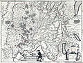
 Map of Miribel region (XVIe century).jpg 510 × 377; 131 KB
-
 Paix des Pyrénées.png 1,832 × 1,773; 634 KB
-
 Pincers (Tenailles) MET 14073.jpg 3,065 × 4,000; 1.41 MB
-
 Plan Bresse 16xx.jpg 7,723 × 5,905; 35.49 MB
-
 Plan pays de Bresse 1619.jpg 4,904 × 4,096; 8.07 MB
-
 Poissy Zeiller 13777.jpg 3,283 × 1,287; 2.08 MB
-
 Profil de Poissy.jpg 770 × 277; 62 KB
-
 Provinces of France 1322-1789.png 2,388 × 2,452; 10.31 MB


_MET_14.28.2a_001_Aug2014.jpg)
_MET_14.28.2a_002_Aug2014.jpg)
_MET_14.28.2a_003_Aug2014.jpg)
_MET_20444.jpg)


.jpg)

_MET_14073.jpg)


