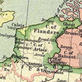
Category:Maps of the county of Flanders
Appearance
Subcategories
This category has the following 3 subcategories, out of 3 total.
B
M
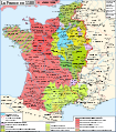
- Maps of France in 1030 (11 F)
Media in category "Maps of the county of Flanders"
The following 71 files are in this category, out of 71 total.
-
1608 17 Flandria Comitatus Kaerius.jpg 1,500 × 1,033; 583 KB
-
1680 Flandriæ de Witt.jpg 4,824 × 4,020; 9.84 MB
-
Blaeu 1645 - Flandria et Zeelandia Comitatus.jpg 3,631 × 3,026; 1.68 MB
-
Blaeu 1645 - Morelanden.jpg 629 × 399; 69 KB
-
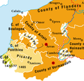
Burgundian northern France 1465–1477.png 416 × 399; 92 KB
-
Carte de Flandre 14353.jpg 3,844 × 2,761; 6.4 MB
-
Charte van Vlaendren 1538 Pieter van der Beke.jpg 1,528 × 1,172; 1.27 MB
-
Cities of Flanders 1350.png 710 × 620; 84 KB
-
County of Flanders (topogaphy).png 760 × 645; 190 KB
-
County of Flanders in 1704.jpg 10,710 × 7,075; 16.08 MB
-
County of Flanders in 1752.jpg 11,130 × 7,052; 15.55 MB
-
County of Flanders with Belgium.png 2,000 × 2,561; 1.08 MB
-
Dutch Urban Centers Flanders.png 373 × 292; 51 KB
-
Flandern 1400.png 454 × 365; 483 KB
-
Flandres -Pagi du Marquisat.png 800 × 560; 79 KB
-
Flandria (Vlaanderen Flanders) 1584 Map by Abraham Ortelius.jpg 12,583 × 9,989; 44.7 MB
-
Flandria Comit. (1).jpg 7,060 × 5,793; 12.71 MB
-
French Flanders and Hainaut.png 891 × 899; 22 KB
-
Golfe de l'Aa.jpg 1,055 × 570; 191 KB
-
Grafschaft Hennegau 1250.PNG 745 × 479; 265 KB
-
Herzogtum Lothringen 1000.PNG 980 × 976; 623 KB
-
Histoire de Lille et de la Flandre wallonne (1848) (14589986837).jpg 3,128 × 2,164; 1.15 MB
-
Kanalen tussen Gent en Brugge.jpg 1,000 × 586; 691 KB
-
Kasselrijen in Vlaanderen (1680).svg 1,989 × 1,611; 440 KB
-
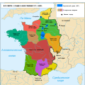
Le royaume des Francs sous Hugues Capet-be.svg 1,796 × 1,796; 1.36 MB
-
Le royaume des Francs sous Hugues Capet-en.svg 1,796 × 1,796; 1.37 MB
-
Le royaume des Francs sous Hugues Capet-es.svg 1,916 × 1,916; 1.37 MB
-
Le royaume des Francs sous Hugues Capet-fr.svg 1,796 × 1,796; 1.38 MB
-
Le royaume des Francs sous Hugues Capet-ka.svg 1,796 × 1,800; 1.23 MB
-
Le royaume des Francs sous Hugues Capet-ru.svg 1,796 × 1,796; 1.07 MB
-
Locatie Belle-Ambacht.svg 1,960 × 1,611; 290 KB
-
Locatie Broekburg-Ambacht.svg 1,960 × 1,611; 290 KB
-
Locatie Kassel-Ambacht.svg 1,960 × 1,611; 290 KB
-
Locatie Kasselrij Doornik.svg 1,960 × 1,611; 290 KB
-
Locatie Kasselrij Dowaai.svg 1,960 × 1,611; 290 KB
-
Locatie Kasselrij Ieper.svg 1,960 × 1,611; 290 KB
-
Locatie Kasselrij Kortrijk.svg 1,960 × 1,611; 290 KB
-
Locatie Kasselrij Oudenaarde.svg 1,960 × 1,611; 290 KB
-
Locatie Kasselrij Rijsel.svg 1,960 × 1,611; 290 KB
-
Locatie Land van Aalst.svg 1,960 × 1,611; 290 KB
-
Locatie Land van Beveren.svg 1,960 × 1,611; 290 KB
-
Locatie Land van Bornem.svg 1,960 × 1,611; 290 KB
-
Locatie Land van den Doel.svg 1,960 × 1,611; 290 KB
-
Locatie Land van Dendermonde.svg 1,960 × 1,611; 290 KB
-
Locatie Land van Saeftinghe.svg 1,960 × 1,611; 290 KB
-
Locatie Land van Waas.svg 1,960 × 1,611; 290 KB
-
Locatie Oudburg.svg 1,960 × 1,611; 290 KB
-
Locatie Veurne-Ambacht.svg 1,960 × 1,611; 290 KB
-
Locatie Vier Ambachten.svg 1,960 × 1,611; 290 KB
-
Locatie Winoksbergen-Ambacht.svg 1,960 × 1,611; 290 KB
-
Locator County of Flanders (1350).svg 2,818 × 3,608; 422 KB
-
Lotharingia-959.svg 3,161 × 4,174; 547 KB
-
Low Countries Locator Flanders.svg 1,550 × 2,000; 381 KB
-
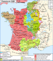
Map France 1180-br.svg 988 × 1,124; 1.9 MB
-
Map France 1180-de.svg 988 × 1,124; 1.94 MB
-
Map France 1180-es.svg 988 × 1,124; 2.1 MB
-
Map France 1180-fr.svg 988 × 1,124; 1.88 MB
-
Map France 1180-ru.svg 988 × 1,124; 1.88 MB
-
Map France 1180-uk.svg 988 × 1,124; 1.68 MB
-
Map of the Netherlands 1780.JPG 1,092 × 882; 255 KB
-
Quad Flandria.jpg 3,345 × 2,498; 7.53 MB
-
VlaanderenArtesie1477.png 327 × 327; 227 KB
-
War of the Brabantian Succession (1355–1357) locator map.svg 2,813 × 3,602; 388 KB


