Category:Maps of the history of Provence
Jump to navigation
Jump to search
Maps of the history of Provence
Media in category "Maps of the history of Provence"
The following 27 files are in this category, out of 27 total.
-
 C. 768 Frankish Dominions (486-768).jpg 3,890 × 3,010; 3.66 MB
-
 AltaYBajaBorgoñaSiglosIXX.svg 1,002 × 1,014; 1.17 MB
-
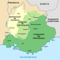
 Carta de Provença en 1125.png 964 × 964; 123 KB
-
 Carte provence 1125-ar.png 964 × 964; 130 KB
-
 Carte provence 1125-es.svg 7,089 × 7,087; 269 KB
-
 Carte provence 1125.png 964 × 964; 125 KB
-
 Carte-Royaume-dArles.png 1,500 × 1,529; 412 KB
-
 Fraxinetum.png 2,446 × 2,174; 692 KB
-
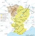
 Karte Hoch Niederburgund-FR.png 2,000 × 2,126; 549 KB
-
 Karte Hoch und Niederburgund EN.png 2,000 × 2,126; 538 KB
-
 Karte Hoch und Niederburgund-el.png 1,310 × 1,338; 200 KB
-
 Karte Hoch- und Niederburgund.png 2,000 × 2,126; 549 KB
-
 Karte Königreich Arelat DE.png 1,500 × 1,529; 414 KB
-
 Kingdom of Arles 1000.svg 485 × 340; 1.25 MB
-
 La Bourgogne aux XI et XIIe siècles-es.svg 1,050 × 1,450; 515 KB
-
 La Bourgogne aux XI et XIIe siècles.svg 1,050 × 1,450; 302 KB
-
 Map France 1180-br.svg 988 × 1,124; 1.9 MB
-
 Map France 1180-de.svg 988 × 1,124; 1.94 MB
-
 Map France 1180-es.svg 988 × 1,124; 1.97 MB
-
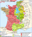
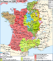 Map France 1180-fr.svg 988 × 1,124; 1.88 MB
-
 Map France 1180-ru.svg 988 × 1,124; 1.88 MB
-
 Map France 1180-uk.svg 988 × 1,124; 1.68 MB
-
 Map Kingdom Arelat AR.png 1,454 × 1,485; 856 KB
-
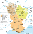
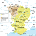
 Map Kingdom Arelat EN.png 1,310 × 1,338; 209 KB
-
 Map Kingdom Arelat-el.png 1,310 × 1,338; 227 KB
-
 Provence - Province.jpg 3,600 × 2,100; 1.9 MB
-
 Provence in France (1789).svg 2,000 × 1,922; 1.05 MB
.jpg)


.svg)