Category:Maps of Braunschweig
Jump to navigation
Jump to search

Wikimedia category | |||||
| Upload media | |||||
| Instance of | |||||
|---|---|---|---|---|---|
| Category combines topics | |||||
| Brunswick | |||||
city in Lower Saxony, Germany | |||||
| Instance of |
| ||||
| Part of | |||||
| Location | Lower Saxony, Germany | ||||
| Located in or next to body of water | |||||
| Head of government |
| ||||
| Inception |
| ||||
| Significant event |
| ||||
| Highest point | |||||
| Population |
| ||||
| Area |
| ||||
| Elevation above sea level |
| ||||
| Replaces | |||||
| Said to be the same as | Braunschweig | ||||
| official website | |||||
 | |||||
Subcategories
This category has the following 6 subcategories, out of 6 total.
E
L
O
T
Media in category "Maps of Braunschweig"
The following 50 files are in this category, out of 50 total.
-
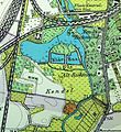
0591 prinzenpark Kartenausschnut2014 AltewiekHelmstedter.jpg 405 × 344; 113 KB
-
Altewiekring 70 Bauskizze Ausschnitt197x.jpg 1,435 × 1,820; 2.24 MB
-
Ausschnitt Kennelgebiet aus Ortsbauplan1889.jpg 860 × 935; 827 KB
-
AusschnittRiddagshausen SK20-001C StadtplanBS-200ppi Okt2016.jpg 855 × 933; 225 KB
-
Braunschweig, Bevölkerungsdichte.png 350 × 430; 68 KB
-
Braunschweig Brunswick Ebstorfer Karte (1300).jpg 367 × 283; 54 KB
-
Braunschweig Brunswick Flohwinkel Stadtplan Map 1899.jpg 1,340 × 1,630; 779 KB
-
Braunschweig Brunswick Karte 1899 Ausschnitt Schlossgarten.jpg 386 × 277; 111 KB
-
Braunschweig Brunswick Karte Andreaskirche+Umgebung.jpg 800 × 752; 677 KB
-
Braunschweig Brunswick Karte Novemberrevolution in BS.jpg 800 × 970; 819 KB
-
Braunschweig Brunswick Kreuzkloster Stadtplan 1899.jpg 1,057 × 1,300; 351 KB
-
Braunschweig Brunswick Luftlagekarte Oktober 1944.jpg 1,024 × 1,057; 1,009 KB
-
Braunschweig Brunswick Oestliches Ringgebiet (1899).jpg 1,792 × 1,848; 1.19 MB
-
Braunschweig Brunswick Ringgleis 1899.jpg 1,600 × 892; 1.37 MB
-
Braunschweig Brunswick Stadtplan gesamt (1899).jpg 1,280 × 1,310; 1.68 MB
-
Braunschweig Kiryat Tivon Park Karte.png 425 × 383; 131 KB
-
Braunschweig Park Viewegs Garten Karte.png 651 × 550; 153 KB
-
Braunschweig Stadtplan mit Vororten von 1899 AusschnittWestbahnhof.jpg 1,379 × 1,014; 698 KB
-
Braunschweig um 1400.jpg 1,024 × 1,130; 394 KB
-
Braunschweig Wallanlagen.png 630 × 462; 688 KB
-
Braunschweig.png 900 × 1,100; 204 KB
-
Braunschweigische Landeseisenbahn 1905.png 722 × 569; 1.03 MB
-
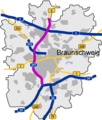
BS A391.png 1,404 × 1,648; 269 KB
-
BWahlkreis 51.svg 720 × 640; 85 KB
-
Defense Map - Braunschweig - DPLA - 4cebc1d44c980a4fb16adcc4d9f90b7a.jpg 8,828 × 7,177; 6.89 MB
-
Eintracht-Stadion.png 581 × 800; 449 KB
-
ElmAsseTal.jpg 509 × 339; 79 KB
-
FischerbrückeAusschnittInfotafel201711.jpg 1,237 × 883; 851 KB
-
Hagen (Karte).png 559 × 796; 635 KB
-
Karte vom Luenischteich mit Badeanstalt.jpg 636 × 512; 137 KB
-
Kreyenfeld Krähenfeld.jpg 474 × 500; 95 KB
-
Lageplan Braunschweig HBF.jpg 333 × 350; 113 KB
-
Lageplan.jpg 376 × 318; 35 KB
-
Lämmchenteich1752und1899.jpg 997 × 829; 754 KB
-
Neustadt (Karte).png 530 × 462; 283 KB
-
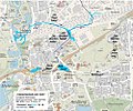
Okerumflut Braunschweig 1765 heute (Bastionszählweise Sack).png 1,088 × 1,242; 2.16 MB
-
Okerumflut Braunschweig 1765 heute.png 1,088 × 1,242; 2.16 MB
-
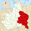
Ostfalia locator map (1000).svg 1,500 × 1,500; 5.62 MB
-
Plan Braunschweig Parcours 2004.png 906 × 906; 822 KB
-
Plan Lichtparcours 2000.png 906 × 906; 825 KB
-
Plan Lichtparcours 2010.png 906 × 906; 821 KB
-
Region Braunschweig Karte.png 354 × 600; 80 KB
-
Sack (Karte).png 412 × 320; 189 KB
-
SituationsplanÖlperMühle1844 mitAnmerkungen.jpg 1,364 × 1,840; 719 KB
-
Teddy Bear GPS Drawing.jpg 1,770 × 1,304; 1.03 MB
-
Vechelde - DPLA - 6adf9f16e41e0d501da0491cf0b36403.jpg 9,920 × 8,022; 11.7 MB
-
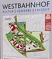
Westbahnhof Schild 201603.jpg 1,713 × 1,920; 1.24 MB
-
Übersichtskarte der Zubringerstraßen zum Harz, Elm, Asse u. Solling.png 2,471 × 3,158; 15.16 MB
