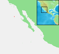
Category:Maps of Guadalupe Island
Jump to navigation
Jump to search
Baja California, Mexico.
Media in category "Maps of Guadalupe Island"
The following 12 files are in this category, out of 12 total.
-
Admiralty Chart No 1936 Islands in the North Pacific Ocean, Published 1849.jpg 5,837 × 7,887; 22.21 MB
-
EVS map Guadalupe center.jpg 1,240 × 904; 429 KB
-
EVS map Guadalupe north.jpg 1,240 × 904; 209 KB
-
EVS map Guadalupe south.jpg 1,240 × 904; 119 KB
-
Guadaloupe Island Alijos Rocks Roca Partida 1881 sea chart.jpg 808 × 1,296; 495 KB
-
Guadalupe Island Map.gif 507 × 724; 43 KB
-
Guadalupe Island nautical chart.png 1,154 × 1,918; 930 KB
-
Isla Guadalupe BC. Mexico.png 1,849 × 1,317; 62 KB
-
Isla Guadalupe be.png 1,849 × 1,317; 35 KB
-
Isla Guadalupe.png 5,400 × 5,400; 7.77 MB
-
Isla Guadalupe.svg 1,000 × 2,000; 51 KB
-
Mexico - Guadalupe.PNG 534 × 484; 32 KB


