Category:Maps of 13th-century Europe
Jump to navigation
Jump to search
| Preceded by: Maps of 12th-century Europe |
Maps of 13th-century Europe 1201 AD-1300 AD |
Succeeded by: Maps of 14th-century Europe |
Subcategories
This category has the following 8 subcategories, out of 8 total.
B
- Maps of 13th-century Bulgaria (38 F)
E
- Maps of 13th-century England (11 F)
F
G
- Maps of 13th-century Greece (39 F)
I
- Maps of 13th-century Italy (7 F)
S
Media in category "Maps of 13th-century Europe"
The following 56 files are in this category, out of 56 total.
-
 Europe en 1200.pdf 1,752 × 1,239; 503 KB
-

-
 1212 CE, Europe.svg 512 × 438; 1.73 MB
-
 1230 CE, Europe-es.svg 2,757 × 2,329; 3.31 MB
-
 1230 CE, Europe.svg 512 × 438; 1.76 MB
-
 Europe en 1250.pdf 1,752 × 1,239; 512 KB
-
 2nd Prussian uprising.svg 1,500 × 1,180; 360 KB
-
 Deutscher Orden 1260+Farb.png 1,200 × 1,043; 436 KB
-
 Livland 1260.png 1,909 × 2,068; 576 KB
-
 Livland 1260.svg 955 × 1,034; 790 KB
-
 Medieval Livonia 1260.svg 955 × 1,034; 734 KB
-
 Teutonic Order 1260.png 1,200 × 1,043; 814 KB
-
 Ливонская Конфедерация 1260.png 600 × 650; 192 KB
-
 Ordensstaat-kirchlich.jpg 539 × 539; 78 KB
-
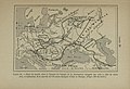
 188 of '(Histoire de la Belgique.)' (11108212804).jpg 2,560 × 1,541; 685 KB
-
 Aegean Sea After the Fourth Crusade (corrected).png 642 × 463; 68 KB
-
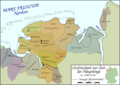
 Altpreußische Landschaften im 13. Jahrhundert.png 900 × 634; 252 KB
-
 AtHistEur1250.jpg 1,299 × 1,440; 233 KB
-
 AtHistEur1250b.jpg 1,317 × 1,445; 259 KB
-
 Balkans 1265.PNG 748 × 900; 1.14 MB
-
 Bosnian Banate in 1204.svg 884 × 706; 929 KB
-
 Conquetes Philippe Auguste.png 800 × 600; 101 KB
-
 Conquistas de Felipe Augusto ca.svg 10,072 × 7,059; 324 KB
-
 Conquistas de Felipe Augusto es.svg 9,442 × 6,618; 304 KB
-
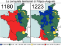 Conquiste territoriali Filippo Augusto.png 796 × 596; 75 KB
-
 Deutscher Orden 1260.png 1,200 × 1,043; 857 KB
-
 Epiro 1205-1230-el.svg 633 × 598; 293 KB
-
 Epiro 1205-1230.svg 633 × 598; 813 KB
-
 Europe 1096-1254 - Religions - Arnaud de Vachon.png 1,254 × 936; 903 KB
-
 Europe en 1300.pdf 1,752 × 1,239; 517 KB
-
 Europe in the 13th century.gif 720 × 599; 26 KB
-
 Europe Moyen-âge.jpg 3,543 × 2,577; 2.25 MB
-
 Europe13eSiecle.jpg 800 × 600; 187 KB
-
 Európa a 13. században.gif 720 × 599; 68 KB
-
 Franconia 1250 AD.png 1,670 × 1,428; 2.81 MB
-
 GeorgianKingdomMap.png 800 × 574; 207 KB
-
 Grand Duchy of Lithuania in 1270.jpg 800 × 651; 445 KB
-

-
 HRR 1250 AD.png 7,189 × 11,212; 37.01 MB
-
 Kingdom of Galicia Volhynia Rus' Ukraine 1245 1349.jpg 2,301 × 2,856; 5.18 MB
-
 Lateinisches Kaisereich.png 3,404 × 2,035; 1.03 MB
-

-
 Map of a Russian war in the Baltics.jpg 1,279 × 1,244; 179 KB
-
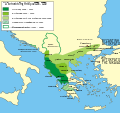
 Map of Epirus.Vetus,Nova.1210.png 593 × 761; 428 KB
-
 Map of Europe in 1200.png 1,340 × 1,050; 1.39 MB
-
 Mapa cister.svg 1,063 × 1,289; 308 KB
-
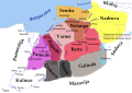
 Mapa d'Estonia.png 634 × 650; 158 KB
-
 NorthernItaly-1250.png 2,160 × 1,540; 2.57 MB
-
 Osteuropa BV042518538.jpg 1,954 × 1,337; 324 KB
-
 Ostfriesland um 1300.png 1,500 × 1,063; 454 KB
-
 Positionskarte EE + LV 1260.png 794 × 861; 120 KB
-
 Prūsų žemės XIII amžiuje.svg 1,790 × 1,260; 769 KB
-
 Public Schools Historical Atlas - Europe 13th century.jpg 1,132 × 918; 374 KB
-
 Shepherd-c-046-047.jpg 1,938 × 1,544; 717 KB
-
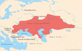 State of Cuman-Kipchak (13.) en.png 2,326 × 1,456; 623 KB
-
 State of Cuman-Kipchak ru.svg 744 × 466; 727 KB


%27_(11108212804).jpg)
.png)


_en.png)
