Category:Maps of 13th-century Serbia
Jump to navigation
Jump to search
| Preceded by: Maps of 12th-century Serbia |
Maps of 13th-century Serbia 1201 AD-1300 AD |
Succeeded by: Maps of 14th-century Serbia |
Subcategories
This category has only the following subcategory.
M
Media in category "Maps of 13th-century Serbia"
The following 18 files are in this category, out of 18 total.
-
 AtlBalk1250.jpg 318 × 327; 171 KB
-
 AtlBalk1300.jpg 318 × 327; 170 KB
-
 Balkans 1265-es.svg 1,418 × 1,431; 1.39 MB
-
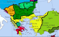
 Balkans 1265.jpg 600 × 422; 75 KB
-
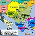
 Balkans1260.gif 551 × 352; 62 KB
-
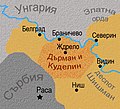 Darman and Kudelin.jpg 687 × 624; 226 KB
-
 Epir1205-1230.png 633 × 596; 37 KB
-
 Epiro1230-1251.png 637 × 600; 53 KB
-
 Epirus 1205 1230.svg 633 × 598; 289 KB
-
 Kingdom of syrmia according to stanoje stanojevic-es.svg 1,279 × 1,016; 789 KB
-
 Kingdom of syrmia according to stanoje stanojevic-sr.png 914 × 586; 58 KB
-
 Kingdom of syrmia according to stanoje stanojevic.png 914 × 586; 73 KB
-
 Serbia in the end of XIII th c and Montenegro today.svg 564 × 420; 33 KB
-
 Serbien 13.Jhd.jpg 470 × 377; 44 KB
-
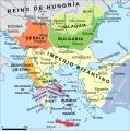
 ShepherdByzempire1265-ar.jpg 1,144 × 900; 721 KB
-
 ShepherdByzempire1265-es.svg 2,186 × 1,701; 1.54 MB
-
 ShepherdByzempire1265.jpg 1,144 × 900; 281 KB
-
 Srbija na kraju XIII vijeka i sadasnje granice Crne Gore.svg 564 × 420; 36 KB


