Category:Maps of 13th-century Iberian Peninsula
Jump to navigation
Jump to search
| Preceded by: Maps of 12th-century Iberian Peninsula |
Maps of 13th-century Iberian Peninsula 1201 AD-1300 AD |
Succeeded by: Maps of 14th-century Iberian Peninsula |
Media in category "Maps of 13th-century Iberian Peninsula"
The following 17 files are in this category, out of 17 total.
-
 Modern history; Europe (1904) (14763413054).jpg 1,928 × 2,888; 1.74 MB
-
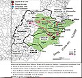 Itinerario del infante Alfonso en 1244.jpg 688 × 658; 180 KB
-
 506-Castile 1210 (hy).png 474 × 506; 96 KB
-
 506-Castile 1210.png 474 × 506; 138 KB
-
 Castelo de Vide plan 13c en 01.png 4,724 × 2,598; 2.08 MB
-
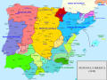
 Castilla1400.png 628 × 504; 513 KB
-
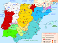
 Iberia1300.png 387 × 324; 36 KB
-
 Mapa distribucion feudal cadiz.JPG 1,118 × 430; 64 KB
-
 Peninsula Iberica 1400.png 738 × 542; 77 KB
-
 Péninsule ibérique en 1224-es.svg 2,000 × 1,500; 715 KB
-
 Péninsule ibérique en 1224.png 2,000 × 1,500; 935 KB
-
 Péninsule ibérique en 1230-es.svg 2,000 × 1,500; 662 KB
-
 Péninsule ibérique en 1230.png 2,000 × 1,500; 839 KB
-
 Péninsule ibérique en 1240.png 2,000 × 1,500; 875 KB
-
 Péninsule ibérique en 1250.png 2,000 × 1,500; 853 KB
-
 Péninsule ibérique en 1275-es.svg 2,000 × 1,500; 641 KB
-
 Péninsule ibérique en 1275.png 2,000 × 1,500; 820 KB
_(14763413054).jpg)

.png)


