Category:Maps of 11th-century Europe
Jump to navigation
Jump to search
| Preceded by: Maps of 10th-century Europe |
Maps of 11th-century Europe 1001 AD-1100 AD |
Succeeded by: Maps of 12th-century Europe |
Subcategories
This category has the following 10 subcategories, out of 10 total.
B
- Maps of 11th-century Bulgaria (15 F)
E
F
- Maps of 11th-century France (9 F)
G
- Maps of 11th-century Greece (4 F)
I
- Maps of 11th-century Italy (36 F)
M
P
- Maps of 11th-century Poland (2 F)
S
- Maps of 11th-century Serbia (56 F)
Media in category "Maps of 11th-century Europe"
The following 47 files are in this category, out of 47 total.
-
 Europe en 1000.pdf 1,752 × 1,239; 501 KB
-
 1025AD-ja.svg 3,338 × 1,198; 46 KB
-
 1025AD-zh.svg 3,338 × 1,198; 55 KB
-
 1025AD.svg 2,670 × 958; 103 KB
-
 1030 CE, Europe-IT.svg 512 × 438; 1.78 MB
-
 1030 CE, Europe.svg 512 × 438; 1.75 MB
-
 Europe en 1050.pdf 1,752 × 1,239; 497 KB
-
 1071 CE, Europe.svg 512 × 438; 1.78 MB
-
 1092 CE, Europe.svg 512 × 438; 1.86 MB
-
 Atlas of European history (1909) (14803819383).jpg 3,504 × 2,240; 1.74 MB
-
 Europe in 1096 (Atlas of European history, 1909).PNG 1,848 × 1,216; 2.35 MB
-

-
 1100 CE, Europe.svg 512 × 438; 1.82 MB
-
 Carte de la premiere croisade-ar.jpg 1,800 × 1,386; 929 KB
-
 Carte de la premiere croisade.jpg 1,800 × 1,386; 990 KB
-
 Croisade1.png 2,811 × 2,165; 7.14 MB
-
 Crusade-fa.png 779 × 600; 646 KB
-
 Kreuzzug.jpg 1,800 × 1,383; 802 KB
-
 Première croisade.jpg 1,800 × 1,386; 1 MB
-
 Prima Crociata.jpg 2,811 × 2,165; 3.75 MB
-
 An introduction to American history, European beginnings (1919) (14593844330).jpg 2,816 × 1,848; 1.12 MB
-
 Die Grafschaft Sizilien.png 1,110 × 801; 186 KB
-
 Die westliche Christenheit Mitte des 11. Jahrhunderts.png 4,520 × 2,664; 491 KB
-
 Droysens-24.jpg 8,925 × 5,837; 4.68 MB
-
 Ethnic map of 11th century.jpg 806 × 526; 236 KB
-
 Europe 1096-1254 - Religions - Arnaud de Vachon.png 1,254 × 936; 903 KB
-
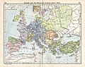
 Europe About A.D. 1000.jpg 1,557 × 1,139; 461 KB
-
 Europe byzantine empires.jpg 2,332 × 1,788; 640 KB
-
 Europe mediterranean 1097.jpg 2,270 × 1,789; 4.85 MB
-
 First.Crusade.Map.jpg 1,730 × 1,402; 730 KB
-
 Great Schism 1054 with former borders.png 2,000 × 2,141; 420 KB
-

-
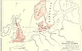
 Ingimundr (map).png 733 × 1,046; 211 KB
-
 Khazarfall1.png 670 × 448; 32 KB
-
 Lagmann mac Gofraid (map).png 662 × 477; 138 KB
-
 Map Kingdom Arelat AR.png 1,454 × 1,485; 856 KB
-
 Map Kingdom Arelat EN.png 1,310 × 1,338; 209 KB
-
 Map of the Kingdom of Galloway circa 1100.png 1,363 × 845; 403 KB
-
 Maps, and tables of chronology and genealogy; (1831) (14779954144).jpg 3,376 × 2,498; 1.63 MB
-
 Modern history; Europe (1904) (14785615523).jpg 2,960 × 2,036; 1.49 MB
-
 Occitània - Division territòriala vèrs 1030.png 1,050 × 755; 397 KB
-
 Polska w 1000 Wojciech Ketrzynski 1894.jpg 1,006 × 1,030; 418 KB
-
 Pope Gregory VII's letters.gif 1,767 × 1,087; 1.2 MB
-
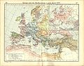
 Putz30.jpg 1,861 × 1,166; 172 KB
-
 Religionskarte für Europa im Jahre 1054..png 2,000 × 1,964; 290 KB
-
 Shepherd-byzanz 1000-enhanced 1-1900x1500.jpg 1,900 × 1,500; 941 KB
-
 Shepherd-c-066-067.jpg 1,938 × 1,542; 712 KB


_(14803819383).jpg)
.PNG)
.jpg)


_(14593844330).jpg)


.png)

.png)


_(14779954144).jpg)
_(14785615523).jpg)


