Category:Maps of 11th-century Iberian Peninsula
Jump to navigation
Jump to search
Iberian Peninsula (territory of present-day ![]() Spain and
Spain and ![]() Portugal) in 1001-1100 CE: Maps showing all or a substantial part of the Iberian Peninsula as it was in the 11th century.
Portugal) in 1001-1100 CE: Maps showing all or a substantial part of the Iberian Peninsula as it was in the 11th century.
| Preceded by: Maps of 10th-century Iberian Peninsula |
Maps of 11th-century Iberian Peninsula 1001 - 1100 CE |
Succeeded by: Maps of 12th-century Iberian Peninsula |
Subcategories
This category has the following 2 subcategories, out of 2 total.
P
S
- Maps of 11th-century Spain (9 F)
Media in category "Maps of 11th-century Iberian Peninsula"
The following 58 files are in this category, out of 58 total.
-
 Péninsule Ibérique en 1002.png 2,000 × 1,500; 841 KB
-
 Reino de Pamplona Sancho III-an.svg 2,779 × 1,050; 488 KB
-
 C. 1037 Iberian Peninsula.jpg 1,574 × 1,236; 1.45 MB
-
 Taifa de Zaragoza.jpg 689 × 564; 104 KB
-
 Almoravid map reconquest loc.jpg 501 × 422; 49 KB
-
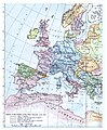 C. 1097 Western Europe and First Crusade Routes.jpg 1,068 × 1,299; 1.67 MB
-
 Comtats catalans s. VIII-XII (modificat).jpg 1,882 × 1,992; 656 KB
-
 Comtats catalans s. VIII-XII-es.svg 659 × 707; 439 KB
-
 Conquistas de la Corona de Aragón.jpg 1,258 × 1,582; 1.12 MB
-
 Reconquista (914-1492).svg 845 × 750; 190 KB
-
 Reino de Pamplona Sancho III.svg 2,779 × 1,050; 525 KB
-
 Europe-south-west-kingdoms + Nederlandse tekst.png 531 × 583; 325 KB
-
 Europe-south-west-kingdoms-ar.png 531 × 422; 231 KB
-
 Europe-south-west-kingdoms.png 531 × 422; 235 KB
-
 Europe-south-west-kingdoms1064.png 763 × 652; 432 KB
-
 Iberia1065.png 477 × 355; 208 KB
-
 Iberiska halvön 1031.GIF 670 × 497; 16 KB
-
 Im596915565-reino-de-león-siglo-X1.jpg 393 × 307; 26 KB
-
 Kart iberia 1031.png 460 × 383; 19 KB
-
 Kingdom of Aragon 11th century-es.svg 1,085 × 862; 192 KB
-
 Kingdom of Aragon 11th century.png 3,391 × 2,694; 1.22 MB
-
 Kingdom of Aragon 11th century.svg 1,085 × 862; 178 KB
-
 Kingdom of Leon 1037 bg.svg 827 × 574; 253 KB
-
 Kingdom of Leon 1037-pt.svg 827 × 574; 255 KB
-
 Kingdom of Leon 1037.svg 827 × 574; 253 KB
-
 Kingdoms of Castile and León 1097.svg 485 × 350; 747 KB
-
 Leon 1030.png 620 × 654; 786 KB
-
 Map Iberian Peninsula 1030-ast.svg 827 × 574; 260 KB
-
 Map Iberian Peninsula 1030-de.svg 827 × 574; 335 KB
-
 Map Iberian Peninsula 1030-es.svg 827 × 574; 280 KB
-
 Map Iberian Peninsula 1030-hu.svg 827 × 574; 265 KB
-
 Map Iberian Peninsula 1037-bg.svg 827 × 574; 253 KB
-
 Map Iberian Peninsula 1037-en.svg 827 × 574; 252 KB
-
 Map Iberian Peninsula 1037-es.svg 827 × 574; 252 KB
-
 Map Iberian Peninsula 1037-hu.svg 827 × 574; 256 KB
-
 Map Iberian Peninsula 1037-pt.svg 512 × 355; 101 KB
-
 Map of the Iberian Peninsula (1060).svg 936 × 653; 4.51 MB
-
 Peninsula iberica 1030 rus.svg 818 × 569; 2.42 MB
-
 Captura de pantalla 2020-05-08 a las 10.27.03.png 908 × 626; 463 KB
-
 Péninsule ibérique en 1037-2-es.svg 1,703 × 1,175; 2.56 MB
-
 Péninsule ibérique en 1037.png 2,000 × 1,500; 1,014 KB
-
 Péninsule ibérique en 1065.png 2,000 × 1,500; 1,014 KB
-
 Péninsule ibérique en 1085.png 2,000 × 1,500; 1,008 KB
-
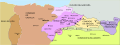
 Reinos de Taifas 1037.jpg 694 × 540; 66 KB
-
 Reinos de Taifas 1037.png 694 × 540; 153 KB
-
 Reinos de Taifas 1037.svg 694 × 540; 278 KB
-
 Reinos de Taifas 1080.png 688 × 526; 146 KB
-
 Reinos de Taifas en 1037 rus.svg 694 × 540; 886 KB
-
 Reinos de Taifas en 1037-ca.svg 694 × 540; 394 KB
-
 Reinos de Taifas en 1037.svg 694 × 540; 839 KB
-
 Reinos de Taifas en 1080 rus.svg 694 × 541; 954 KB
-
 Reinos de Taifas en 1080-ar.png 684 × 529; 134 KB
-
 Reinos de Taifas en 1080-ca.svg 694 × 541; 828 KB
-
 Reinos de Taifas en 1080.svg 694 × 541; 828 KB
-
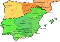
 Religions in southwestern Europe in 1050.jpg 1,398 × 1,374; 631 KB
-
 Royaumes chrétiens et royaumes de Taifas en 1086.svg 1,052 × 745; 833 KB
-
 Señorío de Valencia 1099.png 1,793 × 1,853; 740 KB
-
 الأندلس في عام 1086.png 2,500 × 2,500; 276 KB


.jpg)


.svg)


.svg)


